No Watches or Warnings for Roanoke
Issued: 1:02 am CST Dec 18, 2025 Latitude: 33.1512313 Longitude: -85.3721708 View on Google Maps
|
|
|
|
|
|
|
|
|
|
 |
 |
 |
|
 |
|
 |
|
| Low: °F |
High: °F |
High: °F |
High: °F |
High: °F |
High: °F |
High: °F |
High: °F |
| Low: °F |
Low: °F |
Low: °F |
Low: °F |
Low: °F |
Low: °F |
|
| Rain |
Thunderstorms |
Sunny |
Sunny |
Rain |
Sunny |
Mostly Sunny |
Mostly Sunny |
Current Conditions at
LA GRANGE - (KLGC)
46°
Cloudy
as of 4:15 AM EST
Rel. Humidity: 93%
Dew Point: 45°F
Visibility: 10 Miles
Pressure: 30.05 in.
Flight Rule: VFR
Cloud Level(s): Scattered at 3700ft, Scattered at 6000ft, Solid Overcast at 11000ft
Current Conditions at
NEWNAN-COWETA ARPT - (KCCO)
52°
Clear
as of 4:35 AM EST
Rel. Humidity: 87%
Dew Point: 48°F
Visibility: 10 Miles
Pressure: 30.06 in.
Flight Rule: VFR
Wind Data
7 MPH
130° Southeast
Cloud Level(s): Clear
Current Conditions at
AUBURN - (KAUO)
55°
Mostly Cloudy
as of 2:56 AM CST
Rel. Humidity: 87%
Dew Point: 52°F
Visibility: 10 Miles
Pressure: 30.05 in.
Flight Rule: VFR
Wind Data
10 MPH
130° Southeast
Cloud Level(s): Broken at 10000ft
Current Conditions at
ANNISTON - (KANB)
50°
Mostly Clear
as of 2:53 AM CST
Rel. Humidity: 76%
Dew Point: 43°F
Visibility: 10 Miles
Pressure: 30.04 in.
Flight Rule: VFR
Wind Data
6 MPH
040° Northeast
Cloud Level(s): Few at 3800ft
|
Overnight... A 30 percent chance of rain. Cloudy, with a low around 46. East wind around 5 mph. |
|
|
Thursday... Rain before 3pm, then showers likely and possibly a thunderstorm after 3pm. High near 60. East wind 5 to 10 mph becoming south in the afternoon. Chance of precipitation is 90%. New rainfall amounts between a tenth and quarter of an inch, except higher amounts possible in thunderstorms. |
|
 |
Thursday Night... Showers and possibly a thunderstorm before midnight, then a slight chance of rain between midnight and 3am. Low around 39. South wind around 10 mph becoming northwest after midnight. Winds could gust as high as 25 mph. Chance of precipitation is 80%. New precipitation amounts between a tenth and quarter of an inch, except higher amounts possible in thunderstorms. |
|
|
Friday... Sunny, with a high near 53. Northwest wind 5 to 10 mph. |
|
 |
Friday Night... Mostly clear, with a low around 31. Northwest wind around 5 mph becoming calm. |
|
|
Saturday... Sunny, with a high near 59. |
|
 |
Saturday Night... Partly cloudy, with a low around 41. |
|
|
Sunday... A 20 percent chance of showers before noon. Mostly sunny, with a high near 62. |
|
|
Sunday Night... Mostly clear, with a low around 37. |
|
|
Monday... Sunny, with a high near 56. |
|
|
Monday Night... Partly cloudy, with a low around 38. |
|
|
Tuesday... Mostly sunny, with a high near 61. |
|
|
Tuesday Night... Partly cloudy, with a low around 45. |
|
|
Wednesday... Mostly sunny, with a high near 67. |
|
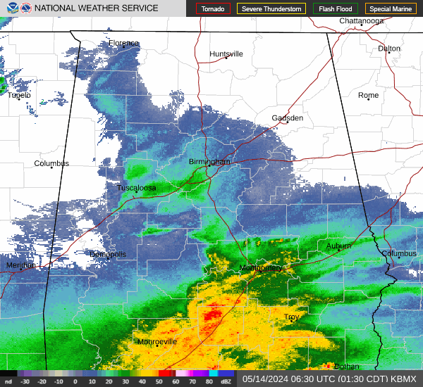
Current Radar Image
Sun Almanac for Roanoke, Alabama
Sunrise: 06:39 AM
Sunset: 4:37 PM
Civil Sunrise:06:12 AM
Civil Sunset: 5:05 PM
Nautical Sunrise: 05:41 AM
Nautical Sunset: 5:36 PM
Astro Sunrise: 05:11 AM
Astro Sunset: 6:06 PM
Alabama's Current Temperatures
 Alabama's Satellite Image
 Alabama's Current Wind Direction
| National Summary |
of upper and lower values of current conditions amongst 7141 locations
in the contiguous United States |
|
High
Temp |
77° |
Keathley C 875, Louisiana
|
|
Low
Temp |
1° |
Crosby Municipal, North Dakota
and 1 other location
|
|
Wind
Speed |
66mph |
Buffalo, South Dakota
|
|
Wind
Gust |
90mph |
Buffalo, South Dakota
|
|
Wind
Chill |
-28° |
Berthoud Pass, Colorado
|
|
High
Pressure |
30.30Hg |
Manhattan/Dwntwn, New York
and 3 other locations
|
|
Low
Pressure |
29.01Hg |
Fosston, Minnesota
and 1 other location
|
|
| # Locations Reporting Snow |
29 |
|
| # Locations Reporting Rain |
66 |
|
| # Locations Reporting Fog |
33 |
|
| Average Temperature in the Contiguous USA |
43° |
|
Any use of the information on this page is at your own risk. This information should not be relied upon in life-threatening situations, potential financial loss situations or in lieu of any officially disseminated information. Visit the
National Weather Service for official information.