Ring Place, New Mexico Weather
Current Conditions at
RATON AIRPORT - (KRTN)
54°
Clear
as of 8:53 AM MDST
Rel. Humidity: 18%
Dew Point: 12°F
Visibility: 10 Miles
Pressure: 29.86 in.
Flight Rule: VFR
Cloud Level(s): Clear
Current Conditions at
LA VETA MOUNTAIN - (KVTP)
36°
Clear
as of 8:55 AM MDST
Rel. Humidity: 34%
Dew Point: 10°F
Visibility: 10 Miles
Pressure: 30.10 in.
Flight Rule: VFR
Wind Data
8 MPH
Gust: 18 MPH
260° West
Cloud Level(s): Clear
Current Conditions at
TRINIDAD - (KTAD)
45°
Clear
as of 8:54 AM MDST
Rel. Humidity: 48%
Dew Point: 27°F
Visibility: 10 Miles
Pressure: 29.92 in.
Flight Rule: VFR
Wind Data
8 MPH
030° Northeast
Cloud Level(s): Clear
Moon Almanac for Ring Place, New Mexico
Moon Phase: Waxing Gibbous
Moon Illumination: 66%
Moon Age: 8.95 Days
Moon is currently below the horizon
Distance from Moon to Earth: 233,856 miles
Upcoming Lunar Events for
Ring Place: |
| Next Event | Event Time | Illum |
|
|
|
| Moonrise: | 04:04 pm Sat | 68.4% |
| High Moon: | 10:57 pm Sat | 71.2% |
| Moonset: | 05:39 am Sun | 73.9% |
 | New Moon: Fri Apr 17 |
 | First Quarter: Thu Apr 23 |
 | Full Moon: Fri May 1 |
 | Last Quarter: Sat May 9 |
| New Moon: Sat May 16 |
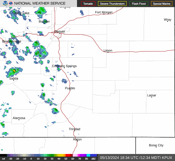
Current Radar Image
| New Mexico State Summary |
of upper and lower values of current conditions amongst 31 locations
in New Mexico |
|
|
|
Low
Temp |
54° |
Raton Airport
and 2 other locations
|
|
Wind
Speed |
21mph |
Melrose Afr
and 2 other locations
|
|
Wind
Gust |
33mph |
Clines Corners
|
|
High
Pressure |
30.01Hg |
Ruidoso
|
|
Low
Pressure |
29.81Hg |
Tucumcari
|
|
| Average temperature in New Mexico |
64° |
|
# Locations Reporting VFR
(Visual Flight Rules) |
31 |
|
New Mexico's Current Temperatures
 New Mexico's Satellite Image
 New Mexico's Current Wind Direction
| National Summary |
of upper and lower values of current conditions amongst 7095 locations
in the contiguous United States |
|
High
Temp |
84° |
Mcentire Angb, South Carolina
|
|
Low
Temp |
19° |
Yellowstone, Wyoming
|
|
Wind
Speed |
29mph |
Crosby Municipal, North Dakota
|
|
Wind
Gust |
39mph |
Jordan, Montana
|
|
Wind
Chill |
9° |
Scobey, Montana
and 2 other locations
|
|
High
Pressure |
30.10Hg |
Block Isl, Rhode Island
and 6 other locations
|
|
Low
Pressure |
29.67Hg |
Nellis AFB, Nevada
|
|
| # Locations Reporting Snow |
7 |
|
| # Locations Reporting Rain |
99 |
|
| # Locations Reporting Thunderstorms / Lightning |
2 |
|
| # Locations Reporting Fog |
5 |
|
| Average Temperature in the Contiguous USA |
58° |
|
Any use of the information on this page is at your own risk. This information should not be relied upon in life-threatening situations, potential financial loss situations or in lieu of any officially disseminated information. Visit the
National Weather Service for official information.