No Watches or Warnings for Primeaux
Issued: 10:51 pm PDT Jul 3, 2025 Latitude: 40.6488044 Longitude: -116.3017478 View on Google Maps
|
|
|
|
|
|
|
|
|
|
 |
 |
|
|
|
|
|
|
| Low: °F |
High: °F |
High: °F |
High: °F |
High: °F |
High: °F |
High: °F |
High: °F |
| Low: °F |
Low: °F |
Low: °F |
Low: °F |
Low: °F |
Low: °F |
|
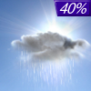
| Rain |
Sunny |
Sunny |
Sunny |
Sunny |
Sunny |
Sunny |
Sunny |
Current Conditions at
ELKO - (KEKO)
63°
Cloudy
Light Rain
as of 12:56 AM PDST
Rel. Humidity: 72%
Dew Point: 54°F
Visibility: 10 Miles
Pressure: 30.04 in.
Flight Rule: VFR
Wind Data
3 MPH
220° Southwest
Cloud Level(s): Few at 7000ft, Solid Overcast at 8500ft
Current Conditions at
WINNEMUCA - (KWMC)
66°
Clear
as of 12:56 AM PDST
Rel. Humidity: 48%
Dew Point: 46°F
Visibility: 10 Miles
Pressure: 30.00 in.
Flight Rule: VFR
Cloud Level(s): Clear
Current Conditions at
EUREKA - (KP68)
61°
Partly Cloudy
as of 12:53 AM PDST
Rel. Humidity: 59%
Dew Point: 46°F
Pressure: 30.13 in.
Wind Data
8 MPH
040° Northeast
Current Conditions at
WENDOVER - (KENV)
79°
Clear
as of 1:56 AM MDST
Rel. Humidity: 26%
Dew Point: 41°F
Visibility: 10 Miles
Pressure: 29.93 in.
Flight Rule: VFR
Wind Data
3 MPH
220° Southwest
Cloud Level(s): Clear
|
Overnight... Scattered showers, mainly before 3am. Cloudy, then gradually becoming partly cloudy, with a low around 56. East wind around 10 mph becoming west northwest. Chance of precipitation is 40%. |
|
|
Independence Day... Sunny, with a high near 81. East wind 10 to 15 mph becoming west in the afternoon. Winds could gust as high as 25 mph. |
|
 |
Friday Night... Mostly clear, with a low around 51. West wind 5 to 15 mph. |
|
|
Saturday... Sunny, with a high near 81. Northeast wind around 5 mph becoming west in the morning. |
|
|
Saturday Night... Mostly clear, with a low around 53. West northwest wind around 10 mph becoming east northeast after midnight. |
|
|
Sunday... Sunny, with a high near 87. |
|
|
Sunday Night... Mostly clear, with a low around 57. |
|
|
Monday... Sunny, with a high near 92. |
|
|
Monday Night... Mostly clear, with a low around 61. |
|
|
Tuesday... Sunny, with a high near 93. |
|
 |
Tuesday Night... Clear, with a low around 60. |
|
|
Wednesday... Sunny, with a high near 92. |
|
|
Wednesday Night... Mostly clear, with a low around 59. |
|
|
Thursday... Sunny, with a high near 91. |
|
Current Radar Image
Sun Almanac for Primeaux, Nevada
Sunrise: 05:20 AM
Sunset: 8:19 PM
Civil Sunrise:04:47 AM
Civil Sunset: 8:52 PM
Nautical Sunrise: 04:05 AM
Nautical Sunset: 9:34 PM
Astro Sunrise: 03:16 AM
Astro Sunset: 10:23 PM
Nevada's Current Temperatures
 Nevada's Satellite Image
 Nevada's Current Wind Direction
| National Summary |
of upper and lower values of current conditions amongst 7025 locations
in the contiguous United States |
|
High
Temp |
91° |
Lake Havasu City, Arizona
and 1 other location
|
|
Low
Temp |
41° |
Bryce Canyon, Utah
and 1 other location
|
|
Wind
Speed |
33mph |
Byron, California
|
|
Wind
Gust |
41mph |
Byron, California
|
|
Wind
Chill |
34° |
Salida Mountain, Colorado
and 1 other location
|
|
Heat
Index |
94° |
Garden Banks172, Louisiana
and 1 other location
|
|
High
Pressure |
30.59Hg |
Salida Mountain, Colorado
|
|
Low
Pressure |
29.61Hg |
Grand Forks AFB, North Dakota
|
|
| # Locations Reporting Snow |
1 |
|
| # Locations Reporting Rain |
47 |
|
| # Locations Reporting Thunderstorms / Lightning |
17 |
|
| # Locations Reporting Fog |
15 |
|
| Average Temperature in the Contiguous USA |
69° |
|
Any use of the information on this page is at your own risk. This information should not be relied upon in life-threatening situations, potential financial loss situations or in lieu of any officially disseminated information. Visit the
National Weather Service for official information.


