Prescott Valley, Arizona Weather
No Watches or Warnings for Prescott Valley
Issued: 9:22 pm MST Sep 13, 2025 Latitude: 34.6100243 Longitude: -112.315721 View on Google Maps
|
|
|
|
|
|
|
|
|
|
 |
 |
|
|
|
 |
 |
 |
| Low: °F |
High: °F |
High: °F |
High: °F |
High: °F |
High: °F |
High: °F |
High: °F |
| Low: °F |
Low: °F |
Low: °F |
Low: °F |
Low: °F |
Low: °F |
|
| Mostly Clear |
Sunny |
Sunny |
Sunny |
Sunny |
Thunderstorms |
Thunderstorms |
Thunderstorms |
Current Conditions at
PRESCOTT - (KPRC)
64°
Clear
as of 8:53 PM MST
Rel. Humidity: 25%
Dew Point: 28°F
Visibility: 10 Miles
Pressure: 30.08 in.
Flight Rule: VFR
Cloud Level(s): Clear
Current Conditions at
FLAGSTAFF - (KFLG)
52°
Clear
as of 8:57 PM MST
Rel. Humidity: 29%
Dew Point: 21°F
Visibility: 10 Miles
Pressure: 30.21 in.
Flight Rule: VFR
Cloud Level(s): Clear
Current Conditions at
DEER VLY/PHOENIX - (KDVT)
82°
Clear
as of 8:53 PM MST
Rel. Humidity: 20%
Dew Point: 37°F
Visibility: 10 Miles
Pressure: 29.83 in.
Flight Rule: VFR
Cloud Level(s): Clear
Current Conditions at
LUKE AFB - (KLUF)
88°
Clear
as of 8:55 PM MST
Rel. Humidity: 10%
Dew Point: 27°F
Visibility: 10 Miles
Pressure: 29.78 in.
Flight Rule: VFR
Cloud Level(s): Clear
|
Tonight... Mostly clear, with a low around 50. Southwest wind 3 to 5 mph. |
|
|
Sunday... Sunny, with a high near 85. Calm wind becoming southeast 5 to 7 mph in the morning. |
|
|
Sunday Night... Mostly clear, with a low around 50. South wind around 6 mph becoming light and variable. |
|
|
Monday... Sunny, with a high near 87. Light and variable wind becoming southwest 5 to 9 mph in the morning. |
|
|
Monday Night... Mostly clear, with a low around 56. Southwest wind 5 to 7 mph becoming light and variable. |
|
|
Tuesday... Sunny, with a high near 89. Northeast wind 5 to 7 mph becoming south in the afternoon. Winds could gust as high as 20 mph. |
|
|
Tuesday Night... Mostly clear, with a low around 58. West wind around 6 mph becoming north after midnight. Winds could gust as high as 15 mph. |
|
|
Wednesday... Sunny, with a high near 90. Calm wind becoming west 5 to 7 mph in the afternoon. Winds could gust as high as 18 mph. |
|
 |
Wednesday Night... Partly cloudy, with a low around 59. West wind around 6 mph becoming light and variable after midnight. Winds could gust as high as 15 mph. |
|
|
Thursday... A 20 percent chance of showers and thunderstorms after 11am. Mostly sunny, with a high near 87. Light and variable wind becoming southwest 5 to 8 mph in the morning. Winds could gust as high as 21 mph. |
|
 |
Thursday Night... A 30 percent chance of showers and thunderstorms. Mostly cloudy, with a low around 60. Southwest wind around 6 mph becoming northeast after midnight. |
|
|
Friday... Showers likely and possibly a thunderstorm. Mostly cloudy, with a high near 81. Southeast wind around 7 mph becoming southwest in the afternoon. Winds could gust as high as 20 mph. Chance of precipitation is 60%. |
|
 |
Friday Night... A 50 percent chance of showers and thunderstorms. Mostly cloudy, with a low around 58. Southwest wind around 5 mph becoming northeast after midnight. |
|
|
Saturday... A 40 percent chance of showers and thunderstorms. Partly sunny, with a high near 80. Southeast wind 5 to 7 mph becoming southwest in the afternoon. Winds could gust as high as 20 mph. |
|
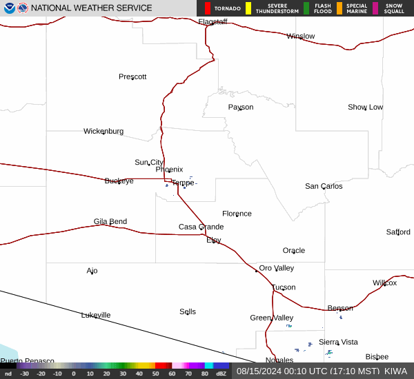
Current Radar Image
Sun Almanac for Prescott Valley, Arizona
Sunrise: 07:12 AM
Sunset: 7:37 PM
Civil Sunrise:06:47 AM
Civil Sunset: 8:02 PM
Nautical Sunrise: 06:17 AM
Nautical Sunset: 8:32 PM
Astro Sunrise: 05:47 AM
Astro Sunset: 9:02 PM
Arizona's Current Temperatures
 Arizona's Satellite Image
 Arizona's Current Wind Direction
| National Summary |
of upper and lower values of current conditions amongst 6977 locations
in the contiguous United States |
|
High
Temp |
91° |
Phoenix, Arizona
|
|
Low
Temp |
32° |
Salida Mountain, Colorado
and 1 other location
|
|
Wind
Speed |
32mph |
Byron, California
|
|
Wind
Gust |
41mph |
Byron, California
|
|
Wind
Chill |
20° |
Salida Mountain, Colorado
|
|
High
Pressure |
30.46Hg |
Salida Mountain, Colorado
|
|
Low
Pressure |
29.72Hg |
Richland, Washington
and 3 other locations
|
|
| # Locations Reporting Rain |
21 |
|
| # Locations Reporting Thunderstorms / Lightning |
5 |
|
| # Locations Reporting Fog |
14 |
|
| Average Temperature in the Contiguous USA |
67° |
|
Any use of the information on this page is at your own risk. This information should not be relied upon in life-threatening situations, potential financial loss situations or in lieu of any officially disseminated information. Visit the
National Weather Service for official information.