Pollock, California Weather
No Watches or Warnings for Pollock
Issued: 5:21 pm PDT May 3, 2024 Latitude: 40.9165388 Longitude: -122.3858447 View on Google Maps
|
|
|
|
|
|
|
|
|
|
 |
 |
 |
 |
 |
|
|
|
| Low: °F |
High: °F |
High: °F |
High: °F |
High: °F |
High: °F |
High: °F |
High: °F |
| Low: °F |
Low: °F |
Low: °F |
Low: °F |
Low: °F |
Low: °F |
|
| Rain |
Thunderstorms |
Mostly Sunny |
Partly Sunny |
Sunny |
Sunny |
Sunny |
Sunny |
Current Conditions at
MT SHASTA - (KMHS)
61°
Mostly Clear
as of 7:56 PM PDST
Rel. Humidity: 26%
Dew Point: 27°F
Visibility: 10 Miles
Pressure: 29.77 in.
Flight Rule: VFR
Cloud Level(s): Few at 11000ft
Current Conditions at
REDDING - (KRDD)
77°
Clear
as of 7:53 PM PDST
Rel. Humidity: 20%
Dew Point: 34°F
Visibility: 10 Miles
Pressure: 29.70 in.
Flight Rule: VFR
Wind Data
5 MPH
210° Southwest
Cloud Level(s): Clear
Current Conditions at
RED BLUFF - (KRBL)
72°
Clear
as of 7:54 PM PDST
Rel. Humidity: 37%
Dew Point: 45°F
Visibility: 10 Miles
Pressure: 29.72 in.
Flight Rule: VFR
Cloud Level(s): Clear
Current Conditions at
ARCATA - (KACV)
54°
Cloudy
Rain Mist
as of 7:53 PM PDST
Rel. Humidity: 100%
Dew Point: 54°F
Visibility: 3 Miles
Pressure: 29.86 in.
Flight Rule: LIFR
Cloud Level(s): Solid Overcast at 400ft
|
Tonight... Showers, mainly after 11pm. Low around 46. West southwest wind 9 to 14 mph becoming south after midnight. Winds could gust as high as 22 mph. Chance of precipitation is 90%. New precipitation amounts between a half and three quarters of an inch possible. |
|
|
Saturday... Showers, with thunderstorms also possible after 2pm. High near 56. South southwest wind 7 to 13 mph becoming west in the afternoon. Winds could gust as high as 20 mph. Chance of precipitation is 90%. New rainfall amounts between three quarters and one inch possible. |
|
 |
Saturday Night... A 40 percent chance of showers and thunderstorms before 11pm. Mostly cloudy, with a low around 36. West wind 5 to 7 mph. New precipitation amounts of less than a tenth of an inch, except higher amounts possible in thunderstorms. |
|
|
Sunday... Mostly sunny, with a high near 59. North northwest wind 5 to 8 mph becoming south in the morning. |
|
 |
Sunday Night... Mostly cloudy, with a low around 40. West southwest wind 5 to 8 mph. |
|
|
Monday... A 30 percent chance of showers after 11am. Partly sunny, with a high near 63. |
|
 |
Monday Night... Mostly clear, with a low around 40. |
|
|
Tuesday... Sunny, with a high near 70. |
|
 |
Tuesday Night... Clear, with a low around 42. |
|
|
Wednesday... Sunny, with a high near 74. |
|
|
Wednesday Night... Clear, with a low around 49. |
|
|
Thursday... Sunny, with a high near 78. |
|
|
Thursday Night... Clear, with a low around 53. |
|
|
Friday... Sunny, with a high near 81. |
|
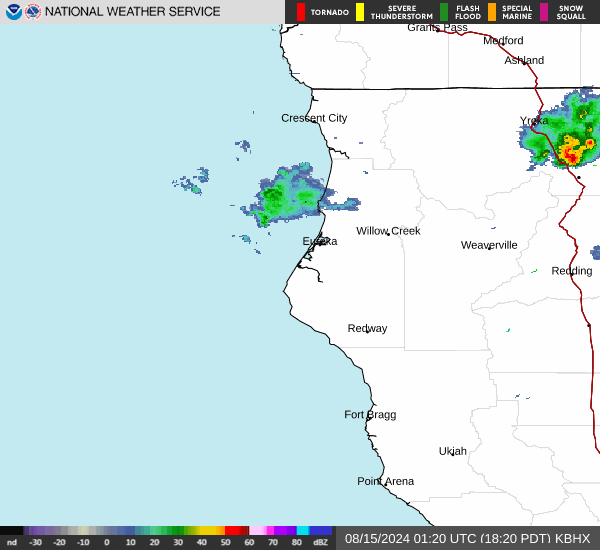
Current Radar Image
Sun Almanac for Pollock, California
Sunrise: 06:04 AM
Sunset: 8:09 PM
Civil Sunrise:05:34 AM
Civil Sunset: 8:39 PM
Nautical Sunrise: 04:57 AM
Nautical Sunset: 9:16 PM
Astro Sunrise: 04:17 AM
Astro Sunset: 9:56 PM
California's Current Temperatures
 California's Satellite Image
 California's Current Wind Direction
| National Summary |
of upper and lower values of current conditions amongst 6871 locations
in the contiguous United States |
|
High
Temp |
90° |
Phoenix, Arizona
|
|
Low
Temp |
30° |
Dubois Municipal, Wyoming
and 6 other locations
|
|
Wind
Speed |
45mph |
Pueblo, Colorado
|
|
Wind
Gust |
64mph |
La Junta, Colorado
|
|
Wind
Chill |
19° |
Salida Mountain, Colorado
|
|
Heat
Index |
94° |
Keathley C 875, Louisiana
|
|
High
Pressure |
30.30Hg |
Presque Isle, Maine
|
|
Low
Pressure |
29.65Hg |
Thermal, California
and 1 other location
|
|
| # Locations Reporting Snow |
2 |
|
| # Locations Reporting Rain |
122 |
|
| # Locations Reporting Thunderstorms / Lightning |
25 |
|
| # Locations Reporting Fog |
7 |
|
| Average Temperature in the Contiguous USA |
61° |
|
Any use of the information on this page is at your own risk. This information should not be relied upon in life-threatening situations, potential financial loss situations or in lieu of any officially disseminated information. Visit the
National Weather Service for official information.