Overgaard, Arizona Weather
No Watches or Warnings for Overgaard
Issued: 12:33 pm MST Dec 18, 2025 Latitude: 34.3908717 Longitude: -110.5531791 View on Google Maps
|
|
|
|
|
|
|
|
|
|
 |
 |
|
|
|
|
 |
|
| High: °F |
Low: °F |
High: °F |
High: °F |
High: °F |
High: °F |
High: °F |
High: °F |
| Low: °F |
Low: °F |
Low: °F |
Low: °F |
Low: °F |
|
| Sunny |
Mostly Clear |
Sunny |
Sunny |
Sunny |
Sunny |
Partly Sunny |
Partly Sunny |
Current Conditions at
SHOW LOW - (KSOW)
59°
Clear
as of 12:55 PM MST
Rel. Humidity: 21%
Dew Point: 19°F
Visibility: 10 Miles
Pressure: 30.17 in.
Flight Rule: VFR
Cloud Level(s): Clear
Current Conditions at
WINSLOW - (KINW)
59°
Clear
as of 12:56 PM MST
Rel. Humidity: 28%
Dew Point: 27°F
Visibility: 10 Miles
Pressure: 30.12 in.
Flight Rule: VFR
Wind Data
6 MPH
300° Northwest
Cloud Level(s): Clear
Current Conditions at
ST JOHNS AIR PARK - (KSJN)
57°
Clear
as of 12:54 PM MST
Rel. Humidity: 24%
Dew Point: 21°F
Visibility: 10 Miles
Pressure: 30.12 in.
Flight Rule: VFR
Cloud Level(s): Clear
Current Conditions at
FLAGSTAFF - (KFLG)
61°
Clear
as of 12:57 PM MST
Rel. Humidity: 11%
Dew Point: 7°F
Visibility: 10 Miles
Pressure: 30.19 in.
Flight Rule: VFR
Wind Data
10 MPH
Gust: 17 MPH
290° West
Cloud Level(s): Clear
|
This Afternoon... Sunny, with a high near 61. North wind around 9 mph. |
|
|
Tonight... Mostly clear, with a low around 37. Southwest wind 3 to 7 mph. |
|
|
Friday... Sunny, with a high near 65. Southwest wind 8 to 18 mph, with gusts as high as 28 mph. |
|
|
Friday Night... Mostly cloudy, then gradually becoming mostly clear, with a low around 36. Southwest wind 14 to 17 mph, with gusts as high as 26 mph. |
|
|
Saturday... Sunny, with a high near 61. Southwest wind 13 to 15 mph, with gusts as high as 24 mph. |
|
 |
Saturday Night... Partly cloudy, with a low around 37. Southwest wind around 10 mph, with gusts as high as 16 mph. |
|
|
Sunday... Sunny, with a high near 62. Southwest wind 10 to 14 mph, with gusts as high as 21 mph. |
|
|
Sunday Night... Partly cloudy, with a low around 34. South wind around 9 mph. |
|
|
Monday... Sunny, with a high near 64. South wind 9 to 13 mph, with gusts as high as 20 mph. |
|
 |
Monday Night... Mostly cloudy, with a low around 37. South wind around 8 mph. |
|
|
Tuesday... Partly sunny, with a high near 58. South wind 8 to 16 mph, with gusts as high as 24 mph. |
|
 |
Tuesday Night... A 20 percent chance of showers. Mostly cloudy, with a low around 36. South wind around 13 mph, with gusts as high as 20 mph. |
|
|
Wednesday... A 30 percent chance of showers. Partly sunny, with a high near 55. South wind 13 to 18 mph, with gusts as high as 28 mph. |
|
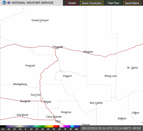
Current Radar Image
Sun Almanac for Overgaard, Arizona
Sunrise: 07:23 AM
Sunset: 5:15 PM
Civil Sunrise:06:55 AM
Civil Sunset: 5:43 PM
Nautical Sunrise: 06:24 AM
Nautical Sunset: 6:14 PM
Astro Sunrise: 05:53 AM
Astro Sunset: 6:45 PM
Arizona's Current Temperatures
 Arizona's Satellite Image
 Arizona's Current Wind Direction
| National Summary |
of upper and lower values of current conditions amongst 6993 locations
in the contiguous United States |
|
High
Temp |
86° |
Jim Hogg, Texas
and 1 other location
|
|
Low
Temp |
-8° |
Rolla Municipal A/P, North Dakota
|
|
Wind
Speed |
49mph |
Salida Mountain, Colorado
|
|
Wind
Gust |
62mph |
Clinton, Oklahoma
and 2 other locations
|
|
Wind
Chill |
-35° |
Rolla Municipal A/P, North Dakota
|
|
Heat
Index |
89° |
Brownsville, Texas
|
|
High
Pressure |
30.35Hg |
Nantucket, Massachusetts
|
|
Low
Pressure |
29.06Hg |
Grand Marais, Minnesota
|
|
| # Locations Reporting Snow |
122 |
|
| # Locations Reporting Rain |
297 |
|
| # Locations Reporting Fog |
22 |
|
| Average Temperature in the Contiguous USA |
51° |
|
Any use of the information on this page is at your own risk. This information should not be relied upon in life-threatening situations, potential financial loss situations or in lieu of any officially disseminated information. Visit the
National Weather Service for official information.