North Guilford, Maine Weather
No Watches or Warnings for North Guilford
Issued: 6:04 pm EST Dec 14, 2025 Latitude: 45.2347735 Longitude: -69.420882 View on Google Maps
|
|
|
|
|
|
|
|
|
|
 |
 |
|
 |
 |
 |
 |
 |
| Low: °F |
High: °F |
High: °F |
High: °F |
High: °F |
High: °F |
High: °F |
High: °F |
| Low: °F |
Low: °F |
Low: °F |
Low: °F |
Low: °F |
Low: °F |
|
| Mostly Clear |
Sunny |
Sunny |
Partly Sunny |
Morning Fog |
Rain & Snow |
Mostly Sunny |
Rain & Snow |
Current Conditions at
GREENVILLE - (KGNR)
Clear
as of 10:56 PM EST
Rel. Humidity: 65%
Dew Point: -0°F
Pressure: 29.76 in.
Wind Data
12 MPH
Gust: 17 MPH
330° Northwest
Current Conditions at
BANGOR - (KBGR)
Mostly Clear
as of 10:53 PM EST
Rel. Humidity: 44%
Dew Point: -2°F
Visibility: 10 Miles
Pressure: 29.84 in.
Flight Rule: VFR
Wind Data
10 MPH
310° Northwest
Cloud Level(s): Few at 9000ft
Current Conditions at
MILLINOCKET - (KMLT)
Mostly Cloudy
as of 10:53 PM EST
Rel. Humidity: 66%
Dew Point: 3°F
Visibility: 10 Miles
Pressure: 29.83 in.
Flight Rule: VFR
Cloud Level(s): Broken at 5000ft
Current Conditions at
WATERVILLE - (KWVL)
12°
Clear
as of 10:56 PM EST
Rel. Humidity: 56%
Dew Point: -0°F
Visibility: 10 Miles
Pressure: 29.86 in.
Flight Rule: VFR
Wind Data
7 MPH
320° Northwest
Cloud Level(s): Clear
|
Tonight... Mostly clear, with a low around 9. Wind chill values as low as -5. Northwest wind around 10 mph, with gusts as high as 20 mph. |
|
|
Monday... Sunny, with a high near 19. Wind chill values as low as -5. Northwest wind 10 to 15 mph, with gusts as high as 28 mph. |
|
 |
Monday Night... Partly cloudy, with a low around 6. Wind chill values as low as -1. West wind 5 to 7 mph becoming calm after midnight. |
|
|
Tuesday... Sunny, with a high near 27. Calm wind becoming west around 5 mph. |
|
 |
Tuesday Night... Mostly cloudy, with a low around 14. Calm wind becoming south around 6 mph after midnight. |
|
|
Wednesday... Partly sunny, with a high near 35. South wind around 7 mph. |
|
|
Wednesday Night... Partly cloudy, with a low around 14. West wind around 5 mph becoming calm after midnight. |
|
|
Thursday... Patchy fog before 9am. Otherwise, mostly sunny, with a high near 41. |
|
 |
Thursday Night... Rain, mainly after 1am. Patchy fog. Low around 30. Chance of precipitation is 80%. |
|
|
Friday... Rain before 3pm, then a chance of rain and snow showers between 3pm and 4pm, then a slight chance of snow showers after 4pm. Patchy fog before 8am. High near 47. Chance of precipitation is 80%. |
|
|
Friday Night... Partly cloudy, with a low around 8. |
|
|
Saturday... Mostly sunny, with a high near 26. |
|
 |
Saturday Night... A chance of snow. Mostly cloudy, with a low around 16. Chance of precipitation is 50%. |
|
|
Sunday... A chance of rain and snow. Mostly cloudy, with a high near 36. Chance of precipitation is 30%. |
|
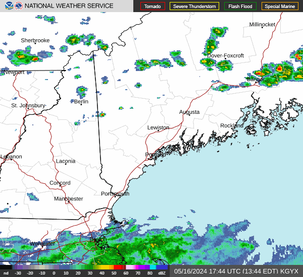
Current Radar Image
Sun Almanac for North Guilford, Maine
Sunrise: 07:10 AM
Sunset: 3:56 PM
Civil Sunrise:06:36 AM
Civil Sunset: 4:30 PM
Nautical Sunrise: 05:58 AM
Nautical Sunset: 5:07 PM
Astro Sunrise: 05:22 AM
Astro Sunset: 5:43 PM
Maine's Current Temperatures
 Maine's Satellite Image
 Maine's Current Wind Direction
| National Summary |
of upper and lower values of current conditions amongst 6969 locations
in the contiguous United States |
|
High
Temp |
73° |
Stuart/Witham, Florida
and 3 other locations
|
|
Low
Temp |
-11° |
Edgar County Arpt, Illinois
and 1 other location
|
|
Wind
Speed |
35mph |
Livingston, Montana
and 1 other location
|
|
Wind
Gust |
51mph |
Livingston, Montana
|
|
Wind
Chill |
-24° |
Hot Springs, Virginia
|
|
High
Pressure |
30.70Hg |
Owensboro, Kentucky
|
|
Low
Pressure |
29.73Hg |
Minot AFB, North Dakota
|
|
| # Locations Reporting Snow |
52 |
|
| # Locations Reporting Rain |
10 |
|
| # Locations Reporting Fog |
13 |
|
| Average Temperature in the Contiguous USA |
26° |
|
Any use of the information on this page is at your own risk. This information should not be relied upon in life-threatening situations, potential financial loss situations or in lieu of any officially disseminated information. Visit the
National Weather Service for official information.