Nelsonville, Alaska Weather
Current Conditions at
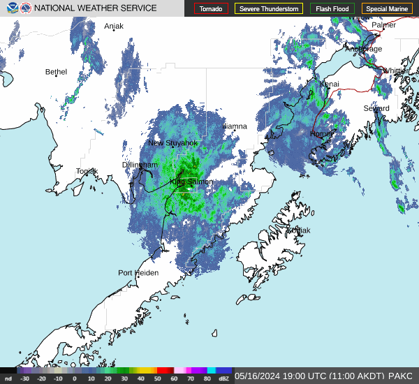
DILLINGHAM - (PADL)
7°
Cloudy
Light Snow
as of 12:56 AM ADST
Rel. Humidity: 65%
Dew Point: -2°F
Visibility: 7 Miles
Pressure: 30.25 in.
Flight Rule: VFR
Cloud Level(s): Scattered at 4900ft, Solid Overcast at 6500ft
Current Conditions at
EGEGIK - (PAII)
3°
Mostly Cloudy
as of 12:56 AM ADST
Rel. Humidity: 65%
Dew Point: -6°F
Visibility: 10 Miles
Pressure: 30.26 in.
Flight Rule: VFR
Cloud Level(s): Broken at 5000ft
Current Conditions at
TOGIAK VILLAGE - (PATG)
10°
Cloudy
Light Snow
as of 12:56 AM ADST
Rel. Humidity: 84%
Dew Point: 7°F
Visibility: 8 Miles
Pressure: 30.26 in.
Flight Rule: MVFR
Cloud Level(s): Solid Overcast at 1500ft
Current Conditions at
KING SALMON - (PAKN)
-8°
Mostly Clear
as of 12:54 AM ADST
Rel. Humidity: 63%
Dew Point: -17°F
Visibility: 10 Miles
Pressure: 30.20 in.
Flight Rule: VFR
Cloud Level(s): Few at 10000ft
Moon Almanac for Nelsonville, Alaska
Moon Phase: Waning Crescent
Moon Illumination: 32%
Moon Age: 23.9 Days
Moon is currently below the horizon
Distance from Moon to Earth: 249,345 miles
Upcoming Lunar Events for
Nelsonville: |
| Next Event | Event Time | Illum |
|
|
|
| Moonrise: | 12:12 pm Fri | 28.8% |
| High Moon: | 02:35 pm Fri | 27.9% |
| Moonset: | 05:05 pm Fri | 27.0% |
 | New Moon: Tue Feb 17 |
 | First Quarter: Tue Feb 24 |
 | Full Moon: Tue Mar 3 |
 | Last Quarter: Wed Mar 11 |
| New Moon: Wed Mar 18 |
Alaska's Current Temperatures
 Alaska's Satellite Image
 Alaska's Current Wind Direction
| National Summary |
of upper and lower values of current conditions amongst 6345 locations
in the contiguous United States |
|
High
Temp |
79° |
Avalon, California
and 1 other location
|
|
Low
Temp |
9° |
Rugby Municipal, North Dakota
|
|
Wind
Speed |
46mph |
Waseca, Minnesota
|
|
Wind
Gust |
66mph |
Redwood Falls, Minnesota
|
|
Wind
Chill |
-6° |
Rugby Municipal, North Dakota
|
|
High
Pressure |
30.39Hg |
Pagosa Springs, Colorado
|
|
Low
Pressure |
29.10Hg |
Hayward, Wisconsin
|
|
| # Locations Reporting Snow |
132 |
|
| # Locations Reporting Rain |
55 |
|
| # Locations Reporting Fog |
17 |
|
| Average Temperature in the Contiguous USA |
40° |
|
Any use of the information on this page is at your own risk. This information should not be relied upon in life-threatening situations, potential financial loss situations or in lieu of any officially disseminated information. Visit the
National Weather Service for official information.