Monticello, New Mexico Weather
No Watches or Warnings for Monticello
Issued: 5:19 pm MDT Jul 5, 2025 Latitude: 33.3970138 Longitude: -107.4508694 View on Google Maps
|
|
|
|
|
|
|
|
|
|
 |
 |
 |
|
|
|
 |
 |
| Low: °F |
High: °F |
High: °F |
High: °F |
High: °F |
High: °F |
High: °F |
High: °F |
| Low: °F |
Low: °F |
Low: °F |
Low: °F |
Low: °F |
Low: °F |
|
| Mostly Clear |
Thunderstorms |
Thunderstorms |
Thunderstorms |
Thunderstorms |
Thunderstorms |
Thunderstorms |
Thunderstorms |
Current Conditions at
TRUTH OR CONSQ - (KTCS)
95°
Clear
as of 5:53 PM MDST
Rel. Humidity: 12%
Dew Point: 36°F
Visibility: 10 Miles
Pressure: 30.07 in.
Flight Rule: VFR
Cloud Level(s): Clear
Current Conditions at
SILVER CITY - (KSVC)
91°
Partly Cloudy
as of 6:35 PM MDST
Rel. Humidity: 13%
Dew Point: 34°F
Visibility: 10 Miles
Pressure: 30.14 in.
Flight Rule: VFR
Wind Data
5 MPH
240° Southwest
Cloud Level(s): Scattered at 12000ft
Current Conditions at
DEMING - (KDMN)
99°
Clear
as of 5:53 PM MDST
Rel. Humidity: 13%
Dew Point: 41°F
Visibility: 10 Miles
Pressure: 30.05 in.
Flight Rule: VFR
Cloud Level(s): Clear
Current Conditions at
LAS CRUCES - (KLRU)
97°
Clear
as of 6:35 PM MDST
Rel. Humidity: 9%
Dew Point: 30°F
Visibility: 10 Miles
Pressure: 30.05 in.
Flight Rule: VFR
Cloud Level(s): Clear
|
Tonight... Mostly clear, with a low around 68. Southeast wind 5 to 9 mph becoming northwest after midnight. |
|
|
Sunday... A 20 percent chance of showers and thunderstorms after 5pm. Sunny, with a high near 94. North northwest wind 6 to 11 mph becoming south southeast in the afternoon. Winds could gust as high as 18 mph. |
|
 |
Sunday Night... A 30 percent chance of showers and thunderstorms before midnight. Partly cloudy, with a low around 69. South southwest wind 5 to 10 mph becoming northwest in the evening. |
|
|
Monday... Showers and thunderstorms likely after noon. Sunny, with a high near 94. Northwest wind 5 to 8 mph becoming southeast in the afternoon. Chance of precipitation is 60%. |
|
|
Monday Night... A 30 percent chance of showers and thunderstorms before midnight. Partly cloudy, with a low around 68. Southwest wind 6 to 8 mph. |
|
|
Tuesday... A 20 percent chance of showers and thunderstorms after noon. Sunny, with a high near 95. West northwest wind 6 to 8 mph becoming east southeast in the afternoon. |
|
 |
Tuesday Night... A 20 percent chance of showers and thunderstorms before midnight. Partly cloudy, with a low around 70. Southeast wind 5 to 7 mph becoming west after midnight. |
|
|
Wednesday... A 20 percent chance of showers and thunderstorms after noon. Sunny, with a high near 96. West northwest wind 5 to 8 mph becoming southeast in the afternoon. |
|
 |
Wednesday Night... A 30 percent chance of showers and thunderstorms before midnight. Mostly clear, with a low around 70. Southeast wind around 7 mph becoming west southwest after midnight. |
|
|
Thursday... A 20 percent chance of showers and thunderstorms after noon. Sunny, with a high near 99. |
|
|
Thursday Night... A 30 percent chance of showers and thunderstorms. Partly cloudy, with a low around 72. |
|
|
Friday... A 30 percent chance of showers and thunderstorms. Mostly sunny, with a high near 98. |
|
 |
Friday Night... A 40 percent chance of showers and thunderstorms. Partly cloudy, with a low around 70. |
|
|
Saturday... A 40 percent chance of showers and thunderstorms. Mostly sunny, with a high near 94. |
|
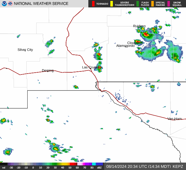
Current Radar Image
Sun Almanac for Monticello, New Mexico
Sunrise: 06:06 AM
Sunset: 8:23 PM
Civil Sunrise:05:37 AM
Civil Sunset: 8:52 PM
Nautical Sunrise: 05:02 AM
Nautical Sunset: 9:27 PM
Astro Sunrise: 04:24 AM
Astro Sunset: 10:05 PM
New Mexico's Current Temperatures
 New Mexico's Satellite Image
 New Mexico's Current Wind Direction
| National Summary |
of upper and lower values of current conditions amongst 6935 locations
in the contiguous United States |
|
High
Temp |
111° |
Palm Springs, California
|
|
Low
Temp |
50° |
West Yellowstone, Montana
|
|
Wind
Speed |
32mph |
Nebraska City Municipal, Nebraska
|
|
Wind
Gust |
47mph |
Nebraska City Municipal, Nebraska
|
|
High
Pressure |
30.78Hg |
Salida Mountain, Colorado
|
|
Low
Pressure |
29.77Hg |
Munising, Michigan
|
|
| # Locations Reporting Rain |
83 |
|
| # Locations Reporting Thunderstorms / Lightning |
14 |
|
| # Locations Reporting Fog |
3 |
|
| Average Temperature in the Contiguous USA |
81° |
|
Any use of the information on this page is at your own risk. This information should not be relied upon in life-threatening situations, potential financial loss situations or in lieu of any officially disseminated information. Visit the
National Weather Service for official information.