Mission, Nebraska Weather
Current Conditions at
BEATRICE - (KBIE)
Cloudy
as of 6:35 PM CDST
Rel. Humidity: 81%
Dew Point: 37°F
Visibility: 10 Miles
Pressure: 29.94 in.
Flight Rule: MVFR
Wind Data
22 MPH
330° Northwest
Cloud Level(s): Solid Overcast at 1200ft
Current Conditions at
FALLS CITY - (KFNB)
Cloudy
Light Thunderstorm Rain
as of 6:39 PM CDST
Rel. Humidity: 93%
Dew Point: 41°F
Visibility: 7 Miles
Pressure: 29.88 in.
Flight Rule: IFR
Wind Data
17 MPH
Gust: 28 MPH
310° Northwest
Cloud Level(s): Solid Overcast at 900ft
Current Conditions at
NEBRASKA CITY MUNI - (KAFK)
Cloudy
as of 6:35 PM CDST
Rel. Humidity: 100%
Dew Point: 41°F
Visibility: 10 Miles
Pressure: 29.89 in.
Flight Rule: IFR
Wind Data
17 MPH
330° Northwest
Cloud Level(s): Solid Overcast at 700ft
Current Conditions at
MANHATTAN - (KMHK)
Cloudy
as of 6:36 PM CDST
Rel. Humidity: 71%
Dew Point: 41°F
Visibility: 10 Miles
Pressure: 29.94 in.
Flight Rule: MVFR
Cloud Level(s): Broken at 2000ft, Solid Overcast at 6500ft
Moon Almanac for Mission, Nebraska
Moon Phase: Full Moon
Moon Illumination: 96%
Moon Age: 16.5 Days
Moon is currently below the horizon
Distance from Moon to Earth: 249,214 miles
Upcoming Lunar Events for
Mission: |
| Next Event | Event Time | Illum |
|
|
|
| Moonrise: | 10:55 pm Fri | 96.0% |
| High Moon: | 03:59 am Sat | 95.1% |
| Moonset: | 08:57 am Sat | 94.2% |
 | New Moon: Wed Mar 18 |
 | First Quarter: Wed Mar 25 |
 | Full Moon: Wed Apr 1 |
 | Last Quarter: Fri Apr 10 |
| New Moon: Fri Apr 17 |
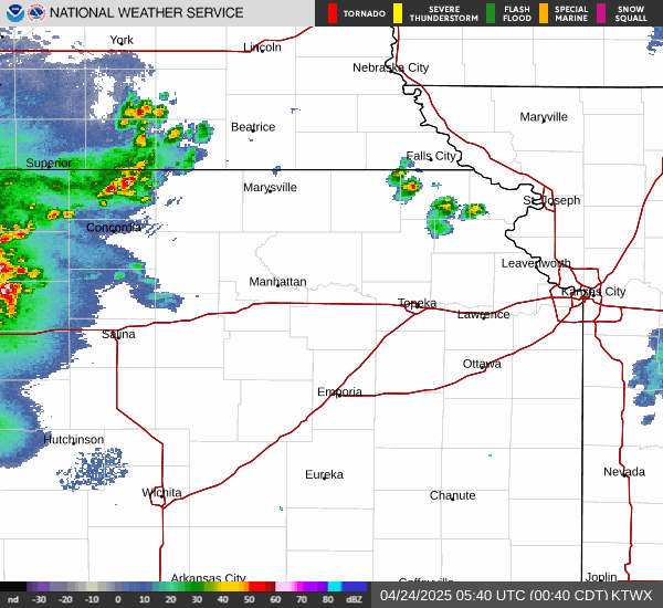
Current Radar Image
| Nebraska State Summary |
of upper and lower values of current conditions amongst 34 locations
in Nebraska |
|
|
|
|
|
|
|
|
|
|
|
High
Pressure |
30.11Hg |
Chadron
|
|
Low
Pressure |
29.88Hg |
Falls City
and 1 other location
|
|
| Average temperature in Nebraska |
45° |
|
| # Locations Reporting Rain |
1 |
|
# Locations Reporting VFR
(Visual Flight Rules) |
34 |
|
Nebraska's Current Temperatures
 Nebraska's Satellite Image
 Nebraska's Current Wind Direction
| National Summary |
of upper and lower values of current conditions amongst 6939 locations
in the contiguous United States |
|
High
Temp |
95° |
Laredo AFB, Texas
|
|
Low
Temp |
10° |
Berthoud Pass, Colorado
|
|
Wind
Speed |
36mph |
Sterling Municipal, Colorado
|
|
Wind
Gust |
51mph |
Berthoud Pass, Colorado
|
|
Wind
Chill |
-12° |
Berthoud Pass, Colorado
|
|
Heat
Index |
96° |
Laredo AFB, Texas
|
|
High
Pressure |
30.41Hg |
Friday Harbor, Washington
and 4 other locations
|
|
Low
Pressure |
29.73Hg |
Laredo AFB, Texas
and 1 other location
|
|
| # Locations Reporting Snow |
38 |
|
| # Locations Reporting Rain |
86 |
|
| # Locations Reporting Thunderstorms / Lightning |
19 |
|
| # Locations Reporting Fog |
7 |
|
| Average Temperature in the Contiguous USA |
63° |
|
Any use of the information on this page is at your own risk. This information should not be relied upon in life-threatening situations, potential financial loss situations or in lieu of any officially disseminated information. Visit the
National Weather Service for official information.