Mills, New Mexico Weather
No Watches or Warnings for Mills
Issued: 12:01 pm MDT Jul 5, 2025 Latitude: 36.0853104 Longitude: -104.2552577 View on Google Maps
|
|
|
|
|
|
|
|
|
|
 |
 |
 |
 |
 |
 |
|
 |
| High: °F |
Low: °F |
High: °F |
High: °F |
High: °F |
High: °F |
High: °F |
High: °F |
| Low: °F |
Low: °F |
Low: °F |
Low: °F |
Low: °F |
|
| Thunderstorms |
Thunderstorms |
Thunderstorms |
Thunderstorms |
Thunderstorms |
Sunny |
Sunny |
Thunderstorms |
Current Conditions at
RATON AIRPORT - (KRTN)
82°
Clear
as of 11:53 AM MDST
Rel. Humidity: 34%
Dew Point: 52°F
Visibility: 10 Miles
Pressure: 30.30 in.
Flight Rule: VFR
Cloud Level(s): Clear
Current Conditions at
LAS VEGAS - (KLVS)
81°
Clear
as of 11:53 AM MDST
Rel. Humidity: 42%
Dew Point: 55°F
Visibility: 10 Miles
Pressure: 30.36 in.
Flight Rule: VFR
Cloud Level(s): Clear
Current Conditions at
CLAYTON - (KCAO)
84°
Clear
as of 11:55 AM MDST
Rel. Humidity: 45%
Dew Point: 61°F
Visibility: 10 Miles
Pressure: 30.21 in.
Flight Rule: VFR
Wind Data
10 MPH
Gust: 21 MPH
020° North
Cloud Level(s): Clear
Current Conditions at
TUCUMCARI - (KTCC)
82°
Clear
as of 11:53 AM MDST
Rel. Humidity: 65%
Dew Point: 70°F
Visibility: 10 Miles
Pressure: 30.12 in.
Flight Rule: VFR
Wind Data
8 MPH
060° Northeast
Cloud Level(s): Clear
|
This Afternoon... A 50 percent chance of showers and thunderstorms, mainly after 3pm. Partly sunny, with a high near 86. East wind around 10 mph becoming south. New rainfall amounts of less than a tenth of an inch, except higher amounts possible in thunderstorms. |
|
|
Tonight... Scattered showers and thunderstorms, mainly before 9pm. Partly cloudy, with a low around 58. South wind 5 to 10 mph becoming north after midnight. Chance of precipitation is 30%. |
|
|
Sunday... Scattered showers and thunderstorms after 3pm. Some of the storms could be severe. Increasing clouds, with a high near 85. Northwest wind 5 to 15 mph becoming south in the afternoon. Chance of precipitation is 40%. |
|
 |
Sunday Night... Scattered showers and thunderstorms before midnight. Some of the storms could be severe. Partly cloudy, with a low around 58. Southeast wind 5 to 15 mph becoming southwest after midnight. Chance of precipitation is 40%. |
|
|
Monday... Scattered showers and thunderstorms after noon. Mostly sunny, with a high near 81. Northeast wind 5 to 15 mph becoming southwest in the afternoon. Chance of precipitation is 50%. |
|
|
Monday Night... A 30 percent chance of showers and thunderstorms before midnight. Partly cloudy, with a low around 57. |
|
|
Tuesday... A 20 percent chance of showers and thunderstorms after noon. Sunny, with a high near 85. |
|
 |
Tuesday Night... A 20 percent chance of showers and thunderstorms before midnight. Mostly clear, with a low around 58. |
|
|
Wednesday... Sunny, with a high near 88. |
|
 |
Wednesday Night... Mostly clear, with a low around 60. |
|
|
Thursday... Sunny, with a high near 93. |
|
 |
Thursday Night... A 20 percent chance of showers and thunderstorms. Mostly cloudy, with a low around 60. |
|
|
Friday... A 20 percent chance of showers and thunderstorms. Mostly sunny, with a high near 86. |
|
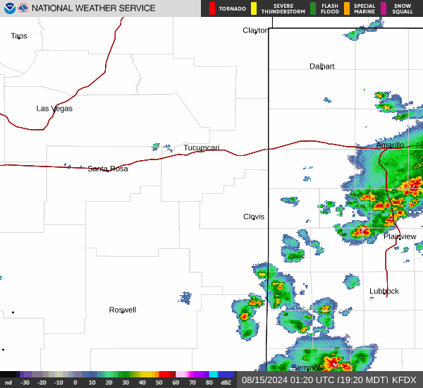
Current Radar Image
Sun Almanac for Mills, New Mexico
Sunrise: 05:46 AM
Sunset: 8:17 PM
Civil Sunrise:05:16 AM
Civil Sunset: 8:47 PM
Nautical Sunrise: 04:39 AM
Nautical Sunset: 9:25 PM
Astro Sunrise: 03:58 AM
Astro Sunset: 10:06 PM
New Mexico's Current Temperatures
 New Mexico's Satellite Image
 New Mexico's Current Wind Direction
| National Summary |
of upper and lower values of current conditions amongst 7048 locations
in the contiguous United States |
|
High
Temp |
104° |
Davis-Monthan AFB, Arizona
|
|
Low
Temp |
46° |
Mullan Pass, Idaho
|
|
Wind
Speed |
25mph |
Gwinn, Michigan
|
|
Wind
Gust |
36mph |
Mercury, Nevada
|
|
Heat
Index |
111° |
Fairfield, Iowa
|
|
High
Pressure |
30.84Hg |
Salida Mountain, Colorado
|
|
Low
Pressure |
29.80Hg |
Munising, Michigan
|
|
| # Locations Reporting Rain |
65 |
|
| # Locations Reporting Thunderstorms / Lightning |
11 |
|
| Average Temperature in the Contiguous USA |
83° |
|
Any use of the information on this page is at your own risk. This information should not be relied upon in life-threatening situations, potential financial loss situations or in lieu of any officially disseminated information. Visit the
National Weather Service for official information.