| your sport, your way | ||||
 |  |  |  |  |
|

| Overnight | Tuesday | Wednesday | Thursday | Friday | Saturday | Sunday | Monday |
 |
 |
 |
 |
 |
 |
|
|
| Low: 73°F | High: 94°F | High: 90°F | High: 93°F | High: 93°F | High: 93°F | High: 92°F | High: 90°F |
| Low: 74°F | Low: 71°F | Low: 69°F | Low: 72°F | Low: 73°F | Low: 71°F | ||
| Thunderstorms | Thunderstorms | Thunderstorms | Thunderstorms | Thunderstorms | Thunderstorms | Thunderstorms | Thunderstorms |


|
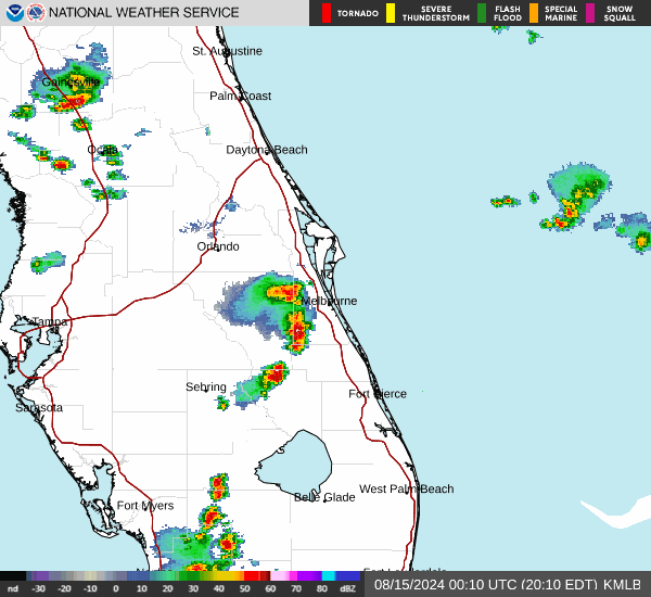
Overnight... A 30 percent chance of showers and thunderstorms before 2am. Mostly cloudy, with a low around 73. South southeast wind 10 to 15 mph, with gusts as high as 20 mph. |
|
Tuesday... A 50 percent chance of showers and thunderstorms, mainly after 11am. Partly sunny, with a high near 94. Heat index values as high as 102. South southwest wind 10 to 15 mph, with gusts as high as 25 mph. New rainfall amounts of less than a tenth of an inch, except higher amounts possible in thunderstorms. |
 |
Tuesday Night... A 40 percent chance of showers and thunderstorms, mainly after 2am. Partly cloudy, with a low around 74. South wind 10 to 15 mph. |
|
Wednesday... A chance of showers and thunderstorms, then showers likely and possibly a thunderstorm after 8am. Mostly cloudy, with a high near 90. Windy, with a west southwest wind 10 to 20 mph, with gusts as high as 30 mph. Chance of precipitation is 70%. |
 |
Wednesday Night... A 20 percent chance of showers and thunderstorms. Partly cloudy, with a low around 71. West southwest wind 10 to 15 mph, with gusts as high as 25 mph. |
|
Thursday... A 20 percent chance of showers and thunderstorms after 2pm. Sunny, with a high near 93. West wind 10 to 15 mph, with gusts as high as 20 mph. |
 |
Thursday Night... Partly cloudy, with a low around 69. West southwest wind 5 to 10 mph. |
|
Friday... A 30 percent chance of showers and thunderstorms after 2pm. Mostly sunny, with a high near 93. Southwest wind 5 to 10 mph. |
 |
Friday Night... A 30 percent chance of showers and thunderstorms, mainly before 8pm. Partly cloudy, with a low around 72. South southwest wind 5 to 10 mph. |
|
Saturday... A 40 percent chance of showers and thunderstorms. Mostly sunny, with a high near 93. West southwest wind 10 to 15 mph, with gusts as high as 25 mph. |
|
Saturday Night... A 20 percent chance of showers and thunderstorms. Partly cloudy, with a low around 73. West wind around 10 mph, with gusts as high as 20 mph. |
|
Sunday... A 40 percent chance of showers and thunderstorms. Mostly sunny, with a high near 92. West southwest wind 10 to 15 mph, with gusts as high as 20 mph. |
|
Sunday Night... A 30 percent chance of showers and thunderstorms. Partly cloudy, with a low around 71. West southwest wind around 10 mph. |
|
Monday... A 40 percent chance of showers and thunderstorms. Mostly sunny, with a high near 90. West southwest wind 10 to 15 mph, with gusts as high as 25 mph. |