Midway, California Weather
No Watches or Warnings for Midway
Issued: 12:02 pm PDT May 4, 2024 Latitude: 40.5020998 Longitude: -121.9663831 View on Google Maps
|
|
|
|
|
|
|
|
|
|
 |
 |
 |
|
 |
|
|
|
| High: °F |
Low: °F |
High: °F |
High: °F |
High: °F |
High: °F |
High: °F |
High: °F |
| Low: °F |
Low: °F |
Low: °F |
Low: °F |
Low: °F |
|
| Thunderstorms |
Thunderstorms |
Partly Sunny |
Partly Sunny |
Sunny |
Sunny |
Sunny |
Sunny |
Current Conditions at
REDDING - (KRDD)
52°
Cloudy
Light Rain
as of 11:53 AM PDST
Rel. Humidity: 81%
Dew Point: 46°F
Visibility: 10 Miles
Pressure: 29.63 in.
Flight Rule: VFR
Wind Data
7 MPH
130° Southeast
Cloud Level(s): Broken at 4700ft, Solid Overcast at 5500ft
Current Conditions at
RED BLUFF - (KRBL)
52°
Cloudy
Light Rain
as of 12:06 PM PDST
Rel. Humidity: 81%
Dew Point: 46°F
Visibility: 9 Miles
Pressure: 29.65 in.
Flight Rule: IFR
Wind Data
8 MPH
130° Southeast
Cloud Level(s): Broken at 800ft, Broken at 1200ft, Solid Overcast at 5000ft
Current Conditions at
MT SHASTA - (KMHS)
34°
Cloudy
Snow Fog
as of 11:56 AM PDST
Rel. Humidity: 93%
Dew Point: 32°F
Visibility: 1/2 Miles
Pressure: 29.57 in.
Flight Rule: IFR
Current Conditions at
OROVILLE - (KOVE)
Cloudy
Light Rain Mist
as of 11:53 AM PDST
Rel. Humidity: 87%
Dew Point: 46°F
Visibility: 6 Miles
Pressure: 29.72 in.
Flight Rule: VFR
Wind Data
14 MPH
170° South
Cloud Level(s): Scattered at 1100ft, Scattered at 1600ft, Solid Overcast at 5500ft
|
This Afternoon... Showers, with thunderstorms also possible after 2pm. Temperature falling to around 46 by 4pm. South wind 10 to 13 mph, with gusts as high as 20 mph. Chance of precipitation is 80%. New rainfall amounts between a quarter and half of an inch possible. |
|
|
Tonight... Showers and thunderstorms likely before 2am, then a slight chance of showers between 2am and 3am. Mostly cloudy, with a low around 36. South southeast wind 3 to 6 mph. Chance of precipitation is 70%. New rainfall amounts between a tenth and quarter of an inch, except higher amounts possible in thunderstorms. |
|
|
Sunday... Partly sunny, with a high near 54. Southeast wind 5 to 9 mph becoming south southwest in the morning. |
|
 |
Sunday Night... Mostly cloudy, with a low around 42. Southeast wind 3 to 7 mph. |
|
|
Monday... Partly sunny, with a high near 59. Light south southeast wind becoming south southwest 5 to 10 mph in the morning. |
|
 |
Monday Night... Partly cloudy, with a low around 39. |
|
|
Tuesday... Sunny, with a high near 64. |
|
 |
Tuesday Night... Clear, with a low around 43. |
|
|
Wednesday... Sunny, with a high near 71. |
|
|
Wednesday Night... Clear, with a low around 49. |
|
|
Thursday... Sunny, with a high near 78. |
|
|
Thursday Night... Clear, with a low around 54. |
|
|
Friday... Sunny, with a high near 82. |
|
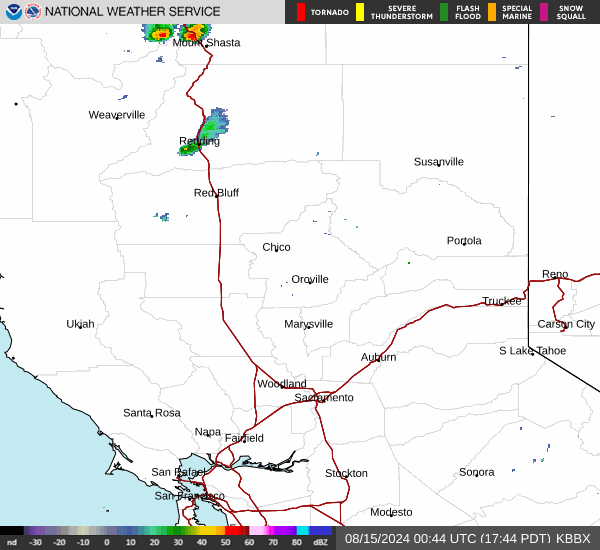
Current Radar Image
Sun Almanac for Midway, California
Sunrise: 06:02 AM
Sunset: 8:07 PM
Civil Sunrise:05:32 AM
Civil Sunset: 8:37 PM
Nautical Sunrise: 04:55 AM
Nautical Sunset: 9:14 PM
Astro Sunrise: 04:15 AM
Astro Sunset: 9:54 PM
California's Current Temperatures
 California's Satellite Image
 California's Current Wind Direction
| National Summary |
of upper and lower values of current conditions amongst 6967 locations
in the contiguous United States |
|
High
Temp |
91° |
Gila Bend (Aaf), Arizona
and 2 other locations
|
|
Low
Temp |
34° |
Klamath Falls, Oregon
and 2 other locations
|
|
Wind
Speed |
38mph |
Reno, Nevada
|
|
Wind
Gust |
55mph |
Reno, Nevada
|
|
Wind
Chill |
21° |
Berthoud Pass, Colorado
|
|
Heat
Index |
109° |
Ft Rucker/Hanche, Alabama
|
|
High
Pressure |
30.40Hg |
Rockland, Maine
and 2 other locations
|
|
Low
Pressure |
29.45Hg |
Pendleton, Oregon
and 1 other location
|
|
| # Locations Reporting Snow |
2 |
|
| # Locations Reporting Rain |
190 |
|
| # Locations Reporting Thunderstorms / Lightning |
21 |
|
| # Locations Reporting Fog |
8 |
|
| Average Temperature in the Contiguous USA |
67° |
|
Any use of the information on this page is at your own risk. This information should not be relied upon in life-threatening situations, potential financial loss situations or in lieu of any officially disseminated information. Visit the
National Weather Service for official information.