Melrose, Virginia Weather
No Watches or Warnings for Melrose
Issued: 4:30 pm EDT May 2, 2024 Latitude: 37.0495853 Longitude: -79.0550172 View on Google Maps
|
|
|
|
|
|
|
|
|
|
 |
 |
 |
 |
|
 |
 |
|
| Low: °F |
High: °F |
High: °F |
High: °F |
High: °F |
High: °F |
High: °F |
High: °F |
| Low: °F |
Low: °F |
Low: °F |
Low: °F |
Low: °F |
Low: °F |
|
| Mostly Clear |
Mostly Sunny |
Thunderstorms |
Thunderstorms |
Thunderstorms |
Thunderstorms |
Thunderstorms |
Thunderstorms |
Current Conditions at
LYNCHBURG - (KLYH)
88°
Clear
as of 3:54 PM EDST
Rel. Humidity: 27%
Dew Point: 50°F
Visibility: 10 Miles
Pressure: 29.97 in.
Flight Rule: VFR
Cloud Level(s): Clear
Current Conditions at
DANVILLE - (KDAN)
88°
Clear
as of 3:53 PM EDST
Rel. Humidity: 31%
Dew Point: 54°F
Visibility: 10 Miles
Pressure: 29.96 in.
Flight Rule: VFR
Cloud Level(s): Clear
Current Conditions at
FARMVILLE - (KFVX)
88°
Clear
as of 4:35 PM EDST
Rel. Humidity: 29%
Dew Point: 52°F
Visibility: 10 Miles
Pressure: 29.94 in.
Flight Rule: VFR
Cloud Level(s): Clear
Current Conditions at
ROXBORO - (KTDF)
86°
Partly Cloudy
as of 4:25 PM EDST
Rel. Humidity: 33%
Dew Point: 54°F
Visibility: 10 Miles
Pressure: 29.99 in.
Flight Rule: VFR
Cloud Level(s): Scattered at 7000ft
|
Tonight... Mostly clear, with a low around 60. South wind around 6 mph. |
|
|
Friday... Mostly sunny, with a high near 89. Calm wind becoming south 5 to 8 mph in the morning. |
|
 |
Friday Night... A chance of showers and thunderstorms, mainly after 3am. Mostly cloudy, with a low around 60. Southeast wind 6 to 8 mph becoming northeast after midnight. Chance of precipitation is 30%. New rainfall amounts of less than a tenth of an inch, except higher amounts possible in thunderstorms. |
|
|
Saturday... A chance of showers and thunderstorms. Cloudy, with a high near 75. East wind around 7 mph. Chance of precipitation is 50%. New rainfall amounts between a tenth and quarter of an inch, except higher amounts possible in thunderstorms. |
|
 |
Saturday Night... Showers likely and possibly a thunderstorm. Cloudy, with a low around 62. East wind 6 to 9 mph. Chance of precipitation is 70%. New rainfall amounts between a quarter and half of an inch possible. |
|
|
Sunday... A chance of showers and thunderstorms, then showers likely and possibly a thunderstorm after 2pm. Mostly cloudy, with a high near 78. Chance of precipitation is 60%. New rainfall amounts between a tenth and quarter of an inch, except higher amounts possible in thunderstorms. |
|
 |
Sunday Night... Showers and thunderstorms likely before 11pm, then a chance of showers between 11pm and 2am. Mostly cloudy, with a low around 63. Chance of precipitation is 60%. |
|
|
Monday... Showers likely and possibly a thunderstorm, mainly after 2pm. Mostly cloudy, with a high near 83. Chance of precipitation is 60%. |
|
|
Monday Night... Showers and thunderstorms likely before 11pm, then a chance of showers between 11pm and 2am. Mostly cloudy, with a low around 63. Chance of precipitation is 60%. |
|
|
Tuesday... A chance of showers and thunderstorms after 2pm. Partly sunny, with a high near 85. Chance of precipitation is 30%. |
|
 |
Tuesday Night... A chance of showers and thunderstorms. Partly cloudy, with a low around 65. Chance of precipitation is 30%. |
|
|
Wednesday... A chance of showers and thunderstorms. Mostly sunny and hot, with a high near 90. Chance of precipitation is 30%. |
|
|
Wednesday Night... A chance of showers and thunderstorms. Mostly cloudy, with a low around 66. Chance of precipitation is 30%. |
|
|
Thursday... A chance of showers and thunderstorms. Partly sunny, with a high near 88. Chance of precipitation is 30%. |
|
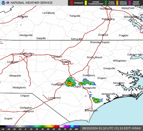
Current Radar Image
Sun Almanac for Melrose, Virginia
Sunrise: 06:20 AM
Sunset: 8:07 PM
Civil Sunrise:05:52 AM
Civil Sunset: 8:35 PM
Nautical Sunrise: 05:18 AM
Nautical Sunset: 9:09 PM
Astro Sunrise: 04:42 AM
Astro Sunset: 9:45 PM
Virginia's Current Temperatures
 Virginia's Satellite Image
 Virginia's Current Wind Direction
| National Summary |
of upper and lower values of current conditions amongst 7011 locations
in the contiguous United States |
|
High
Temp |
97° |
Baltimore Inner Harbor, Maryland
and 1 other location
|
|
Low
Temp |
32° |
Salida Mountain, Colorado
|
|
Wind
Speed |
32mph |
Hettinger, North Dakota
|
|
Wind
Gust |
51mph |
Hettinger, North Dakota
|
|
Wind
Chill |
17° |
Salida Mountain, Colorado
|
|
Heat
Index |
110° |
Ft Rucker/Hanche, Alabama
|
|
High
Pressure |
30.21Hg |
Salida Mountain, Colorado
|
|
Low
Pressure |
29.63Hg |
Edinburg Intl Arpt, Texas
|
|
| # Locations Reporting Snow |
2 |
|
| # Locations Reporting Rain |
117 |
|
| # Locations Reporting Thunderstorms / Lightning |
9 |
|
| Average Temperature in the Contiguous USA |
71° |
|
Any use of the information on this page is at your own risk. This information should not be relied upon in life-threatening situations, potential financial loss situations or in lieu of any officially disseminated information. Visit the
National Weather Service for official information.