No Watches or Warnings for Marion
Issued: 1:57 am EDT Apr 29, 2024 Latitude: 32.6623663 Longitude: -83.4371196 View on Google Maps
|
|
|
|
|
|
|
|
|
|
 |
 |
 |
|
|
 |
 |
|
| Low: °F |
High: °F |
High: °F |
High: °F |
High: °F |
High: °F |
High: °F |
High: °F |
| Low: °F |
Low: °F |
Low: °F |
Low: °F |
Low: °F |
Low: °F |
|
| Mostly Clear |
Sunny |
Thunderstorms |
Sunny |
Sunny |
Thunderstorms |
Thunderstorms |
Thunderstorms |
Current Conditions at
ROBINS AFB - (KWRB)
64°
Clear
as of 12:55 AM EDST
Rel. Humidity: 72%
Dew Point: 55°F
Visibility: 10 Miles
Pressure: 30.15 in.
Flight Rule: VFR
Cloud Level(s): Clear
Current Conditions at
MACON - (KMCN)
61°
Clear
as of 12:53 AM EDST
Rel. Humidity: 82%
Dew Point: 55°F
Visibility: 10 Miles
Pressure: 30.16 in.
Flight Rule: VFR
Wind Data
8 MPH
130° Southeast
Cloud Level(s): Clear
Current Conditions at
DUBLIN/BUD BARRON - (KDBN)
63°
Clear
as of 1:35 AM EDST
Rel. Humidity: 72%
Dew Point: 54°F
Visibility: 10 Miles
Pressure: 30.19 in.
Flight Rule: VFR
Wind Data
5 MPH
120° Southeast
Cloud Level(s): Clear
Current Conditions at
MILLEDGEVILLE/BALDWIN - (KMLJ)
63°
Mostly Clear
as of 1:35 AM EDST
Rel. Humidity: 82%
Dew Point: 57°F
Visibility: 10 Miles
Pressure: 30.17 in.
Flight Rule: VFR
Cloud Level(s): Few at 4600ft
|
Overnight... Mostly clear, with a low around 58. Southeast wind around 5 mph. |
|
|
Monday... Sunny, with a high near 83. South wind 5 to 10 mph. |
|
 |
Monday Night... Partly cloudy, with a low around 62. Southeast wind 5 to 10 mph. |
|
|
Tuesday... A slight chance of showers between 10am and 1pm, then a chance of showers and thunderstorms after 1pm. Partly sunny, with a high near 85. Southwest wind 5 to 10 mph. Chance of precipitation is 40%. |
|
 |
Tuesday Night... A chance of showers and thunderstorms before 11pm, then a slight chance of showers between 11pm and 2am. Partly cloudy, with a low around 62. West wind around 5 mph. Chance of precipitation is 30%. |
|
|
Wednesday... Sunny, with a high near 89. |
|
 |
Wednesday Night... Clear, with a low around 61. |
|
|
Thursday... Sunny, with a high near 90. |
|
|
Thursday Night... Mostly clear, with a low around 63. |
|
|
Friday... A 20 percent chance of showers and thunderstorms after 2pm. Mostly sunny, with a high near 88. |
|
 |
Friday Night... A 20 percent chance of showers and thunderstorms. Partly cloudy, with a low around 64. |
|
|
Saturday... A 30 percent chance of showers and thunderstorms. Mostly sunny, with a high near 85. |
|
|
Saturday Night... A 30 percent chance of showers and thunderstorms. Partly cloudy, with a low around 63. |
|
|
Sunday... A 20 percent chance of showers and thunderstorms. Mostly sunny, with a high near 87. |
|
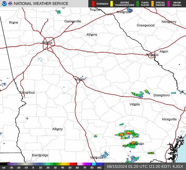
Current Radar Image
Sun Almanac for Marion, Georgia
Sunrise: 06:48 AM
Sunset: 8:14 PM
Civil Sunrise:06:22 AM
Civil Sunset: 8:40 PM
Nautical Sunrise: 05:51 AM
Nautical Sunset: 9:11 PM
Astro Sunrise: 05:18 AM
Astro Sunset: 9:44 PM
Georgia's Current Temperatures
 Georgia's Satellite Image
 Georgia's Current Wind Direction
| National Summary |
of upper and lower values of current conditions amongst 6950 locations
in the contiguous United States |
|
High
Temp |
82° |
Kingsville NAS, Texas
|
|
Low
Temp |
1° |
Imperial Beach NAS, California
|
|
Wind
Speed |
31mph |
Grandview, Missouri
|
|
Wind
Gust |
45mph |
Berthoud Pass, Colorado
|
|
Wind
Chill |
0° |
Berthoud Pass, Colorado
|
|
High
Pressure |
30.27Hg |
Salida Mountain, Colorado
|
|
Low
Pressure |
29.66Hg |
Worthington, Minnesota
|
|
| # Locations Reporting Snow |
5 |
|
| # Locations Reporting Rain |
141 |
|
| # Locations Reporting Thunderstorms / Lightning |
5 |
|
| # Locations Reporting Fog |
24 |
|
| Average Temperature in the Contiguous USA |
57° |
|
Any use of the information on this page is at your own risk. This information should not be relied upon in life-threatening situations, potential financial loss situations or in lieu of any officially disseminated information. Visit the
National Weather Service for official information.