Keys Field, South Carolina Weather
Issued: 7:59 pm EDT Jul 17, 2025 Latitude: 33.7435039 Longitude: -79.0678157 View on Google Maps
|
|
|
|
|
|
|
|
|
|
 |
 |
|
 |
 |
 |
 |
 |
| Low: °F |
High: °F |
High: °F |
High: °F |
High: °F |
High: °F |
High: °F |
High: °F |
| Low: °F |
Low: °F |
Low: °F |
Low: °F |
Low: °F |
Low: °F |
|
| Cloudy |
Thunderstorms |
Thunderstorms |
Thunderstorms |
Thunderstorms |
Thunderstorms |
Thunderstorms |
Thunderstorms |
Current Conditions at
MYRTLE BEACH AFB - (KMYR)
82°
Clear
as of 10:53 PM EDST
Rel. Humidity: 83%
Dew Point: 77°F
Visibility: 10 Miles
Pressure: 30.13 in.
Flight Rule: VFR
Wind Data
7 MPH
210° Southwest
Cloud Level(s): Clear
Current Conditions at
N MYRTLE BEACH - (KCRE)
82°
Clear
as of 10:53 PM EDST
Rel. Humidity: 83%
Dew Point: 77°F
Visibility: 10 Miles
Pressure: 30.12 in.
Flight Rule: VFR
Wind Data
15 MPH
230° Southwest
Cloud Level(s): Clear
Current Conditions at
WHITEVILLE/COLUMBUS - (KCPC)
81°
Clear
as of 11:15 PM EDST
Rel. Humidity: 83%
Dew Point: 75°F
Visibility: 10 Miles
Pressure: 30.13 in.
Flight Rule: VFR
Cloud Level(s): Clear
Current Conditions at
BRUNSWICK COUNTY ARPT - (KSUT)
82°
Mostly Cloudy
as of 11:15 PM EDST
Rel. Humidity: 83%
Dew Point: 77°F
Visibility: 10 Miles
Pressure: 30.11 in.
Flight Rule: MVFR
Wind Data
20 MPH
220° Southwest
Cloud Level(s): Broken at 1500ft
|
Tonight... Partly cloudy, with a low around 77. Southwest wind 3 to 6 mph. |
|
|
Friday... A slight chance of showers and thunderstorms after 2pm. Mostly sunny, with a high near 95. Heat index values as high as 109. Southwest wind 5 to 7 mph. Chance of precipitation is 20%. |
|
 |
Friday Night... Mostly clear, with a low around 77. Southwest wind 3 to 6 mph. |
|
|
Saturday... A slight chance of showers and thunderstorms after 2pm. Mostly sunny, with a high near 96. Heat index values as high as 110. Southwest wind 5 to 7 mph. Chance of precipitation is 20%. |
|
|
Saturday Night... Partly cloudy, with a low around 78. Southwest wind around 6 mph. |
|
|
Sunday... A slight chance of showers and thunderstorms after 2pm. Sunny and hot, with a high near 97. Chance of precipitation is 20%. |
|
|
Sunday Night... Partly cloudy, with a low around 77. |
|
|
Monday... Showers and thunderstorms likely after 2pm. Mostly sunny, with a high near 94. Chance of precipitation is 60%. |
|
 |
Monday Night... Showers and thunderstorms likely, mainly before 8pm. Mostly cloudy, with a low around 74. Chance of precipitation is 60%. |
|
|
Tuesday... Showers and thunderstorms likely, mainly after 2pm. Partly sunny, with a high near 89. Chance of precipitation is 60%. |
|
 |
Tuesday Night... Showers and thunderstorms likely. Partly cloudy, with a low around 74. Chance of precipitation is 60%. |
|
|
Wednesday... A chance of showers and thunderstorms. Mostly sunny, with a high near 90. Chance of precipitation is 40%. |
|
 |
Wednesday Night... A chance of showers and thunderstorms. Partly cloudy, with a low around 73. Chance of precipitation is 30%. |
|
|
Thursday... A chance of showers and thunderstorms. Mostly sunny, with a high near 90. Chance of precipitation is 30%. |
|
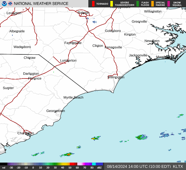
Current Radar Image
Sun Almanac for Keys Field, South Carolina
Sunrise: 06:18 AM
Sunset: 8:27 PM
Civil Sunrise:05:50 AM
Civil Sunset: 8:55 PM
Nautical Sunrise: 05:16 AM
Nautical Sunset: 9:29 PM
Astro Sunrise: 04:39 AM
Astro Sunset: 10:06 PM
South Carolina's Current Temperatures
 South Carolina's Satellite Image
 South Carolina's Current Wind Direction
| National Summary |
of upper and lower values of current conditions amongst 6896 locations
in the contiguous United States |
|
High
Temp |
99° |
Laguna (Aaf), Arizona
and 4 other locations
|
|
Low
Temp |
46° |
Pagosa Springs, Colorado
|
|
Wind
Speed |
28mph |
Mercury, Nevada
|
|
Wind
Gust |
45mph |
Mercury, Nevada
|
|
Wind
Chill |
42° |
Salida Mountain, Colorado
|
|
Heat
Index |
107° |
Edenton, North Carolina
|
|
High
Pressure |
30.72Hg |
Salida Mountain, Colorado
|
|
Low
Pressure |
29.54Hg |
Caribou, Maine
|
|
| # Locations Reporting Rain |
49 |
|
| # Locations Reporting Thunderstorms / Lightning |
14 |
|
| # Locations Reporting Fog |
3 |
|
| Average Temperature in the Contiguous USA |
74° |
|
Any use of the information on this page is at your own risk. This information should not be relied upon in life-threatening situations, potential financial loss situations or in lieu of any officially disseminated information. Visit the
National Weather Service for official information.