No Watches or Warnings for Kawela
|
|
|
|
|
|
|
|
 |
 |
|
|
|
|
|
|
| Low: °F |
High: °F |
High: °F |
High: °F |
High: °F |
High: °F |
High: °F |
High: °F |
| Low: °F |
Low: °F |
Low: °F |
Low: °F |
Low: °F |
Low: °F |
|
| Thunderstorms |
Rain |
Rain |
Rain |
Rain |
Rain |
Rain |
Rain |
Current Conditions at
WHEELER AFB - (PHHI)
72°
Clear
as of 11:55 PM HDST
Rel. Humidity: 83%
Dew Point: 66°F
Visibility: 10 Miles
Pressure: 30.10 in.
Flight Rule: VFR
Cloud Level(s): Clear
Current Conditions at
KANEOHE BAY MCAS - (PHNG)
79°
Mostly Clear
Light Rain
as of 11:57 PM HDST
Rel. Humidity: 83%
Dew Point: 73°F
Visibility: 10 Miles
Pressure: 30.02 in.
Flight Rule: VFR
Wind Data
14 MPH
Gust: 31 MPH
130° Southeast
Cloud Level(s): Few at 1700ft, Few at 11000ft
Current Conditions at
HONOLULU - (PHNL)
75°
Cloudy
Light Rain
as of 11:53 PM HDST
Rel. Humidity: 88%
Dew Point: 72°F
Visibility: 10 Miles
Pressure: 30.06 in.
Flight Rule: VFR
Cloud Level(s): Scattered at 2400ft, Broken at 4500ft, Solid Overcast at 12000ft
Current Conditions at
LIHUE - (PHLI)
75°
Cloudy
as of 11:53 PM HDST
Rel. Humidity: 88%
Dew Point: 72°F
Visibility: 10 Miles
Pressure: 30.07 in.
Flight Rule: VFR
Wind Data
10 MPH
190° South
Cloud Level(s): Few at 1500ft, Broken at 3500ft, Solid Overcast at 4500ft
|
Tonight... Showers and possibly a thunderstorm before midnight, then scattered showers and thunderstorms after midnight. Low around 72. Breezy, with an east wind 14 to 18 mph, with gusts as high as 25 mph. Chance of precipitation is 100%. New rainfall amounts between a tenth and quarter of an inch, except higher amounts possible in thunderstorms. |
|
|
Sunday... Scattered showers. Mostly sunny, with a high near 82. Breezy, with an east southeast wind 11 to 21 mph, with gusts as high as 29 mph. Chance of precipitation is 30%. New precipitation amounts of less than a tenth of an inch possible. |
|
 |
Sunday Night... Scattered showers after midnight. Partly cloudy, with a low around 72. East wind 11 to 14 mph, with gusts as high as 18 mph. Chance of precipitation is 30%. |
|
|
Monday... Scattered showers before noon. Mostly sunny, with a high near 83. Breezy, with an east wind 14 to 16 mph, with gusts as high as 22 mph. Chance of precipitation is 30%. |
|
|
Monday Night... Scattered showers, mainly after midnight. Partly cloudy, with a low around 73. Breezy, with an east wind 15 to 17 mph, with gusts as high as 24 mph. Chance of precipitation is 30%. New precipitation amounts of less than a tenth of an inch possible. |
|
|
Tuesday... Scattered showers before noon. Mostly sunny, with a high near 83. Breezy, with an east wind 16 to 18 mph, with gusts as high as 25 mph. Chance of precipitation is 30%. |
|
|
Tuesday Night... Scattered showers, mainly after midnight. Partly cloudy, with a low around 72. Breezy, with an east wind 16 to 18 mph, with gusts as high as 25 mph. Chance of precipitation is 30%. |
|
|
Wednesday... Scattered showers before noon. Mostly sunny, with a high near 83. Breezy, with an east wind around 18 mph, with gusts as high as 25 mph. Chance of precipitation is 30%. |
|
|
Wednesday Night... Scattered showers, mainly after midnight. Partly cloudy, with a low around 73. Breezy, with an east wind 18 to 20 mph, with gusts as high as 26 mph. Chance of precipitation is 30%. |
|
|
Thursday... Scattered showers before noon. Mostly sunny, with a high near 82. Breezy, with an east wind around 20 mph, with gusts as high as 28 mph. Chance of precipitation is 30%. |
|
|
Thursday Night... Scattered showers. Partly cloudy, with a low around 72. Breezy, with an east wind 17 to 20 mph, with gusts as high as 28 mph. Chance of precipitation is 30%. |
|
|
Friday... Scattered showers. Mostly sunny, with a high near 83. Breezy, with an east wind 18 to 20 mph, with gusts as high as 29 mph. Chance of precipitation is 30%. |
|
|
Friday Night... Scattered showers. Partly cloudy, with a low around 72. Breezy, with an east wind 15 to 20 mph, with gusts as high as 29 mph. Chance of precipitation is 30%. |
|
|
Saturday... Scattered showers. Mostly sunny, with a high near 83. Breezy, with an east wind 15 to 20 mph, with gusts as high as 28 mph. Chance of precipitation is 30%. |
|
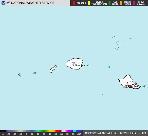
Current Radar Image
Sun Almanac for Kawela, Hawaii
Sunrise: 06:51 AM
Sunset: 8:06 PM
Civil Sunrise:06:27 AM
Civil Sunset: 8:30 PM
Nautical Sunrise: 05:58 AM
Nautical Sunset: 8:59 PM
Astro Sunrise: 05:29 AM
Astro Sunset: 9:28 PM
Hawaii's Current Temperatures
 Hawaii's Satellite Image
 Hawaii's Current Wind Direction
| National Summary |
of upper and lower values of current conditions amongst 6613 locations
in the contiguous United States |
|
High
Temp |
90° |
Orange Grove Nalf, Texas
|
|
Low
Temp |
32° |
Cutbank, Montana
and 1 other location
|
|
Wind
Speed |
33mph |
Russell, Kansas
|
|
Wind
Gust |
46mph |
Russell, Kansas
|
|
Wind
Chill |
22° |
Berthoud Pass, Colorado
|
|
Heat
Index |
102° |
Key WestNAS, Florida
|
|
High
Pressure |
30.41Hg |
Pagosa Springs, Colorado
|
|
Low
Pressure |
29.73Hg |
Worland, Wyoming
and 1 other location
|
|
| # Locations Reporting Snow |
1 |
|
| # Locations Reporting Rain |
39 |
|
| # Locations Reporting Thunderstorms / Lightning |
4 |
|
| # Locations Reporting Fog |
39 |
|
| Average Temperature in the Contiguous USA |
60° |
|
Any use of the information on this page is at your own risk. This information should not be relied upon in life-threatening situations, potential financial loss situations or in lieu of any officially disseminated information. Visit the
National Weather Service for official information.