Hauiki Homes, Hawaii Weather
No Watches or Warnings for Hauiki Homes
Issued: 12:57 pm HST Jul 3, 2025 Latitude: 21.3442709 Longitude: -157.8768235 View on Google Maps
|
|
|
|
|
|
|
|
|
|
 |
 |
 |
 |
 |
 |
 |
 |
High: °F |
Low: °F |
High: °F |
High: °F |
High: °F |
High: °F |
High: °F |
High: °F |
Low: °F |
Low: °F |
Low: °F |
Low: °F |
Low: °F |
|
Rain |
Rain |
Rain |
Rain |
Rain |
Partly Sunny |
Rain |
Partly Sunny |
Current Conditions at
HONOLULU - (PHNL)
88°
Partly Cloudy
as of 12:53 PM HST
Rel. Humidity: 43%
Dew Point: 63°F
Visibility: 10 Miles
Pressure: 30.05 in.
Flight Rule: VFR
Wind Data
22 MPH
Gust: 29 MPH
070° East
Cloud Level(s): Few at 2500ft, Scattered at 4000ft
Current Conditions at
KANEOHE BAY MCAS - (PHNG)
82°
Mostly Cloudy
as of 12:57 PM HST
Rel. Humidity: 61%
Dew Point: 68°F
Visibility: 7 Miles
Pressure: 30.05 in.
Flight Rule: VFR
Cloud Level(s): Scattered at 2900ft, Broken at 12000ft
Current Conditions at
BARBERS POINT NAS - (PHJR)
Partly Cloudy
as of 12:53 PM HST
Rel. Humidity: 48%
Dew Point: 64°F
Visibility: 10 Miles
Pressure: 30.05 in.
Flight Rule: VFR
Wind Data
15 MPH
Gust: 26 MPH
110° East
Cloud Level(s): Scattered at 6000ft
Current Conditions at
WHEELER AFB - (PHHI)
84°
Partly Cloudy
as of 12:55 PM HST
Rel. Humidity: 48%
Dew Point: 63°F
Visibility: 10 Miles
Pressure: 30.07 in.
Flight Rule: VFR
Wind Data
20 MPH
060° Northeast
Cloud Level(s): Few at 12000ft, Few at 15000ft, Scattered at 20000ft
 |
This Afternoon... Isolated showers. Mostly sunny, with a high near 86. Breezy, with an east northeast wind around 15 mph, with gusts as high as 21 mph. Chance of precipitation is 20%. |
|
 |
Tonight... Scattered showers, mainly after midnight. Partly cloudy, with a low around 76. Breezy, with an east northeast wind 8 to 15 mph, with gusts as high as 21 mph. Chance of precipitation is 30%. |
|
 |
Independence Day... Scattered showers, mainly before noon. Mostly sunny, with a high near 85. Breezy, with an east northeast wind 8 to 17 mph, with gusts as high as 24 mph. Chance of precipitation is 30%. |
|
 |
Friday Night... Scattered showers. Mostly cloudy, with a low around 75. Breezy, with an east northeast wind around 17 mph, with gusts as high as 24 mph. Chance of precipitation is 40%. New precipitation amounts of less than a tenth of an inch possible. |
|
 |
Saturday... Scattered showers, mainly before noon. Mostly sunny, with a high near 85. Breezy, with an east northeast wind 16 to 20 mph, with gusts as high as 28 mph. Chance of precipitation is 30%. New precipitation amounts of less than a tenth of an inch possible. |
|
 |
Saturday Night... Scattered showers, mainly after midnight. Mostly cloudy, with a low around 75. Breezy, with an east wind 18 to 20 mph, with gusts as high as 26 mph. Chance of precipitation is 30%. New precipitation amounts of less than a tenth of an inch possible. |
|
 |
Sunday... Scattered showers, mainly before noon. Mostly sunny, with a high near 86. Breezy, with an east northeast wind 20 to 22 mph, with gusts as high as 30 mph. Chance of precipitation is 30%. |
|
 |
Sunday Night... Scattered showers, mainly after midnight. Partly cloudy, with a low around 76. Breezy, with an east northeast wind 18 to 21 mph, with gusts as high as 29 mph. Chance of precipitation is 40%. |
|
 |
Monday... Scattered showers, mainly before noon. Partly sunny, with a high near 86. Breezy, with an east northeast wind 20 to 22 mph, with gusts as high as 31 mph. Chance of precipitation is 40%. |
|
 |
Monday Night... Scattered showers, mainly after midnight. Partly cloudy, with a low around 76. Breezy, with an east northeast wind around 20 mph, with gusts as high as 28 mph. Chance of precipitation is 30%. |
|
 |
Tuesday... Scattered showers. Mostly sunny, with a high near 85. Breezy, with an east northeast wind around 21 mph, with gusts as high as 29 mph. Chance of precipitation is 30%. |
|
 |
Tuesday Night... Scattered showers. Partly cloudy, with a low around 75. Breezy, with an east northeast wind 17 to 20 mph, with gusts as high as 26 mph. Chance of precipitation is 40%. |
|
 |
Wednesday... Scattered showers. Partly sunny, with a high near 86. Breezy, with an east northeast wind around 18 mph, with gusts as high as 26 mph. Chance of precipitation is 40%. |
|
Current Radar Image
Sun Almanac for Hauiki Homes, Hawaii
Sunrise: 06:54 AM
Sunset: 8:18 PM
Civil Sunrise:06:29 AM
Civil Sunset: 8:43 PM
Nautical Sunrise: 06:00 AM
Nautical Sunset: 9:12 PM
Astro Sunrise: 05:29 AM
Astro Sunset: 9:43 PM
Hawaii's Current Temperatures
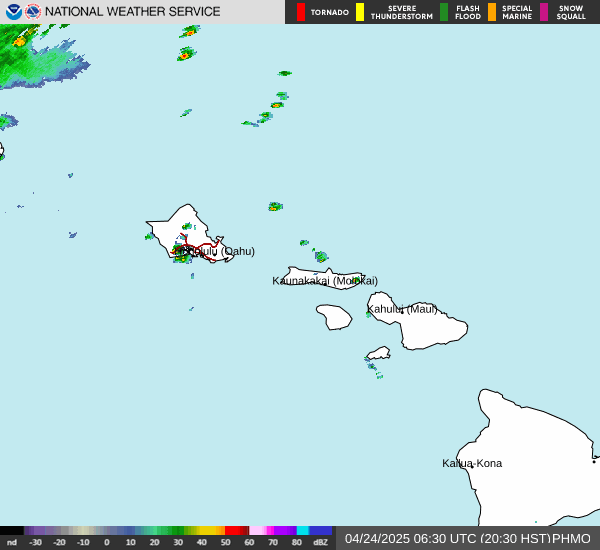
Hawaii's Satellite Image
Hawaii's Current Wind Direction
National Summary |
of upper and lower values of current conditions amongst 6861 locations in the contiguous United States |
|
High Temp |
104° |
Gila Bend (Aaf), Arizona
and 2 other locations
|
|
Low Temp |
46° |
Pagosa Springs, Colorado
|
|
Wind Speed |
38mph |
Nellis AFB, Nevada
|
|
Wind Gust |
59mph |
Boulder City Municipal, Nevada
|
|
Wind Chill |
39° |
Pagosa Springs, Colorado
|
|
Heat Index |
107° |
Benson Municipalcipal, Minnesota
and 1 other location
|
|
High Pressure |
30.58Hg |
Salida Mountain, Colorado
|
|
Low Pressure |
29.65Hg |
Mobridge, South Dakota
and 1 other location
|
|
# Locations Reporting Rain |
102 |
|
# Locations Reporting Thunderstorms / Lightning |
41 |
|
Average Temperature in the Contiguous USA |
83° |
|
Any use of the information on this page is at your own risk. This information should not be relied upon in life-threatening situations, potential financial loss situations or in lieu of any officially disseminated information. Visit the
National Weather Service for official information.