Goldfield, Nevada Weather
No Watches or Warnings for Goldfield
Issued: 4:21 am PDT Jul 4, 2025 Latitude: 37.7085439 Longitude: -117.2356341 View on Google Maps
|
|
|
|
|
|
|
|
|
|
 |
 |
|
|
|
|
|
|
| High: °F |
Low: °F |
High: °F |
High: °F |
High: °F |
High: °F |
High: °F |
High: °F |
|
Low: °F |
Low: °F |
Low: °F |
Low: °F |
Low: °F |
|
| Sunny |
Mostly Clear |
Sunny |
Sunny |
Sunny |
Sunny |
Sunny |
Sunny |
Current Conditions at
TONOPAH - (KTPH)
59°
Clear
as of 5:56 AM PDST
Rel. Humidity: 58%
Dew Point: 45°F
Visibility: 10 Miles
Pressure: 30.06 in.
Flight Rule: VFR
Cloud Level(s): Clear
Current Conditions at
MERCURY - (KDRA)
75°
Clear
as of 5:53 AM PDST
Rel. Humidity: 36%
Dew Point: 46°F
Visibility: 10 Miles
Pressure: 29.92 in.
Flight Rule: VFR
Wind Data
7 MPH
130° Southeast
Cloud Level(s): Clear
|
Independence Day... Sunny, with a high near 85. South wind 5 to 15 mph, with gusts as high as 24 mph. |
|
|
Tonight... Mostly clear, with a low around 57. South wind 6 to 14 mph becoming north northwest after midnight. Winds could gust as high as 22 mph. |
|
|
Saturday... Widespread haze after 1pm. Sunny, with a high near 85. Northwest wind 6 to 11 mph becoming southeast in the morning. Winds could gust as high as 18 mph. |
|
 |
Saturday Night... Clear, with a low around 60. South wind 6 to 11 mph becoming light and variable after midnight. |
|
|
Sunday... Sunny, with a high near 88. Light and variable wind becoming south 10 to 15 mph in the morning. Winds could gust as high as 24 mph. |
|
|
Sunday Night... Clear, with a low around 61. |
|
|
Monday... Sunny, with a high near 89. |
|
|
Monday Night... Clear, with a low around 62. |
|
|
Tuesday... Sunny, with a high near 91. |
|
|
Tuesday Night... Mostly clear, with a low around 65. |
|
|
Wednesday... Sunny, with a high near 94. |
|
|
Wednesday Night... Mostly clear, with a low around 67. |
|
|
Thursday... Sunny, with a high near 95. |
|
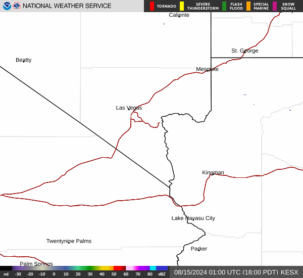
Current Radar Image
Sun Almanac for Goldfield, Nevada
Sunrise: 05:33 AM
Sunset: 8:14 PM
Civil Sunrise:05:02 AM
Civil Sunset: 8:45 PM
Nautical Sunrise: 04:23 AM
Nautical Sunset: 9:24 PM
Astro Sunrise: 03:40 AM
Astro Sunset: 10:07 PM
Nevada's Current Temperatures
 Nevada's Satellite Image
 Nevada's Current Wind Direction
| National Summary |
of upper and lower values of current conditions amongst 7174 locations
in the contiguous United States |
|
High
Temp |
88° |
Key West NAS, Florida
|
|
Low
Temp |
39° |
Yellowstone, Wyoming
and 2 other locations
|
|
Wind
Speed |
26mph |
Salida Mountain, Colorado
|
|
Wind
Gust |
37mph |
Salida Mountain, Colorado
|
|
Wind
Chill |
30° |
Salida Mountain, Colorado
|
|
Heat
Index |
99° |
Galveston, Texas
|
|
High
Pressure |
30.60Hg |
Salida Mountain, Colorado
|
|
Low
Pressure |
29.62Hg |
Hallock, Minnesota
|
|
| # Locations Reporting Snow |
1 |
|
| # Locations Reporting Rain |
49 |
|
| # Locations Reporting Thunderstorms / Lightning |
13 |
|
| # Locations Reporting Fog |
8 |
|
| Average Temperature in the Contiguous USA |
72° |
|
Any use of the information on this page is at your own risk. This information should not be relied upon in life-threatening situations, potential financial loss situations or in lieu of any officially disseminated information. Visit the
National Weather Service for official information.