No Watches or Warnings for Flint
Issued: 2:04 pm MST Dec 29, 2025 Latitude: 42.9165483 Longitude: -116.782904 View on Google Maps
|
|
|
|
|
|
|
|
|
|
 |
 |
 |
 |
 |
 |
 |
|
| Low: °F |
High: °F |
High: °F |
High: °F |
High: °F |
High: °F |
High: °F |
High: °F |
| Low: °F |
Low: °F |
Low: °F |
Low: °F |
Low: °F |
Low: °F |
|
| Mostly Clear |
Sunny |
Partly Sunny |
Rain & Snow |
Rain |
Rain & Snow |
Snow |
Snow |
Current Conditions at
MOUNTAIN HOME AFB - (KMUO)
23°
Clear
as of 10:55 PM MST
Rel. Humidity: 79%
Dew Point: 18°F
Visibility: 10 Miles
Pressure: 30.57 in.
Flight Rule: VFR
Cloud Level(s): Clear
Current Conditions at
CALDWELL - (KEUL)
28°
Clear
as of 10:56 PM MST
Rel. Humidity: 86%
Dew Point: 25°F
Visibility: 10 Miles
Pressure: 30.61 in.
Flight Rule: VFR
Cloud Level(s): Clear
Current Conditions at
BOISE - (KBOI)
28°
Clear
as of 10:53 PM MST
Rel. Humidity: 68%
Dew Point: 19°F
Visibility: 10 Miles
Pressure: 30.57 in.
Flight Rule: VFR
Wind Data
7 MPH
130° Southeast
Cloud Level(s): Clear
Current Conditions at
ROME - (KREO)
19°
Cloudy
as of 10:52 PM MST
Rel. Humidity: 92%
Dew Point: 18°F
Pressure: 30.50 in.
|
Tonight... Mostly clear, with a low around 24. East wind 3 to 5 mph. |
|
|
Tuesday... Sunny, with a high near 44. East wind 3 to 6 mph. |
|
 |
Tuesday Night... Increasing clouds, with a low around 27. East southeast wind around 6 mph. |
|
|
Wednesday... Partly sunny, with a high near 45. South southeast wind 3 to 5 mph. |
|
 |
Wednesday Night... A 20 percent chance of rain after 11pm. Snow level 6000 feet. Mostly cloudy, with a low around 31. South wind around 6 mph. |
|
|
New Year's Day... Rain and snow likely, mainly after 11am. Snow level 6400 feet rising to 7300 feet in the afternoon. Cloudy, with a high near 44. Chance of precipitation is 60%. Little or no snow accumulation expected. |
|
 |
Thursday Night... Rain. Low around 34. Chance of precipitation is 80%. |
|
|
Friday... A 50 percent chance of rain. Mostly cloudy, with a high near 48. |
|
 |
Friday Night... A 50 percent chance of rain. Mostly cloudy, with a low around 33. |
|
|
Saturday... A chance of rain and snow. Snow level 6000 feet. Mostly cloudy, with a high near 43. Chance of precipitation is 50%. |
|
 |
Saturday Night... A chance of rain and snow. Mostly cloudy, with a low around 28. Chance of precipitation is 40%. |
|
|
Sunday... A 40 percent chance of snow. Partly sunny, with a high near 41. |
|
 |
Sunday Night... A 30 percent chance of snow. Mostly cloudy, with a low around 28. |
|
|
Monday... A 40 percent chance of snow. Partly sunny, with a high near 42. |
|
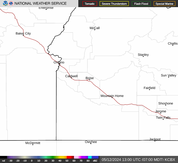
Current Radar Image
Sun Almanac for Flint, Idaho
Sunrise: 08:18 AM
Sunset: 5:22 PM
Civil Sunrise:07:46 AM
Civil Sunset: 5:54 PM
Nautical Sunrise: 07:10 AM
Nautical Sunset: 6:30 PM
Astro Sunrise: 06:36 AM
Astro Sunset: 7:04 PM
Idaho's Current Temperatures
 Idaho's Satellite Image
 Idaho's Current Wind Direction
| National Summary |
of upper and lower values of current conditions amongst 7019 locations
in the contiguous United States |
|
High
Temp |
72° |
Key West NAS, Florida
and 1 other location
|
|
Low
Temp |
-27° |
Fremont Municipalcipal Arpt, Nebraska
|
|
Wind
Speed |
40mph |
Livingston, Montana
|
|
Wind
Gust |
61mph |
Reedsville, Pennsylvania
and 1 other location
|
|
Wind
Chill |
-25° |
Grand Marais, Minnesota
|
|
High
Pressure |
30.65Hg |
Elk City, Idaho
|
|
Low
Pressure |
28.86Hg |
Houlton, Maine
|
|
| # Locations Reporting Snow |
213 |
|
| # Locations Reporting Rain |
1 |
|
| # Locations Reporting Fog |
10 |
|
| Average Temperature in the Contiguous USA |
28° |
|
Any use of the information on this page is at your own risk. This information should not be relied upon in life-threatening situations, potential financial loss situations or in lieu of any officially disseminated information. Visit the
National Weather Service for official information.