Elk Basin, Wyoming Weather
Current Conditions at
CODY - (KCOD)
52°
Mostly Cloudy
as of 5:56 PM MDST
Rel. Humidity: 40%
Dew Point: 28°F
Visibility: 10 Miles
Pressure: 30.30 in.
Flight Rule: VFR
Cloud Level(s): Broken at 9000ft
Current Conditions at
SOUTH BIG HORN - (KGEY)
55°
Clear
as of 5:53 PM MDST
Rel. Humidity: 35%
Dew Point: 28°F
Visibility: 10 Miles
Pressure: 30.27 in.
Flight Rule: VFR
Cloud Level(s): Clear
Current Conditions at
BILLINGS - (KBIL)
63°
Partly Cloudy
as of 5:53 PM MDST
Rel. Humidity: 25%
Dew Point: 27°F
Visibility: 10 Miles
Pressure: 30.24 in.
Flight Rule: VFR
Wind Data
22 MPH
Gust: 28 MPH
300° Northwest
Cloud Level(s): Scattered at 8000ft, Scattered at 25000ft
Current Conditions at
YELLOWSTONE - (KP60)
41°
Partly Cloudy
as of 5:56 PM MDST
Rel. Humidity: 52%
Dew Point: 25°F
Pressure: 30.39 in.
Moon Almanac for Elk Basin, Wyoming
Moon Phase: Waning Gibbous
Moon Illumination: 92%
Moon Age: 17.5 Days
Moon is currently below the horizon
Distance from Moon to Earth: 250,725 miles
Upcoming Lunar Events for
Elk Basin: |
| Next Event | Event Time | Illum |
|
|
|
| Moonrise: | 01:09 am Sun | 90.8% |
| High Moon: | 05:38 am Sun | 89.7% |
| Moonset: | 10:00 am Sun | 88.6% |
 | New Moon: Wed Mar 18 |
 | First Quarter: Wed Mar 25 |
 | Full Moon: Wed Apr 1 |
 | Last Quarter: Fri Apr 10 |
| New Moon: Fri Apr 17 |
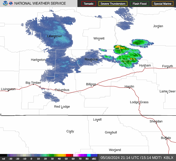
Current Radar Image
| Wyoming State Summary |
of upper and lower values of current conditions amongst 37 locations
in Wyoming |
|
|
|
|
|
Wind
Speed |
22mph |
Pine Bluffs Municipal
|
|
|
|
Wind
Chill |
37° |
Dubois Municipal
|
|
High
Pressure |
30.40Hg |
Fort Bridger
|
|
Low
Pressure |
30.23Hg |
Guernsey
and 1 other location
|
|
| Average temperature in Wyoming |
50° |
|
# Locations Reporting VFR
(Visual Flight Rules) |
37 |
|
Wyoming's Current Temperatures
 Wyoming's Satellite Image
 Wyoming's Current Wind Direction
| National Summary |
of upper and lower values of current conditions amongst 6849 locations
in the contiguous United States |
|
High
Temp |
91° |
Corona Municipal A/P, California
|
|
Low
Temp |
23° |
Berthoud Pass, Colorado
|
|
Wind
Speed |
31mph |
Maurice, Iowa
|
|
Wind
Gust |
46mph |
Whitefield, New Hampshire
and 1 other location
|
|
Wind
Chill |
13° |
Grand Marais, Minnesota
|
|
Heat
Index |
92° |
Mcallen, Texas
|
|
High
Pressure |
30.55Hg |
Salida Mountain, Colorado
|
|
Low
Pressure |
29.63Hg |
Newberry, Michigan
|
|
| # Locations Reporting Snow |
38 |
|
| # Locations Reporting Rain |
103 |
|
| # Locations Reporting Thunderstorms / Lightning |
6 |
|
| # Locations Reporting Fog |
3 |
|
| Average Temperature in the Contiguous USA |
60° |
|
Any use of the information on this page is at your own risk. This information should not be relied upon in life-threatening situations, potential financial loss situations or in lieu of any officially disseminated information. Visit the
National Weather Service for official information.