Dugdale, Minnesota Weather
No Watches or Warnings for Dugdale
|
|
|
|
|
|
|
|
 |
 |
 |
 |
|
 |
 |
 |
| Low: °F |
High: °F |
High: °F |
High: °F |
High: °F |
High: °F |
High: °F |
High: °F |
| Low: °F |
Low: °F |
Low: °F |
Low: °F |
Low: °F |
Low: °F |
|
| Mostly Cloudy |
Mostly Cloudy |
Blowing Snow |
Freezing Rain |
Blowing Snow |
Snow |
Partly Sunny |
Mostly Sunny |
Current Conditions at
CROOKSTON MUNICIPAL FIELD - (KCKN)
Clear
as of 2:15 AM CST
Rel. Humidity: 84%
Dew Point: 7°F
Visibility: 10 Miles
Pressure: 29.89 in.
Flight Rule: VFR
Cloud Level(s): Clear
Current Conditions at
FOSSTON - (KFSE)
10°
Clear
as of 2:15 AM CST
Rel. Humidity: 78%
Dew Point: 5°F
Visibility: 10 Miles
Pressure: 29.88 in.
Flight Rule: VFR
Wind Data
6 MPH
210° Southwest
Cloud Level(s): Clear
Current Conditions at
THIEF RIVER FALLS - (KTVF)
10°
Clear
as of 1:56 AM CST
Rel. Humidity: 84%
Dew Point: 7°F
Visibility: 10 Miles
Pressure: 29.88 in.
Flight Rule: VFR
Cloud Level(s): Clear
Current Conditions at
GRAND FORKS INTL - (KGFK)
10°
Clear
as of 1:53 AM CST
Rel. Humidity: 84%
Dew Point: 7°F
Visibility: 10 Miles
Pressure: 29.87 in.
Flight Rule: VFR
Cloud Level(s): Clear
|
Overnight... Mostly cloudy, with a low around 9. South southwest wind 6 to 9 mph. |
|
|
Monday... Mostly cloudy, then gradually becoming sunny, with a high near 21. West northwest wind 5 to 7 mph becoming light and variable. |
|
|
Monday Night... Patchy blowing snow after 3am. Mostly cloudy, with a temperature rising to around 29 by 5am. Breezy, with a south wind 8 to 13 mph increasing to 15 to 20 mph after midnight. Winds could gust as high as 32 mph. |
|
|
Tuesday... Patchy blowing snow before 9am. Mostly sunny, with a high near 40. Breezy, with a south southwest wind 18 to 21 mph becoming west northwest in the afternoon. Winds could gust as high as 32 mph. |
|
|
Tuesday Night... Mostly cloudy, with a low around 9. Northwest wind 13 to 18 mph becoming northwest 6 to 11 mph after midnight. Winds could gust as high as 29 mph. |
|
|
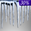
Wednesday... A chance of freezing rain after noon. Partly sunny, with a high near 32. South wind 10 to 18 mph, with gusts as high as 29 mph. Chance of precipitation is 30%. |
|
|
Wednesday Night... Snow. Patchy blowing snow after 1am. Low around -3. Blustery, with a south wind 17 to 22 mph becoming north northwest 23 to 28 mph after midnight. Winds could gust as high as 43 mph. Chance of precipitation is 80%. |
|
|
Thursday... A 40 percent chance of snow before noon. Areas of blowing snow before 3pm. Partly sunny, with a high near 10. Blustery, with a north northwest wind 23 to 28 mph decreasing to 11 to 16 mph in the afternoon. Winds could gust as high as 43 mph. |
|
 |
Thursday Night... Partly cloudy, with a low around -20. North northwest wind 7 to 13 mph becoming south southeast after midnight. |
|
|
Friday... A 40 percent chance of snow. Mostly cloudy, with a high near 20. Breezy, with a south southeast wind 14 to 20 mph, with gusts as high as 32 mph. |
|
 |
Friday Night... A 20 percent chance of snow. Mostly cloudy, with a low around 1. South southeast wind 13 to 17 mph becoming west after midnight. Winds could gust as high as 29 mph. |
|
|
Saturday... Partly sunny, with a high near 14. West northwest wind 8 to 13 mph. |
|
|
Saturday Night... Partly cloudy, with a low around -12. Northwest wind 6 to 8 mph becoming south after midnight. |
|
|
Sunday... Mostly sunny, with a high near 12. South wind 8 to 10 mph. |
|
Current Radar Image
Sun Almanac for Dugdale, Minnesota
Sunrise: 08:07 AM
Sunset: 4:33 PM
Civil Sunrise:07:31 AM
Civil Sunset: 5:10 PM
Nautical Sunrise: 06:52 AM
Nautical Sunset: 5:49 PM
Astro Sunrise: 06:14 AM
Astro Sunset: 6:27 PM
Minnesota's Current Temperatures
 Minnesota's Satellite Image
 Minnesota's Current Wind Direction
| National Summary |
of upper and lower values of current conditions amongst 7095 locations
in the contiguous United States |
|
High
Temp |
72° |
Key West Intl, Florida
and 2 other locations
|
|
Low
Temp |
-9° |
Terre Haute, Indiana
and 2 other locations
|
|
Wind
Speed |
35mph |
Whidbey IsNAS, Washington
|
|
Wind
Gust |
52mph |
Whidbey IsNAS, Washington
|
|
Wind
Chill |
-23° |
Bloomington, Illinois
|
|
High
Pressure |
30.63Hg |
Newport Municipal A/P, Arkansas
and 1 other location
|
|
Low
Pressure |
29.73Hg |
Frenchville, Maine
and 2 other locations
|
|
| # Locations Reporting Snow |
50 |
|
| # Locations Reporting Rain |
19 |
|
| # Locations Reporting Fog |
27 |
|
| Average Temperature in the Contiguous USA |
24° |
|
Any use of the information on this page is at your own risk. This information should not be relied upon in life-threatening situations, potential financial loss situations or in lieu of any officially disseminated information. Visit the
National Weather Service for official information.


