No Watches or Warnings for Deal
Issued: 2:04 pm MST Dec 20, 2025 Latitude: 43.5065509 Longitude: -116.5415163 View on Google Maps
|
|
|
|
|
|
|
|
|
|
 |
 |
 |
 |
 |
 |
|
 |
| Low: °F |
High: °F |
High: °F |
High: °F |
High: °F |
High: °F |
High: °F |
High: °F |
| Low: °F |
Low: °F |
Low: °F |
Low: °F |
Low: °F |
Low: °F |
|
| Rain |
Rain |
Rain |
Rain |
Rain |
Rain |
Rain |
Sunny |
Current Conditions at
CALDWELL - (KEUL)
37°
Clear
as of 9:56 PM MST
Rel. Humidity: 80%
Dew Point: 32°F
Visibility: 10 Miles
Pressure: 30.00 in.
Flight Rule: VFR
Cloud Level(s): Clear
Current Conditions at
BOISE - (KBOI)
Clear
as of 9:53 PM MST
Rel. Humidity: 64%
Dew Point: 28°F
Visibility: 10 Miles
Pressure: 30.00 in.
Flight Rule: VFR
Wind Data
9 MPH
120° Southeast
Cloud Level(s): Clear
Current Conditions at
ONTARIO - (KONO)
32°
Partly Cloudy
as of 9:53 PM MST
Rel. Humidity: 86%
Dew Point: 28°F
Visibility: 10 Miles
Pressure: 30.02 in.
Flight Rule: VFR
Cloud Level(s): Scattered at 7000ft
Current Conditions at
MOUNTAIN HOME AFB - (KMUO)
36°
Clear
as of 9:55 PM MST
Rel. Humidity: 80%
Dew Point: 30°F
Visibility: 10 Miles
Pressure: 30.01 in.
Flight Rule: VFR
Wind Data
5 MPH
120° Southeast
Cloud Level(s): Clear
|
Tonight... Rain. Low around 34. Southeast wind 7 to 9 mph. Chance of precipitation is 90%. New precipitation amounts between a tenth and quarter of an inch possible. |
|
|
Sunday... Rain. High near 46. Southeast wind 5 to 10 mph. Chance of precipitation is 100%. New precipitation amounts between a quarter and half of an inch possible. |
|
|
Sunday Night... Rain. Low around 38. Southeast wind around 5 mph becoming light and variable. Chance of precipitation is 90%. New precipitation amounts between a tenth and quarter of an inch possible. |
|
|
Monday... A 30 percent chance of rain, mainly before 11am. Mostly cloudy, with a high near 51. Calm wind becoming east northeast around 6 mph in the afternoon. |
|
 |
Monday Night... Mostly cloudy, with a low around 37. Southeast wind 5 to 7 mph. |
|
|
Tuesday... Rain likely, mainly before 11am. Cloudy, with a high near 48. Chance of precipitation is 60%. |
|
 |
Tuesday Night... A 20 percent chance of rain. Mostly cloudy, with a low around 37. |
|
|
Wednesday... Rain likely, mainly after 11am. Mostly cloudy, with a high near 54. Chance of precipitation is 60%. |
|
 |
Wednesday Night... A 40 percent chance of rain. Mostly cloudy, with a low around 35. |
|
|
Christmas Day... A 40 percent chance of rain. Mostly cloudy, with a high near 52. |
|
 |
Thursday Night... A 50 percent chance of rain. Mostly cloudy, with a low around 34. |
|
|
Friday... A 30 percent chance of rain. Partly sunny, with a high near 48. |
|
 |
Friday Night... Mostly clear, with a low around 29. |
|
|
Saturday... Sunny, with a high near 44. |
|
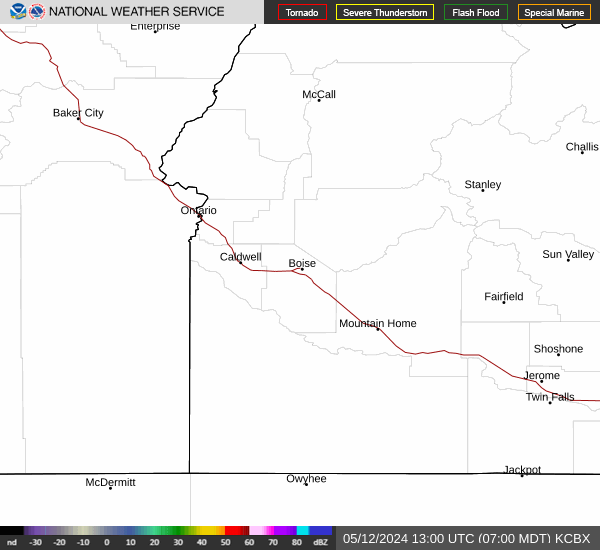
Current Radar Image
Sun Almanac for Deal, Idaho
Sunrise: 08:16 AM
Sunset: 5:13 PM
Civil Sunrise:07:43 AM
Civil Sunset: 5:46 PM
Nautical Sunrise: 07:07 AM
Nautical Sunset: 6:22 PM
Astro Sunrise: 06:32 AM
Astro Sunset: 6:57 PM
Idaho's Current Temperatures
 Idaho's Satellite Image
 Idaho's Current Wind Direction
| National Summary |
of upper and lower values of current conditions amongst 6991 locations
in the contiguous United States |
|
High
Temp |
79° |
Keathley C 875, Louisiana
|
|
Low
Temp |
-9° |
Hallock, Minnesota
|
|
Wind
Speed |
33mph |
Mackinac Island, Michigan
|
|
Wind
Gust |
46mph |
Mackinac Island, Michigan
|
|
Wind
Chill |
-20° |
Grand Marais, Minnesota
|
|
High
Pressure |
30.42Hg |
Salida Mountain, Colorado
|
|
Low
Pressure |
29.34Hg |
Charlie, Montana
|
|
| # Locations Reporting Snow |
13 |
|
| # Locations Reporting Rain |
32 |
|
| # Locations Reporting Fog |
22 |
|
| Average Temperature in the Contiguous USA |
38° |
|
Any use of the information on this page is at your own risk. This information should not be relied upon in life-threatening situations, potential financial loss situations or in lieu of any officially disseminated information. Visit the
National Weather Service for official information.