Clareton, Wyoming Weather
Issued: 1:06 pm MST Dec 16, 2025 Latitude: 43.7005309 Longitude: -104.6924624 View on Google Maps
|
|
|
|
|
|
|
|
|
|
 |
 |
 |
 |
|
|
|
 |
| High: °F |
Low: °F |
High: °F |
High: °F |
High: °F |
High: °F |
High: °F |
High: °F |
| Low: °F |
Low: °F |
Low: °F |
Low: °F |
Low: °F |
|
| Sunny |
Cloudy |
Rain |
Partly Sunny |
Partly Sunny |
Partly Sunny |
Partly Sunny |
Mostly Sunny |
Current Conditions at
CUSTER - (KCUT)
52°
Clear
as of 12:53 PM MST
Rel. Humidity: 32%
Dew Point: 23°F
Visibility: 10 Miles
Pressure: 29.89 in.
Flight Rule: VFR
Wind Data
10 MPH
Gust: 17 MPH
270° West
Cloud Level(s): Clear
Current Conditions at
GILLETTE - (KGCC)
Mostly Cloudy
as of 12:53 PM MST
Rel. Humidity: 43%
Dew Point: 28°F
Visibility: 10 Miles
Pressure: 29.91 in.
Flight Rule: VFR
Wind Data
9 MPH
320° Northwest
Cloud Level(s): Broken at 12000ft
Current Conditions at
CONVERSE COUNTY ARPT - (KDGW)
57°
Clear
as of 12:53 PM MST
Rel. Humidity: 24%
Dew Point: 21°F
Visibility: 10 Miles
Pressure: 29.94 in.
Flight Rule: VFR
Wind Data
25 MPH
Gust: 36 MPH
300° Northwest
Cloud Level(s): Clear
Current Conditions at
CHADRON - (KCDR)
64°
Clear
as of 12:53 PM MST
Rel. Humidity: 25%
Dew Point: 28°F
Visibility: 10 Miles
Pressure: 29.83 in.
Flight Rule: VFR
Wind Data
20 MPH
Gust: 30 MPH
280° West
Cloud Level(s): Clear
|
This Afternoon... Sunny, with a high near 54. North wind 8 to 11 mph, with gusts as high as 20 mph. |
|
|
Tonight... Partly cloudy, with a low around 29. Wind chill values as low as 18. West wind 6 to 11 mph becoming southwest 12 to 17 mph after midnight. Winds could gust as high as 24 mph. |
|
|
Wednesday... A 40 percent chance of rain, mainly between 11am and 5pm. Partly sunny, with a high near 57. Wind chill values as low as 18 early. Windy, with a southwest wind 24 to 29 mph becoming west 34 to 39 mph in the afternoon. Winds could gust as high as 55 mph. |
|
 |
Wednesday Night... A 20 percent chance of snow before 11pm. Partly cloudy, with a low around 20. Wind chill values as low as 6. Windy, with a northwest wind 25 to 34 mph, with gusts as high as 49 mph. |
|
|
Thursday... Partly sunny, with a high near 36. Windy, with a northwest wind 21 to 31 mph becoming south 8 to 13 mph in the afternoon. Winds could gust as high as 43 mph. |
|
 |
Thursday Night... Mostly cloudy, with a temperature falling to near 26 by 8pm, then rising to around 42 during the remainder of the night. Breezy, with a southeast wind 9 to 14 mph becoming west 16 to 21 mph after midnight. Winds could gust as high as 34 mph. |
|
|
Friday... Partly sunny, with a high near 58. Breezy, with a west wind 20 to 28 mph, with gusts as high as 40 mph. |
|
 |
Friday Night... A slight chance of snow after 11pm. Mostly cloudy, with a low around 27. West wind 15 to 18 mph, with gusts as high as 29 mph. |
|
|
Saturday... Partly sunny, with a high near 43. |
|
|
Saturday Night... Partly cloudy, with a low around 22. |
|
|
Sunday... Partly sunny, with a high near 44. |
|
|
Sunday Night... Mostly cloudy, with a low around 30. |
|
|
Monday... Mostly sunny, with a high near 57. |
|
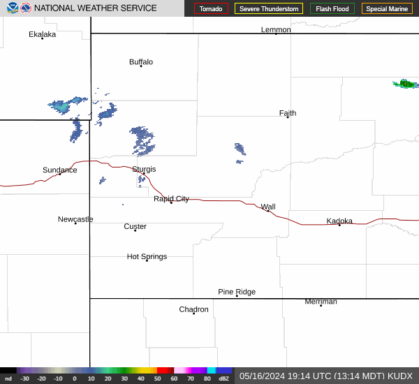
Current Radar Image
Sun Almanac for Clareton, Wyoming
Sunrise: 07:27 AM
Sunset: 4:23 PM
Civil Sunrise:06:54 AM
Civil Sunset: 4:56 PM
Nautical Sunrise: 06:17 AM
Nautical Sunset: 5:32 PM
Astro Sunrise: 05:42 AM
Astro Sunset: 6:07 PM
Wyoming's Current Temperatures
 Wyoming's Satellite Image
 Wyoming's Current Wind Direction
| National Summary |
of upper and lower values of current conditions amongst 7089 locations
in the contiguous United States |
|
High
Temp |
82° |
Borrego Springs, California
and 1 other location
|
|
Low
Temp |
14° |
Solon Springs, Wisconsin
|
|
Wind
Speed |
40mph |
Alpha, Wyoming
|
|
Wind
Gust |
51mph |
Big Timber, Montana
|
|
Wind
Chill |
4° |
Berthoud Pass, Colorado
|
|
High
Pressure |
30.41Hg |
Salida Mountain, Colorado
|
|
Low
Pressure |
29.14Hg |
International Falls, Minnesota
|
|
| # Locations Reporting Snow |
2 |
|
| # Locations Reporting Rain |
30 |
|
| # Locations Reporting Thunderstorms / Lightning |
3 |
|
| # Locations Reporting Fog |
4 |
|
| Average Temperature in the Contiguous USA |
50° |
|
Any use of the information on this page is at your own risk. This information should not be relied upon in life-threatening situations, potential financial loss situations or in lieu of any officially disseminated information. Visit the
National Weather Service for official information.