Chippewa, Montana Weather
Current Conditions at
LEWISTOWN - (KLWT)
Cloudy
Light Snow Mist
as of 6:54 AM MDST
Rel. Humidity: 92%
Dew Point: 27°F
Visibility: 1 1/2 Miles
Pressure: 30.06 in.
Flight Rule: IFR
Cloud Level(s): Solid Overcast at 700ft
Current Conditions at
BILLINGS - (KBIL)
Cloudy
Light Snow
as of 6:53 AM MDST
Rel. Humidity: 74%
Dew Point: 27°F
Visibility: 10 Miles
Pressure: 30.00 in.
Flight Rule: VFR
Wind Data
15 MPH
330° Northwest
Cloud Level(s): Solid Overcast at 4300ft
Current Conditions at
JORDAN - (KJDN)
Cloudy
as of 6:48 AM MDST
Rel. Humidity: 92%
Dew Point: 28°F
Pressure: 30.04 in.
Wind Data
10 MPH
050° Northeast
Current Conditions at
HAVRE - (KHVR)
32°
Cloudy
Light Snow Mist
as of 6:53 AM MDST
Rel. Humidity: 100%
Dew Point: 32°F
Visibility: 2 1/2 Miles
Pressure: 30.11 in.
Flight Rule: IFR
Cloud Level(s): Broken at 700ft, Solid Overcast at 3800ft
Moon Almanac for Chippewa, Montana
Moon Phase: Full Moon
Moon Illumination: 98%
Moon Age: 16.1 Days
Moon is currently below the horizon
Distance from Moon to Earth: 248,377 miles
Upcoming Lunar Events for
Chippewa: |
| Next Event | Event Time | Illum |
|
|
|
| Moonrise: | 12:08 am Sat | 95.8% |
| High Moon: | 04:52 am Sat | 95.0% |
| Moonset: | 09:26 am Sat | 94.1% |
 | New Moon: Wed Mar 18 |
 | First Quarter: Wed Mar 25 |
 | Full Moon: Wed Apr 1 |
 | Last Quarter: Fri Apr 10 |
| New Moon: Fri Apr 17 |
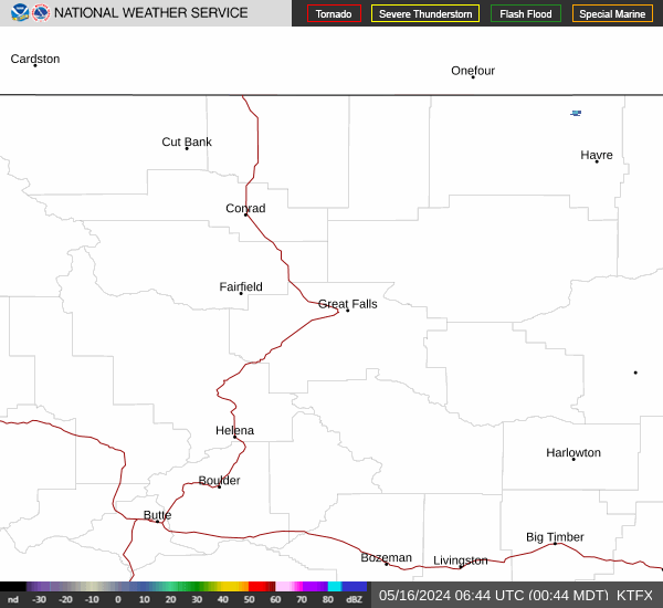
Current Radar Image
| Montana State Summary |
of upper and lower values of current conditions amongst 40 locations
in Montana |
|
|
|
|
|
Wind
Speed |
25mph |
Big Timber
|
|
Wind
Gust |
31mph |
Big Timber
|
|
|
|
High
Pressure |
30.22Hg |
Plains
|
|
Low
Pressure |
29.97Hg |
Baker
|
|
| Average temperature in Montana |
31° |
|
| # Locations Reporting Snow |
22 |
|
# Locations Reporting IFR
(Instrument Flight Rules) |
7 |
|
# Locations Reporting MVFR
(Marginal Visual Flight Rules) |
7 |
|
# Locations Reporting VFR
(Visual Flight Rules) |
26 |
|
Montana's Current Temperatures
 Montana's Satellite Image
 Montana's Current Wind Direction
| National Summary |
of upper and lower values of current conditions amongst 6065 locations
in the contiguous United States |
|
High
Temp |
79° |
Keathley C 875, Louisiana
|
|
Low
Temp |
3° |
Berthoud Pass, Colorado
|
|
Wind
Speed |
41mph |
Berthoud Pass, Colorado
|
|
Wind
Gust |
58mph |
Goodland, Kansas
|
|
Wind
Chill |
-24° |
Berthoud Pass, Colorado
|
|
High
Pressure |
30.42Hg |
Vancouver, Washington
|
|
Low
Pressure |
29.64Hg |
Salina, Kansas
|
|
| # Locations Reporting Snow |
54 |
|
| # Locations Reporting Rain |
34 |
|
| # Locations Reporting Fog |
20 |
|
| Average Temperature in the Contiguous USA |
50° |
|
Any use of the information on this page is at your own risk. This information should not be relied upon in life-threatening situations, potential financial loss situations or in lieu of any officially disseminated information. Visit the
National Weather Service for official information.