Cherokee, Georgia Weather
Issued: 9:46 am EDT May 5, 2024 Latitude: 32.8581945 Longitude: -83.7696277 View on Google Maps
|
|
|
|
|
|
|
|
|
|
 |
 |
 |
 |
 |
 |
 |
|
| High: °F |
Low: °F |
High: °F |
High: °F |
High: °F |
High: °F |
High: °F |
High: °F |
| Low: °F |
Low: °F |
Low: °F |
Low: °F |
Low: °F |
|
| Thunderstorms |
Thunderstorms |
Thunderstorms |
Sunny |
Mostly Sunny |
Thunderstorms |
Thunderstorms |
Sunny |
Current Conditions at
MACON - (KMCN)
77°
Cloudy
as of 11:53 AM EDST
Rel. Humidity: 69%
Dew Point: 66°F
Visibility: 10 Miles
Pressure: 30.08 in.
Flight Rule: MVFR
Cloud Level(s): Solid Overcast at 1800ft
Current Conditions at
ROBINS AFB - (KWRB)
79°
Partly Cloudy
as of 12:13 PM EDST
Rel. Humidity: 65%
Dew Point: 66°F
Visibility: 10 Miles
Pressure: 30.07 in.
Flight Rule: VFR
Cloud Level(s): Scattered at 2200ft
Current Conditions at
THOMASTON - (KOPN)
73°
Mostly Cloudy
as of 11:55 AM EDST
Rel. Humidity: 69%
Dew Point: 63°F
Visibility: 10 Miles
Pressure: 30.11 in.
Flight Rule: MVFR
Cloud Level(s): Broken at 1200ft
Current Conditions at
MILLEDGEVILLE/BALDWIN - (KMLJ)
75°
Partly Cloudy
as of 11:55 AM EDST
Rel. Humidity: 83%
Dew Point: 70°F
Visibility: 10 Miles
Pressure: 30.08 in.
Flight Rule: VFR
Cloud Level(s): Scattered at 1300ft
|
This Afternoon... A 30 percent chance of showers and thunderstorms, mainly after 3pm. Mostly sunny, with a high near 85. South wind around 5 mph. |
|
|
Tonight... A chance of showers and thunderstorms, mainly before 3am, then a slight chance of thunderstorms after 5am. Patchy fog after 2am. Otherwise, partly cloudy, with a low around 66. South wind around 5 mph becoming calm. Chance of precipitation is 30%. |
|
|
Monday... A slight chance of showers, with thunderstorms also possible after 2pm. Patchy fog before 10am. Otherwise, partly sunny, with a high near 85. Southwest wind around 5 mph. Chance of precipitation is 20%. |
|
 |
Monday Night... A 20 percent chance of showers and thunderstorms before 2am. Partly cloudy, with a low around 65. South wind around 5 mph. |
|
|
Tuesday... Sunny, with a high near 88. Southwest wind 5 to 10 mph, with gusts as high as 20 mph. |
|
 |
Tuesday Night... Mostly clear, with a low around 68. |
|
|
Wednesday... Mostly sunny, with a high near 90. |
|
 |
Wednesday Night... Partly cloudy, with a low around 70. |
|
|
Thursday... A 40 percent chance of showers and thunderstorms, mainly after 2pm. Partly sunny, with a high near 88. |
|
 |
Thursday Night... A 40 percent chance of showers and thunderstorms. Mostly cloudy, with a low around 66. |
|
|
Friday... Showers likely and possibly a thunderstorm. Partly sunny, with a high near 81. Chance of precipitation is 60%. |
|
|
Friday Night... Partly cloudy, with a low around 56. |
|
|
Saturday... Sunny, with a high near 76. |
|
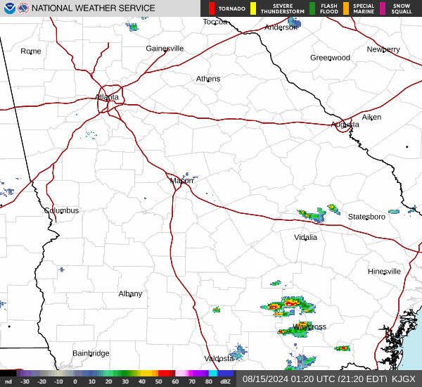
Current Radar Image
Sun Almanac for Cherokee, Georgia
Sunrise: 06:43 AM
Sunset: 8:20 PM
Civil Sunrise:06:17 AM
Civil Sunset: 8:47 PM
Nautical Sunrise: 05:45 AM
Nautical Sunset: 9:19 PM
Astro Sunrise: 05:11 AM
Astro Sunset: 9:52 PM
Georgia's Current Temperatures
 Georgia's Satellite Image
 Georgia's Current Wind Direction
| National Summary |
of upper and lower values of current conditions amongst 7002 locations
in the contiguous United States |
|
High
Temp |
90° |
Jacksonville Cecil Fld, Florida
|
|
Low
Temp |
30° |
Mammoth Lakes, California
|
|
Wind
Speed |
38mph |
Cedar City, Utah
and 1 other location
|
|
Wind
Gust |
52mph |
Cedar City, Utah
|
|
Wind
Chill |
17° |
Pagosa Springs, Colorado
and 1 other location
|
|
Heat
Index |
103° |
Scottsboro, Alabama
|
|
High
Pressure |
30.35Hg |
Rockland, Maine
and 2 other locations
|
|
Low
Pressure |
29.42Hg |
Missoula, Montana
|
|
| # Locations Reporting Snow |
10 |
|
| # Locations Reporting Rain |
167 |
|
| # Locations Reporting Thunderstorms / Lightning |
10 |
|
| # Locations Reporting Fog |
5 |
|
| Average Temperature in the Contiguous USA |
63° |
|
Any use of the information on this page is at your own risk. This information should not be relied upon in life-threatening situations, potential financial loss situations or in lieu of any officially disseminated information. Visit the
National Weather Service for official information.