Cheever, New Hampshire Weather
Issued: 6:12 am EST Jan 30, 2026 Latitude: 43.7989596 Longitude: -71.9103606 View on Google Maps
|
|
|
|
|
|
|
|
|
|
 |
 |
 |
|
|
|
|
|
| High: °F |
Low: °F |
High: °F |
High: °F |
High: °F |
High: °F |
High: °F |
High: °F |
| Low: °F |
Low: °F |
Low: °F |
Low: °F |
Low: °F |
|
| Partly Sunny |
Cloudy |
Mostly Sunny |
Partly Sunny |
Mostly Sunny |
Mostly Sunny |
Mostly Sunny |
Partly Sunny |
Current Conditions at
LEBANON - (KLEB)
7°
Clear
as of 10:53 AM EST
Rel. Humidity: 46%
Dew Point: -9°F
Visibility: 10 Miles
Pressure: 30.00 in.
Flight Rule: VFR
Wind Data
8 MPH
300° Northwest
Cloud Level(s): Clear
Current Conditions at
LACONIA - (KLCI)
Mostly Cloudy
as of 10:56 AM EST
Rel. Humidity: 50%
Dew Point: -9°F
Visibility: 10 Miles
Pressure: 29.91 in.
Flight Rule: VFR
Wind Data
15 MPH
Gust: 21 MPH
270° West
Cloud Level(s): Broken at 9500ft
Current Conditions at
MONTPELIER - (KMPV)
Mostly Cloudy
as of 10:51 AM EST
Rel. Humidity: 58%
Dew Point: -13°F
Visibility: 10 Miles
Pressure: 30.00 in.
Flight Rule: VFR
Wind Data
16 MPH
Gust: 25 MPH
320° Northwest
Cloud Level(s): Broken at 4100ft
Current Conditions at
WHITEFIELD - (KHIE)
-2°
Cloudy
as of 10:52 AM EST
Rel. Humidity: 53%
Dew Point: -15°F
Visibility: 10 Miles
Pressure: 29.95 in.
Flight Rule: VFR
Wind Data
8 MPH
240° Southwest
Cloud Level(s): Solid Overcast at 3500ft
|
Today... Partly sunny and cold, with a high near 4. Wind chill values as low as -20. Northwest wind around 15 mph, with gusts as high as 30 mph. |
|
|
Tonight... Partly cloudy, with a low around -7. Wind chill values as low as -22. Northwest wind 10 to 15 mph, with gusts as high as 25 mph. |
|
|
Saturday... Mostly sunny, with a high near 12. Wind chill values as low as -24. Northwest wind 5 to 10 mph. |
|
|
Saturday Night... Partly cloudy, with a low around -7. Wind chill values as low as -17. Northwest wind around 5 mph. |
|
|
Sunday... Partly sunny, with a high near 17. Northwest wind 5 to 10 mph, with gusts as high as 20 mph. |
|
 |
Sunday Night... Mostly cloudy, with a low around 1. |
|
|
Monday... Mostly sunny, with a high near 23. |
|
|
Monday Night... Partly cloudy, with a low around 3. |
|
|
Tuesday... Mostly sunny, with a high near 26. |
|
|
Tuesday Night... Mostly cloudy, with a low around 4. |
|
|
Wednesday... Mostly sunny, with a high near 21. |
|
|
Wednesday Night... Partly cloudy, with a low around 2. |
|
|
Thursday... Partly sunny, with a high near 24. |
|
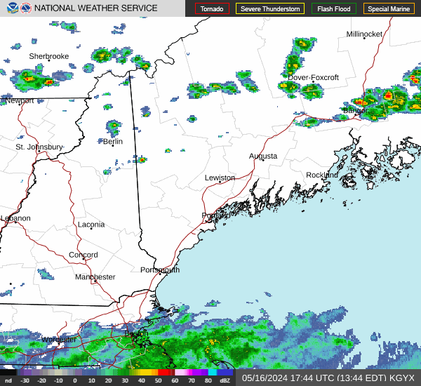
Current Radar Image
Sun Almanac for Cheever, New Hampshire
Sunrise: 07:06 AM
Sunset: 4:56 PM
Civil Sunrise:06:36 AM
Civil Sunset: 5:26 PM
Nautical Sunrise: 06:01 AM
Nautical Sunset: 6:01 PM
Astro Sunrise: 05:27 AM
Astro Sunset: 6:35 PM
New Hampshire's Current Temperatures
 New Hampshire's Satellite Image
 New Hampshire's Current Wind Direction
| National Summary |
of upper and lower values of current conditions amongst 7169 locations
in the contiguous United States |
|
High
Temp |
70° |
Cape Kennedy Air Force Station, Florida
and 4 other locations
|
|
Low
Temp |
-17° |
Baudette, Minnesota
and 2 other locations
|
|
Wind
Speed |
32mph |
Whidbey IsNAS, Washington
|
|
Wind
Gust |
45mph |
Whidbey IsNAS, Washington
|
|
Wind
Chill |
-29° |
Saranac Lake, New York
|
|
High
Pressure |
30.84Hg |
Hutson Field, North Dakota
|
|
Low
Pressure |
29.62Hg |
Frenchville, Maine
|
|
| # Locations Reporting Snow |
102 |
|
| # Locations Reporting Rain |
18 |
|
| # Locations Reporting Fog |
25 |
|
| Average Temperature in the Contiguous USA |
27° |
|
Any use of the information on this page is at your own risk. This information should not be relied upon in life-threatening situations, potential financial loss situations or in lieu of any officially disseminated information. Visit the
National Weather Service for official information.