Chandler, Colorado Weather
Current Conditions at
FORT CARSON - (KFCS)
Mostly Clear
Snow
as of 7:02 AM MDST
Rel. Humidity: 73%
Dew Point: 19°F
Visibility: 1/2 Miles
Pressure: 29.83 in.
Flight Rule: IFR
Wind Data
45 MPH
Gust: 53 MPH
0° North
Cloud Level(s): Few at 800ft
Current Conditions at
PUEBLO - (KPUB)
Cloudy
Light Snow
as of 6:53 AM MDST
Rel. Humidity: 50%
Dew Point: 18°F
Visibility: 9 Miles
Pressure: 29.85 in.
Flight Rule: VFR
Wind Data
31 MPH
Gust: 56 MPH
350° North
Cloud Level(s): Solid Overcast at 7000ft
Current Conditions at
COLORADO SPRINGS - (KCOS)
Cloudy
Snow Freezing Fog
as of 6:54 AM MDST
Rel. Humidity: 79%
Dew Point: 19°F
Visibility: 1/2 Miles
Pressure: 29.88 in.
Flight Rule: IFR
Wind Data
25 MPH
Gust: 43 MPH
340° North
Cloud Level(s): Solid Overcast at 1300ft
Current Conditions at
USAF ACADEMY - (KAFF)
Cloudy
Light Snow Blowing Snow
as of 6:55 AM MDST
Rel. Humidity: 85%
Dew Point: 19°F
Visibility: 1 Miles
Pressure: 29.90 in.
Flight Rule: IFR
Wind Data
20 MPH
010° North
Cloud Level(s): Solid Overcast at 2600ft
Moon Almanac for Chandler, Colorado
Moon Phase: Waning Crescent
Moon Illumination: 14%
Moon Age: 25.9 Days
Moon is currently above the horizon
Distance from Moon to Earth: 244,413 miles
Upcoming Lunar Events for
Chandler: |
| Next Event | Event Time | Illum |
|
|
|
| High Moon: | 12:34 pm Sun | 12.7% |
| Moonset: | 05:44 pm Sun | 11.3% |
| Moonrise: | 08:00 am Mon | 7.6% |
| High Moon: | 01:21 pm Mon | 6.4% |
| Moonset: | 06:51 pm Mon | 5.3% |
 | New Moon: Tue Feb 17 |
 | First Quarter: Tue Feb 24 |
 | Full Moon: Tue Mar 3 |
 | Last Quarter: Wed Mar 11 |
| New Moon: Wed Mar 18 |
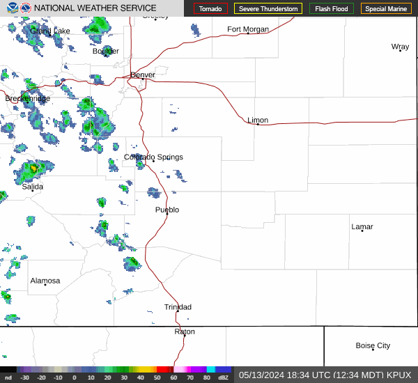
Current Radar Image
| Colorado State Summary |
of upper and lower values of current conditions amongst 66 locations
in Colorado |
|
|
|
|
|
Wind
Speed |
45mph |
Fort Carson
|
|
Wind
Gust |
61mph |
Salida Mountain
|
|
Wind
Chill |
-17° |
Copper Mtn/Red Clff
|
|
High
Pressure |
30.16Hg |
Rangely
|
|
Low
Pressure |
29.68Hg |
Berthoud Pass
|
|
| Average temperature in Colorado |
26° |
|
| # Locations Reporting Snow |
15 |
|
# Locations Reporting IFR
(Instrument Flight Rules) |
8 |
|
# Locations Reporting MVFR
(Marginal Visual Flight Rules) |
4 |
|
# Locations Reporting VFR
(Visual Flight Rules) |
54 |
|
Colorado's Current Temperatures
 Colorado's Satellite Image
 Colorado's Current Wind Direction
| National Summary |
of upper and lower values of current conditions amongst 7064 locations
in the contiguous United States |
|
High
Temp |
81° |
Key West Intl, Florida
|
|
Low
Temp |
-8° |
Mike, Montana
and 2 other locations
|
|
Wind
Speed |
45mph |
Brewster Field, Nebraska
and 1 other location
|
|
Wind
Gust |
64mph |
Ruidoso, New Mexico
|
|
Wind
Chill |
-27° |
Mike, Montana
|
|
High
Pressure |
30.52Hg |
Boston, Massachusetts
and 5 other locations
|
|
Low
Pressure |
29.26Hg |
Kansas City, Missouri
and 1 other location
|
|
| # Locations Reporting Snow |
170 |
|
| # Locations Reporting Rain |
24 |
|
| # Locations Reporting Thunderstorms / Lightning |
21 |
|
| # Locations Reporting Fog |
41 |
|
| Average Temperature in the Contiguous USA |
45° |
|
Any use of the information on this page is at your own risk. This information should not be relied upon in life-threatening situations, potential financial loss situations or in lieu of any officially disseminated information. Visit the
National Weather Service for official information.