Cedar Hill, Georgia Weather
Issued: 7:16 pm EDT Jul 6, 2025 Latitude: 34.0223306 Longitude: -83.7654507 View on Google Maps
|
|
|
|
|
|
|
|
|
|
 |
 |
 |
 |
 |
 |
 |
|
| Low: °F |
High: °F |
High: °F |
High: °F |
High: °F |
High: °F |
High: °F |
High: °F |
| Low: °F |
Low: °F |
Low: °F |
Low: °F |
Low: °F |
Low: °F |
|
| Mostly Clear |
Sunny |
Thunderstorms |
Thunderstorms |
Thunderstorms |
Thunderstorms |
Thunderstorms |
Thunderstorms |
Current Conditions at
WINDER - (KWDR)
81°
Clear
as of 9:55 PM EDST
Rel. Humidity: 69%
Dew Point: 70°F
Visibility: 10 Miles
Pressure: 30.02 in.
Flight Rule: VFR
Cloud Level(s): Clear
Current Conditions at
LAWRENCEVILLE - (KLZU)
82°
Clear
as of 9:56 PM EDST
Rel. Humidity: 58%
Dew Point: 66°F
Visibility: 10 Miles
Pressure: 30.02 in.
Flight Rule: VFR
Cloud Level(s): Clear
Current Conditions at
GAINESVILLE - (KGVL)
81°
Clear
as of 9:53 PM EDST
Rel. Humidity: 61%
Dew Point: 66°F
Visibility: 10 Miles
Pressure: 30.04 in.
Flight Rule: VFR
Cloud Level(s): Clear
Current Conditions at
ATHENS - (KAHN)
82°
Mostly Clear
as of 9:51 PM EDST
Rel. Humidity: 65%
Dew Point: 70°F
Visibility: 10 Miles
Pressure: 29.99 in.
Flight Rule: VFR
Cloud Level(s): Few at 7000ft
|
Tonight... Mostly clear, with a low around 71. Calm wind. |
|
|
Monday... Sunny, with a high near 96. Calm wind becoming west around 5 mph. |
|
|
Monday Night... Mostly clear, with a low around 74. Calm wind. |
|
|
Tuesday... A 30 percent chance of showers and thunderstorms after 2pm. Sunny, with a high near 96. Heat index values as high as 99. Calm wind becoming west around 5 mph. |
|
 |
Tuesday Night... A chance of showers and thunderstorms before 11pm, then a slight chance of showers between 11pm and 2am. Mostly clear, with a low around 74. Calm wind. Chance of precipitation is 30%. |
|
|
Wednesday... A slight chance of showers, then a chance of showers and thunderstorms after 11am. Mostly sunny, with a high near 93. Chance of precipitation is 50%. |
|
 |
Wednesday Night... A 50 percent chance of showers and thunderstorms before 2am. Mostly cloudy, with a low around 71. |
|
|
Thursday... Showers and thunderstorms likely, mainly after 2pm. Mostly sunny, with a high near 90. Chance of precipitation is 70%. |
|
 |
Thursday Night... Showers and thunderstorms likely before 8pm, then showers likely and possibly a thunderstorm between 8pm and 2am, then a slight chance of showers after 2am. Mostly cloudy, with a low around 71. Chance of precipitation is 60%. |
|
|
Friday... A slight chance of showers, then showers and thunderstorms likely after 8am. Partly sunny, with a high near 88. Chance of precipitation is 70%. |
|
|
Friday Night... Showers and thunderstorms likely. Mostly cloudy, with a low around 71. Chance of precipitation is 60%. |
|
|
Saturday... A 40 percent chance of showers and thunderstorms. Mostly sunny, with a high near 92. |
|
 |
Saturday Night... A 30 percent chance of showers and thunderstorms. Partly cloudy, with a low around 72. |
|
|
Sunday... A 50 percent chance of showers and thunderstorms. Mostly sunny, with a high near 92. |
|
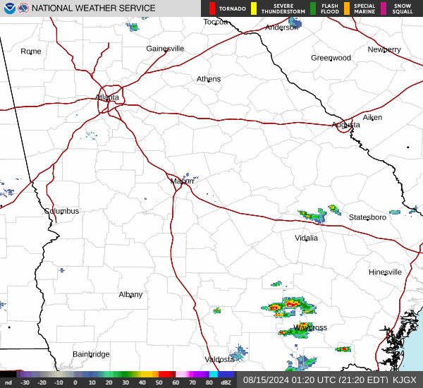
Current Radar Image
Sun Almanac for Cedar Hill, Georgia
Sunrise: 06:30 AM
Sunset: 8:50 PM
Civil Sunrise:06:01 AM
Civil Sunset: 9:19 PM
Nautical Sunrise: 05:26 AM
Nautical Sunset: 9:54 PM
Astro Sunrise: 04:47 AM
Astro Sunset: 10:33 PM
Georgia's Current Temperatures
 Georgia's Satellite Image
 Georgia's Current Wind Direction
| National Summary |
of upper and lower values of current conditions amongst 6731 locations
in the contiguous United States |
|
High
Temp |
109° |
Blythe, California
and 1 other location
|
|
Low
Temp |
54° |
Grand Marais, The Bay Of, Minnesota
and 2 other locations
|
|
Wind
Speed |
32mph |
Garden City, Kansas
|
|
Wind
Gust |
45mph |
Garden City, Kansas
|
|
Heat
Index |
110° |
Needles, California
|
|
High
Pressure |
30.73Hg |
Salida Mountain, Colorado
|
|
Low
Pressure |
29.66Hg |
Thermal, California
|
|
| # Locations Reporting Rain |
67 |
|
| # Locations Reporting Thunderstorms / Lightning |
13 |
|
| Average Temperature in the Contiguous USA |
77° |
|
Any use of the information on this page is at your own risk. This information should not be relied upon in life-threatening situations, potential financial loss situations or in lieu of any officially disseminated information. Visit the
National Weather Service for official information.