Buckeye, California Weather
No Watches or Warnings for Buckeye
Issued: 5:21 pm PDT Apr 30, 2024 Latitude: 39.7954415 Longitude: -121.3041304 View on Google Maps
|
|
|
|
|
|
|
|
|
|
 |
 |
|
|
 |
 |
 |
 |
| Low: °F |
High: °F |
High: °F |
High: °F |
High: °F |
High: °F |
High: °F |
High: °F |
| Low: °F |
Low: °F |
Low: °F |
Low: °F |
Low: °F |
Low: °F |
|
| Clear |
Sunny |
Sunny |
Sunny |
Rain |
Rain & Snow |
Mostly Sunny |
Rain |
Current Conditions at
OROVILLE - (KOVE)
77°
Clear
as of 5:53 PM PDST
Rel. Humidity: 15%
Dew Point: 27°F
Visibility: 10 Miles
Pressure: 29.91 in.
Flight Rule: VFR
Wind Data
7 MPH
300° Northwest
Cloud Level(s): Clear
Current Conditions at
BEALE AFB - (KBAB)
77°
Clear
as of 5:55 PM PDST
Rel. Humidity: 12%
Dew Point: 21°F
Visibility: 10 Miles
Pressure: 29.88 in.
Flight Rule: VFR
Wind Data
8 MPH
310° Northwest
Cloud Level(s): Clear
Current Conditions at
BLUE CANYON - (KBLU)
54°
Clear
as of 5:52 PM PDST
Rel. Humidity: 25%
Dew Point: 19°F
Visibility: 10 Miles
Pressure: 30.03 in.
Flight Rule: VFR
Cloud Level(s): Clear
Current Conditions at
MARYSVILLE - (KMYV)
79°
Clear
as of 5:53 PM PDST
Rel. Humidity: 13%
Dew Point: 25°F
Visibility: 10 Miles
Pressure: 29.90 in.
Flight Rule: VFR
Wind Data
10 MPH
330° Northwest
Cloud Level(s): Clear
|
Tonight... Clear, with a low around 39. Breezy, with a north northwest wind 10 to 15 mph becoming northeast 24 to 29 mph in the evening. |
|
|
Wednesday... Sunny, with a high near 58. Breezy, with a northeast wind 24 to 29 mph becoming north 13 to 18 mph in the afternoon. Winds could gust as high as 34 mph. |
|
 |
Wednesday Night... Mostly clear, with a low around 43. Northwest wind 10 to 14 mph becoming northeast in the evening. |
|
|
Thursday... Sunny, with a high near 59. North northeast wind 10 to 18 mph becoming west in the morning. Winds could gust as high as 21 mph. |
|
|
Thursday Night... Mostly clear, with a low around 44. West wind 13 to 18 mph becoming north northeast 7 to 12 mph in the evening. Winds could gust as high as 21 mph. |
|
|
Friday... Sunny, with a high near 62. |
|
 |
Friday Night... A 20 percent chance of showers after 11pm. Mostly cloudy, with a low around 40. |
|
|
Saturday... Showers likely. Mostly cloudy, with a high near 44. |
|
 |
Saturday Night... A chance of rain showers before 8pm, then a chance of rain and snow showers between 8pm and 11pm, then a slight chance of snow showers after 11pm. Mostly cloudy, with a low around 34. |
|
|
Sunday... A slight chance of snow showers before 2pm, then a slight chance of rain showers. Mostly sunny, with a high near 44. |
|
 |
Sunday Night... Partly cloudy, with a low around 36. |
|
|
Monday... Mostly sunny, with a high near 50. |
|
 |
Monday Night... A slight chance of showers. Mostly cloudy, with a low around 41. |
|
|
Tuesday... A slight chance of showers. Mostly sunny, with a high near 50. |
|
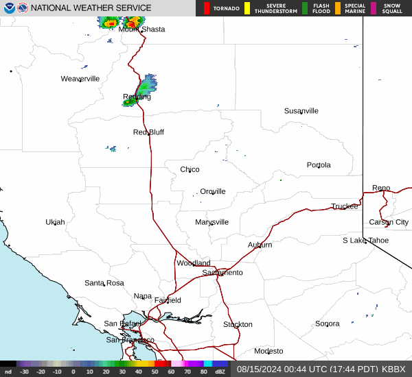
Current Radar Image
Sun Almanac for Buckeye, California
Sunrise: 06:06 AM
Sunset: 7:59 PM
Civil Sunrise:05:36 AM
Civil Sunset: 8:28 PM
Nautical Sunrise: 05:01 AM
Nautical Sunset: 9:04 PM
Astro Sunrise: 04:23 AM
Astro Sunset: 9:42 PM
California's Current Temperatures
 California's Satellite Image
 California's Current Wind Direction
| National Summary |
of upper and lower values of current conditions amongst 6890 locations
in the contiguous United States |
|
High
Temp |
93° |
Chandler Municipal Arpt, Arizona
and 8 other locations
|
|
Low
Temp |
27° |
Mullan Pass, Idaho
|
|
Wind
Speed |
32mph |
Chickasha Municipalcipal Arpt, Oklahoma
and 1 other location
|
|
Wind
Gust |
54mph |
Chickasha Municipalcipal Arpt, Oklahoma
|
|
Wind
Chill |
21° |
Berthoud Pass, Colorado
|
|
Heat
Index |
94° |
Laredo AFB, Texas
and 1 other location
|
|
High
Pressure |
30.73Hg |
Ottawa, Ohio
|
|
Low
Pressure |
29.54Hg |
Wahpeton, North Dakota
|
|
| # Locations Reporting Snow |
3 |
|
| # Locations Reporting Rain |
141 |
|
| # Locations Reporting Thunderstorms / Lightning |
18 |
|
| # Locations Reporting Fog |
4 |
|
| Average Temperature in the Contiguous USA |
65° |
|
Any use of the information on this page is at your own risk. This information should not be relied upon in life-threatening situations, potential financial loss situations or in lieu of any officially disseminated information. Visit the
National Weather Service for official information.