Brevik, Minnesota Weather
No Watches or Warnings for Brevik
Issued: 4:06 pm CST Dec 15, 2025 Latitude: 47.083011 Longitude: -94.2885863 View on Google Maps
|
|
|
|
|
|
|
|
|
|
 |
 |
 |
 |
 |
|
|
 |
| Low: °F |
High: °F |
High: °F |
High: °F |
High: °F |
High: °F |
High: °F |
High: °F |
| Low: °F |
Low: °F |
Low: °F |
Low: °F |
Low: °F |
Low: °F |
|
| Freezing Rain |
Partly Sunny |
Rain & Snow |
Snow |
Snow |
Partly Sunny |
Partly Sunny |
Mostly Cloudy |
Current Conditions at
LONGVILLE - (KXVG)
9°
Clear
as of 7:13 PM CST
Rel. Humidity: 92%
Dew Point: 7°F
Visibility: 10 Miles
Pressure: 29.93 in.
Flight Rule: VFR
Cloud Level(s): Clear
Current Conditions at
PINE RIVER - (KPWC)
5°
Clear
as of 7:15 PM CST
Rel. Humidity: 92%
Dew Point: 3°F
Visibility: 10 Miles
Pressure: 29.92 in.
Flight Rule: VFR
Cloud Level(s): Clear
Current Conditions at
GRAND RAPIDS - (KGPZ)
10°
Clear
as of 6:56 PM CST
Rel. Humidity: 72%
Dew Point: 3°F
Visibility: 10 Miles
Pressure: 29.95 in.
Flight Rule: VFR
Cloud Level(s): Clear
Current Conditions at
PARK RAPIDS - (KPKD)
9°
Clear
as of 6:53 PM CST
Rel. Humidity: 92%
Dew Point: 7°F
Visibility: 10 Miles
Pressure: 29.91 in.
Flight Rule: VFR
Wind Data
5 MPH
140° Southeast
Cloud Level(s): Clear
|
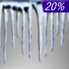
Tonight... A slight chance of freezing rain between 3am and 5am. Mostly cloudy, with a temperature falling to near 10 by 9pm, then rising to around 24 during the remainder of the night. Breezy, with a light south wind increasing to 15 to 20 mph in the evening. Winds could gust as high as 25 mph. Chance of precipitation is 20%. |
|
|
Tuesday... Partly sunny, with a high near 42. Windy, with a southwest wind 15 to 25 mph becoming west in the afternoon. Winds could gust as high as 40 mph. |
|
 |
Tuesday Night... Mostly cloudy, with a low around 12. Windy, with a northwest wind 15 to 25 mph decreasing to 5 to 15 mph after midnight. Winds could gust as high as 40 mph. |
|
|
Wednesday... A slight chance of snow between noon and 3pm, then a slight chance of rain after 3pm. Partly sunny, with a high near 36. Breezy, with a south wind 5 to 10 mph increasing to 15 to 20 mph in the afternoon. Winds could gust as high as 30 mph. Chance of precipitation is 20%. |
|
 |
Wednesday Night... Rain likely before midnight, then rain and snow likely between midnight and 3am, then snow likely after 3am. Mostly cloudy, with a low around 15. Windy, with a south wind 15 to 25 mph becoming northwest after midnight. Winds could gust as high as 35 mph. Chance of precipitation is 70%. New snow accumulation of less than a half inch possible. |
|
|
Thursday... A 50 percent chance of snow, mainly before noon. Mostly cloudy, with a high near 30. Windy, with a northwest wind 25 to 30 mph, with gusts as high as 40 mph. New snow accumulation of less than one inch possible. |
|
 |
Thursday Night... Partly cloudy, with a low around -12. Windy, with a north wind 15 to 25 mph becoming north 5 to 10 mph after midnight. |
|
|
Friday... A chance of snow, mainly after noon. Mostly cloudy, with a high near 17. Breezy, with a southeast wind 10 to 20 mph, with gusts as high as 25 mph. |
|
|
Friday Night... A chance of snow before midnight. Mostly cloudy, with a low around 4. Breezy, with a south wind 15 to 20 mph becoming west after midnight. Winds could gust as high as 25 mph. |
|
|
Saturday... Partly sunny, with a high near 17. Breezy, with a northwest wind 10 to 15 mph, with gusts as high as 20 mph. |
|
|
Saturday Night... Partly cloudy, with a low around -7. Northwest wind 5 to 10 mph, with gusts as high as 15 mph. |
|
|
Sunday... Partly sunny, with a high near 12. West wind around 5 mph becoming south in the afternoon. |
|
|
Sunday Night... Mostly cloudy, with a low around -1. South wind 5 to 10 mph, with gusts as high as 15 mph. |
|
|
Monday... Mostly cloudy, with a high near 18. South wind around 10 mph, with gusts as high as 15 mph. |
|
Current Radar Image
Sun Almanac for Brevik, Minnesota
Sunrise: 07:57 AM
Sunset: 4:28 PM
Civil Sunrise:07:21 AM
Civil Sunset: 5:04 PM
Nautical Sunrise: 06:43 AM
Nautical Sunset: 5:42 PM
Astro Sunrise: 06:05 AM
Astro Sunset: 6:20 PM
Minnesota's Current Temperatures
 Minnesota's Satellite Image
 Minnesota's Current Wind Direction
| National Summary |
of upper and lower values of current conditions amongst 6938 locations
in the contiguous United States |
|
High
Temp |
79° |
Palm Springs, California
|
|
Low
Temp |
5° |
Whitefield, New Hampshire
and 2 other locations
|
|
Wind
Speed |
41mph |
Big Timber, Montana
|
|
Wind
Gust |
52mph |
Big Timber, Montana
|
|
Wind
Chill |
-6° |
Greenville, Maine
|
|
High
Pressure |
30.52Hg |
Salida Mountain, Colorado
|
|
Low
Pressure |
29.57Hg |
Crosby Municipal, North Dakota
|
|
| # Locations Reporting Snow |
10 |
|
| # Locations Reporting Rain |
18 |
|
| # Locations Reporting Fog |
2 |
|
| Average Temperature in the Contiguous USA |
34° |
|
Any use of the information on this page is at your own risk. This information should not be relied upon in life-threatening situations, potential financial loss situations or in lieu of any officially disseminated information. Visit the
National Weather Service for official information.


