Bowlerville, Nevada Weather
No Watches or Warnings for Bowlerville
Issued: 4:21 pm PDT Jul 5, 2025 Latitude: 36.4488457 Longitude: -116.0497531 View on Google Maps
|
|
|
|
|
|
|
|
|
|
 |
 |
|
|
|
|
|
|
| Low: °F |
High: °F |
High: °F |
High: °F |
High: °F |
High: °F |
High: °F |
High: °F |
| Low: °F |
Low: °F |
Low: °F |
Low: °F |
Low: °F |
Low: °F |
|
| Clear |
Sunny |
Sunny |
Sunny |
Sunny |
Sunny |
Sunny |
Sunny |
Current Conditions at
MERCURY - (KDRA)
84°
Clear
as of 8:53 PM PDST
Rel. Humidity: 18%
Dew Point: 37°F
Visibility: 10 Miles
Pressure: 30.01 in.
Flight Rule: VFR
Cloud Level(s): Clear
Current Conditions at
INDIAN SPRINGS - (KINS)
86°
Clear
as of 8:55 PM PDST
Rel. Humidity: 3%
Dew Point: 1°F
Visibility: 10 Miles
Pressure: 29.98 in.
Flight Rule: VFR
Cloud Level(s): Clear
Current Conditions at
NORTH LAS VEGAS - (KVGT)
93°
Clear
as of 8:53 PM PDST
Rel. Humidity: 8%
Dew Point: 25°F
Visibility: 10 Miles
Pressure: 29.91 in.
Flight Rule: VFR
Cloud Level(s): Clear
Current Conditions at
LAS VEGAS - (KHND)
90°
Clear
as of 8:56 PM PDST
Rel. Humidity: 7%
Dew Point: 18°F
Visibility: 10 Miles
Pressure: 29.97 in.
Flight Rule: VFR
Wind Data
13 MPH
210° Southwest
Cloud Level(s): Clear
|
Tonight... Clear, with a low around 72. Southeast wind 8 to 10 mph. |
|
|
Sunday... Sunny, with a high near 98. South southwest wind 5 to 11 mph, with gusts as high as 18 mph. |
|
|
Sunday Night... Clear, with a low around 74. South wind 7 to 9 mph becoming east southeast after midnight. |
|
|
Monday... Sunny, with a high near 99. South southwest wind 6 to 14 mph, with gusts as high as 23 mph. |
|
|
Monday Night... Clear, with a low around 76. Southeast wind 8 to 11 mph. |
|
|
Tuesday... Sunny, with a high near 100. |
|
 |
Tuesday Night... Mostly clear, with a low around 80. |
|
|
Wednesday... Sunny, with a high near 103. |
|
|
Wednesday Night... Mostly clear, with a low around 78. |
|
|
Thursday... Sunny, with a high near 102. |
|
|
Thursday Night... Mostly clear, with a low around 78. |
|
|
Friday... Sunny, with a high near 103. |
|
|
Friday Night... Mostly clear, with a low around 80. |
|
|
Saturday... Sunny, with a high near 103. |
|
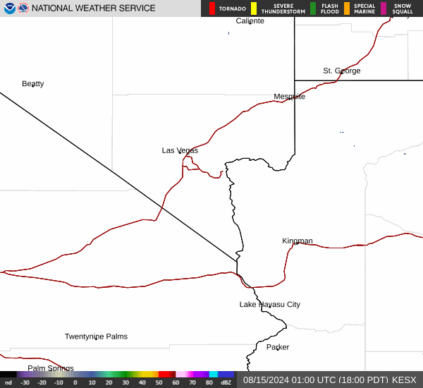
Current Radar Image
Sun Almanac for Bowlerville, Nevada
Sunrise: 05:33 AM
Sunset: 8:05 PM
Civil Sunrise:05:03 AM
Civil Sunset: 8:36 PM
Nautical Sunrise: 04:25 AM
Nautical Sunset: 9:13 PM
Astro Sunrise: 03:44 AM
Astro Sunset: 9:54 PM
Nevada's Current Temperatures
 Nevada's Satellite Image
 Nevada's Current Wind Direction
| National Summary |
of upper and lower values of current conditions amongst 6846 locations
in the contiguous United States |
|
High
Temp |
100° |
Gila Bend (Aaf), Arizona
and 1 other location
|
|
Low
Temp |
46° |
Yellowstone, Wyoming
and 1 other location
|
|
Wind
Speed |
33mph |
Boysen/Thermopol, Wyoming
and 1 other location
|
|
Wind
Gust |
48mph |
Dalhart, Texas
|
|
High
Pressure |
30.80Hg |
Salida Mountain, Colorado
|
|
Low
Pressure |
29.79Hg |
Thermal, California
|
|
| # Locations Reporting Rain |
68 |
|
| # Locations Reporting Thunderstorms / Lightning |
4 |
|
| # Locations Reporting Fog |
3 |
|
| Average Temperature in the Contiguous USA |
73° |
|
Any use of the information on this page is at your own risk. This information should not be relied upon in life-threatening situations, potential financial loss situations or in lieu of any officially disseminated information. Visit the
National Weather Service for official information.