Bellehelen, Nevada Weather
No Watches or Warnings for Bellehelen
Issued: 4:43 pm PDT Jul 3, 2025 Latitude: 38.0682693 Longitude: -116.4658884 View on Google Maps
|
|
|
|
|
|
|
|
|
|
 |
 |
|
|
|
|
|
|
| Low: °F |
High: °F |
High: °F |
High: °F |
High: °F |
High: °F |
High: °F |
High: °F |
| Low: °F |
Low: °F |
Low: °F |
Low: °F |
Low: °F |
Low: °F |
|
| Cloudy |
Sunny |
Sunny |
Sunny |
Sunny |
Sunny |
Sunny |
Sunny |
Current Conditions at
TONOPAH - (KTPH)
79°
Clear
as of 8:56 PM PDST
Rel. Humidity: 22%
Dew Point: 37°F
Visibility: 10 Miles
Pressure: 29.99 in.
Flight Rule: VFR
Wind Data
17 MPH
170° South
Cloud Level(s): Clear
Current Conditions at
EUREKA - (KP68)
72°
Mostly Cloudy
as of 8:53 PM PDST
Rel. Humidity: 30%
Dew Point: 39°F
Pressure: 30.02 in.
Wind Data
8 MPH
300° Northwest
Current Conditions at
MERCURY - (KDRA)
88°
Clear
as of 8:53 PM PDST
Rel. Humidity: 22%
Dew Point: 45°F
Visibility: 10 Miles
Pressure: 29.87 in.
Flight Rule: VFR
Wind Data
13 MPH
180° South
Cloud Level(s): Clear
|
Tonight... Partly cloudy, with a low around 60. Southwest wind 5 to 10 mph, with gusts as high as 20 mph. |
|
|
Independence Day... Sunny, with a high near 78. South southwest wind 5 to 15 mph. |
|
 |
Friday Night... Mostly clear, with a low around 57. South wind 5 to 15 mph. |
|
|
Saturday... Sunny, with a high near 80. South southwest wind 5 to 10 mph. |
|
 |
Saturday Night... Clear, with a low around 59. South southwest wind 5 to 10 mph. |
|
|
Sunday... Sunny, with a high near 83. |
|
|
Sunday Night... Clear, with a low around 62. |
|
|
Monday... Sunny, with a high near 84. |
|
|
Monday Night... Mostly clear, with a low around 64. |
|
|
Tuesday... Sunny, with a high near 85. |
|
|
Tuesday Night... Mostly clear, with a low around 66. |
|
|
Wednesday... Sunny, with a high near 88. |
|
|
Wednesday Night... Mostly clear, with a low around 67. |
|
|
Thursday... Sunny, with a high near 90. |
|
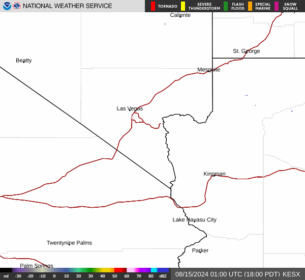
Current Radar Image
Sun Almanac for Bellehelen, Nevada
Sunrise: 05:29 AM
Sunset: 8:12 PM
Civil Sunrise:04:57 AM
Civil Sunset: 8:43 PM
Nautical Sunrise: 04:18 AM
Nautical Sunset: 9:22 PM
Astro Sunrise: 03:34 AM
Astro Sunset: 10:06 PM
Nevada's Current Temperatures
 Nevada's Satellite Image
 Nevada's Current Wind Direction
| National Summary |
of upper and lower values of current conditions amongst 6915 locations
in the contiguous United States |
|
High
Temp |
99° |
Needles, California
|
|
Low
Temp |
43° |
Salida Mountain, Colorado
and 1 other location
|
|
Wind
Speed |
37mph |
Buffalo, South Dakota
|
|
Wind
Gust |
49mph |
Buffalo, South Dakota
|
|
Wind
Chill |
35° |
Salida Mountain, Colorado
|
|
Heat
Index |
102° |
Galveston, Texas
|
|
High
Pressure |
30.63Hg |
Salida Mountain, Colorado
|
|
Low
Pressure |
29.65Hg |
Minot, North Dakota
|
|
| # Locations Reporting Rain |
48 |
|
| # Locations Reporting Thunderstorms / Lightning |
7 |
|
| # Locations Reporting Fog |
3 |
|
| Average Temperature in the Contiguous USA |
72° |
|
Any use of the information on this page is at your own risk. This information should not be relied upon in life-threatening situations, potential financial loss situations or in lieu of any officially disseminated information. Visit the
National Weather Service for official information.