Beechwood, Pennsylvania Weather
No Watches or Warnings for Beechwood
Issued: 6:05 pm EDT May 6, 2024 Latitude: 41.9736744 Longitude: -78.6019703 View on Google Maps
|
|
|
|
|
|
|
|
|
|
 |
 |
 |
 |
 |
 |
|
 |
| Low: °F |
High: °F |
High: °F |
High: °F |
High: °F |
High: °F |
High: °F |
High: °F |
| Low: °F |
Low: °F |
Low: °F |
Low: °F |
Low: °F |
Low: °F |
|
| Mostly Clear |
Mostly Sunny |
Thunderstorms |
Thunderstorms |
Rain |
Partly Sunny |
Partly Sunny |
Rain |
Current Conditions at
BRADFORD - (KBFD)
70°
Clear
as of 5:53 PM EDST
Rel. Humidity: 43%
Dew Point: 46°F
Visibility: 10 Miles
Pressure: 29.95 in.
Flight Rule: VFR
Cloud Level(s): Clear
Current Conditions at
WELLSVILLE MUNI - (KELZ)
66°
Clear
as of 5:56 PM EDST
Rel. Humidity: 37%
Dew Point: 39°F
Visibility: 10 Miles
Pressure: 29.97 in.
Flight Rule: VFR
Cloud Level(s): Clear
Current Conditions at
JAMESTOWN - (KJHW)
63°
Clear
as of 5:56 PM EDST
Rel. Humidity: 36%
Dew Point: 36°F
Visibility: 10 Miles
Pressure: 29.98 in.
Flight Rule: VFR
Cloud Level(s): Clear
Current Conditions at
DUNKIRK - (KDKK)
64°
Clear
as of 5:53 PM EDST
Rel. Humidity: 39%
Dew Point: 39°F
Visibility: 10 Miles
Pressure: 29.97 in.
Flight Rule: VFR
Cloud Level(s): Clear
|
Tonight... Mostly cloudy, then gradually becoming mostly clear, with a low around 46. North wind around 6 mph becoming calm after midnight. |
|
|
Tuesday... Mostly sunny, with a high near 76. Light and variable wind becoming south around 6 mph in the afternoon. |
|
 |
Tuesday Night... Showers and thunderstorms likely before 1am, then showers and possibly a thunderstorm between 1am and 3am, then a chance of showers and thunderstorms after 3am. Low around 60. South wind 7 to 10 mph. Chance of precipitation is 90%. New rainfall amounts between a tenth and quarter of an inch, except higher amounts possible in thunderstorms. |
|
|
Wednesday... A chance of showers and thunderstorms, mainly before 8am. Mostly cloudy, then gradually becoming sunny, with a high near 77. West wind 8 to 16 mph, with gusts as high as 26 mph. Chance of precipitation is 30%. New precipitation amounts of less than a tenth of an inch, except higher amounts possible in thunderstorms. |
|
 |
Wednesday Night... A chance of showers after 2am. Partly cloudy, with a low around 51. Southwest wind 3 to 8 mph. Chance of precipitation is 40%. New precipitation amounts of less than a tenth of an inch possible. |
|
|
Thursday... Showers, with thunderstorms also possible after 11am. High near 66. Chance of precipitation is 90%. New rainfall amounts between a quarter and half of an inch possible. |
|
 |
Thursday Night... Showers likely and possibly a thunderstorm. Mostly cloudy, with a low around 46. Chance of precipitation is 60%. |
|
|
Friday... Showers likely. Mostly cloudy, with a high near 54. Chance of precipitation is 60%. |
|
 |
Friday Night... Scattered showers, mainly before 2am. Partly cloudy, with a low around 40. Chance of precipitation is 30%. |
|
|
Saturday... A chance of showers, mainly after 8am. Partly sunny, with a high near 61. Chance of precipitation is 50%. |
|
 |
Saturday Night... A chance of showers. Mostly cloudy, with a low around 42. Chance of precipitation is 30%. |
|
|
Sunday... A chance of showers. Partly sunny, with a high near 63. Chance of precipitation is 50%. |
|
|
Sunday Night... A chance of showers. Partly cloudy, with a low around 45. Chance of precipitation is 30%. |
|
|
Monday... A chance of showers. Mostly sunny, with a high near 66. Chance of precipitation is 50%. |
|
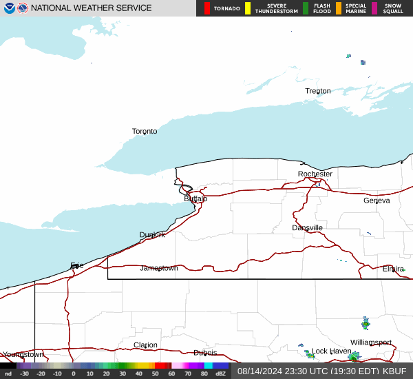
Current Radar Image
Sun Almanac for Beechwood, Pennsylvania
Sunrise: 06:03 AM
Sunset: 8:19 PM
Civil Sunrise:05:32 AM
Civil Sunset: 8:50 PM
Nautical Sunrise: 04:54 AM
Nautical Sunset: 9:28 PM
Astro Sunrise: 04:11 AM
Astro Sunset: 10:11 PM
Pennsylvania's Current Temperatures
 Pennsylvania's Satellite Image
 Pennsylvania's Current Wind Direction
| National Summary |
of upper and lower values of current conditions amongst 5175 locations
in the contiguous United States |
|
High
Temp |
97° |
Zapata Cnty A/P, Texas
and 1 other location
|
|
Low
Temp |
30° |
Granby/Grand Co, Colorado
and 1 other location
|
|
Wind
Speed |
61mph |
Salida Mountain, Colorado
|
|
Wind
Gust |
70mph |
Salida Mountain, Colorado
|
|
Wind
Chill |
15° |
Elk Mountain, Wyoming
|
|
Heat
Index |
111° |
Clarksdale/Fletcher, Mississippi
|
|
High
Pressure |
30.17Hg |
Half Moon Bay A/P, California
and 2 other locations
|
|
Low
Pressure |
29.07Hg |
Spearfish/Clyde Ice, South Dakota
|
|
| # Locations Reporting Snow |
6 |
|
| # Locations Reporting Rain |
56 |
|
| # Locations Reporting Thunderstorms / Lightning |
20 |
|
| # Locations Reporting Fog |
2 |
|
| Average Temperature in the Contiguous USA |
72° |
|
Any use of the information on this page is at your own risk. This information should not be relied upon in life-threatening situations, potential financial loss situations or in lieu of any officially disseminated information. Visit the
National Weather Service for official information.