Beechwood, Pennsylvania Weather
No Watches or Warnings for Beechwood
Issued: 10:55 pm EDT May 6, 2024 Latitude: 41.4850624 Longitude: -78.390849 View on Google Maps
|
|
|
|
|
|
|
|
|
|
 |
 |
 |
 |
 |
 |
|
|
| Low: °F |
High: °F |
High: °F |
High: °F |
High: °F |
High: °F |
High: °F |
High: °F |
| Low: °F |
Low: °F |
Low: °F |
Low: °F |
Low: °F |
Low: °F |
|
| Cloudy |
Thunderstorms |
Thunderstorms |
Thunderstorms |
Rain |
Partly Sunny |
Partly Sunny |
Partly Sunny |
Current Conditions at
BRADFORD - (KBFD)
57°
Clear
as of 9:53 PM EDST
Rel. Humidity: 62%
Dew Point: 45°F
Visibility: 10 Miles
Pressure: 29.94 in.
Flight Rule: VFR
Cloud Level(s): Clear
Current Conditions at
CLEARFIELD - (KFIG)
63°
Clear
as of 9:54 PM EDST
Rel. Humidity: 77%
Dew Point: 55°F
Visibility: 10 Miles
Pressure: 29.91 in.
Flight Rule: VFR
Cloud Level(s): Clear
Current Conditions at
DUBOIS - (KDUJ)
64°
Clear
as of 9:53 PM EDST
Rel. Humidity: 55%
Dew Point: 48°F
Visibility: 10 Miles
Pressure: 29.91 in.
Flight Rule: VFR
Wind Data
3 MPH
030° Northeast
Cloud Level(s): Clear
Current Conditions at
WELLSVILLE MUNI - (KELZ)
57°
Clear
as of 9:56 PM EDST
Rel. Humidity: 47%
Dew Point: 37°F
Visibility: 10 Miles
Pressure: 29.96 in.
Flight Rule: VFR
Cloud Level(s): Clear
|
Tonight... Partly cloudy, with a low around 50. Northeast wind 3 to 5 mph. |
|
|
Tuesday... A slight chance of showers between 3pm and 4pm, then a slight chance of showers and thunderstorms after 4pm. Mostly sunny, with a high near 75. Light and variable wind becoming southeast around 5 mph in the afternoon. Chance of precipitation is 20%. |
|
 |
Tuesday Night... Showers and thunderstorms likely before 1am, then showers and possibly a thunderstorm between 1am and 3am, then a chance of showers and thunderstorms after 3am. Low around 61. South wind 7 to 9 mph. Chance of precipitation is 90%. New rainfall amounts between a tenth and quarter of an inch, except higher amounts possible in thunderstorms. |
|
|
Wednesday... A chance of showers and thunderstorms, mainly before 8am. Mostly cloudy, then gradually becoming sunny, with a high near 79. West wind 10 to 16 mph, with gusts as high as 25 mph. Chance of precipitation is 30%. New precipitation amounts of less than a tenth of an inch, except higher amounts possible in thunderstorms. |
|
 |
Wednesday Night... A chance of showers after 2am. Partly cloudy, with a low around 52. West wind 5 to 9 mph. Chance of precipitation is 40%. New precipitation amounts of less than a tenth of an inch possible. |
|
|
Thursday... Showers, with thunderstorms also possible after 11am. High near 67. Chance of precipitation is 90%. New rainfall amounts between a half and three quarters of an inch possible. |
|
 |
Thursday Night... Showers likely and possibly a thunderstorm. Mostly cloudy, with a low around 48. Chance of precipitation is 60%. |
|
|
Friday... Showers likely. Mostly cloudy, with a high near 58. Chance of precipitation is 70%. |
|
 |
Friday Night... A chance of showers before 2am. Mostly cloudy, with a low around 41. Chance of precipitation is 30%. |
|
|
Saturday... Showers likely, mainly after 2pm. Partly sunny, with a high near 62. Chance of precipitation is 60%. |
|
 |
Saturday Night... Showers likely. Mostly cloudy, with a low around 43. Chance of precipitation is 60%. |
|
|
Sunday... Showers likely. Partly sunny, with a high near 63. Chance of precipitation is 70%. |
|
 |
Sunday Night... A chance of showers. Partly cloudy, with a low around 42. Chance of precipitation is 30%. |
|
|
Monday... A chance of showers. Partly sunny, with a high near 67. Chance of precipitation is 50%. |
|
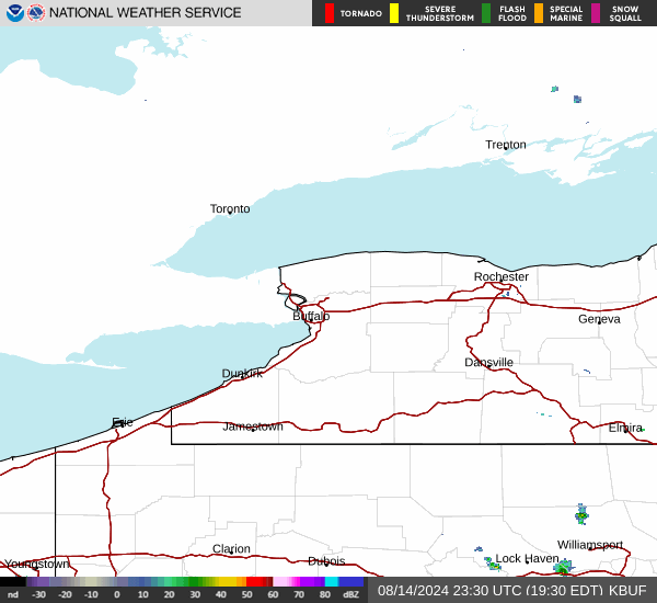
Current Radar Image
Sun Almanac for Beechwood, Pennsylvania
Sunrise: 06:03 AM
Sunset: 8:17 PM
Civil Sunrise:05:33 AM
Civil Sunset: 8:48 PM
Nautical Sunrise: 04:55 AM
Nautical Sunset: 9:26 PM
Astro Sunrise: 04:13 AM
Astro Sunset: 10:07 PM
Pennsylvania's Current Temperatures
 Pennsylvania's Satellite Image
 Pennsylvania's Current Wind Direction
| National Summary |
of upper and lower values of current conditions amongst 6889 locations
in the contiguous United States |
|
High
Temp |
90° |
Del Rio, Texas
|
|
Low
Temp |
30° |
Mullan Pass, Idaho
and 1 other location
|
|
Wind
Speed |
48mph |
Dakota Hill, Colorado
|
|
Wind
Gust |
73mph |
Dakota Hill, Colorado
|
|
Wind
Chill |
18° |
Elk Mountain, Wyoming
and 1 other location
|
|
Heat
Index |
95° |
Del Rio, Texas
|
|
High
Pressure |
30.71Hg |
Ottawa, Ohio
|
|
Low
Pressure |
29.04Hg |
Buffalo, South Dakota
|
|
| # Locations Reporting Snow |
8 |
|
| # Locations Reporting Rain |
125 |
|
| # Locations Reporting Thunderstorms / Lightning |
31 |
|
| # Locations Reporting Fog |
11 |
|
| Average Temperature in the Contiguous USA |
65° |
|
Any use of the information on this page is at your own risk. This information should not be relied upon in life-threatening situations, potential financial loss situations or in lieu of any officially disseminated information. Visit the
National Weather Service for official information.