No Watches or Warnings for Basin
Issued: 3:15 am CST Dec 17, 2025 Latitude: 31.3415568 Longitude: -86.1307808 View on Google Maps
|
|
|
|
|
|
|
|
|
|
 |
 |
 |
 |
|
 |
 |
|
| Low: °F |
High: °F |
High: °F |
High: °F |
High: °F |
High: °F |
High: °F |
High: °F |
| Low: °F |
Low: °F |
Low: °F |
Low: °F |
Low: °F |
Low: °F |
|
| Mostly Cloudy |
Mostly Cloudy |
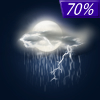
Thunderstorms |
Sunny |
Sunny |
Rain |
Mostly Sunny |
Mostly Sunny |
Current Conditions at
ANDALUSIA - (K79J)
37°
Clear
as of 2:56 AM CST
Rel. Humidity: 86%
Dew Point: 34°F
Visibility: 10 Miles
Pressure: 30.19 in.
Flight Rule: VFR
Cloud Level(s): Clear
Current Conditions at
FT RUCKER - (KOZR)
37°
Partly Cloudy
as of 2:55 AM CST
Rel. Humidity: 80%
Dew Point: 32°F
Visibility: 10 Miles
Pressure: 30.17 in.
Flight Rule: VFR
Wind Data
3 MPH
050° Northeast
Cloud Level(s): Scattered at 22000ft
Current Conditions at
TROY - (KTOI)
32°
Clear
as of 2:53 AM CST
Rel. Humidity: 86%
Dew Point: 28°F
Visibility: 10 Miles
Pressure: 30.22 in.
Flight Rule: VFR
Cloud Level(s): Clear
Current Conditions at
CRESTVIEW - (KCEW)
34°
Clear
as of 2:53 AM CST
Rel. Humidity: 93%
Dew Point: 32°F
Visibility: 9 Miles
Pressure: 30.20 in.
Flight Rule: VFR
Cloud Level(s): Clear
|
Overnight... Mostly cloudy, with a low around 37. Calm wind. |
|
|
Wednesday... Mostly cloudy, with a high near 64. Calm wind becoming east around 5 mph. |
|
 |
Wednesday Night... A 20 percent chance of showers after 5am. Cloudy, with a low around 50. Calm wind becoming east around 5 mph. |
|
|
Thursday... A chance of showers and thunderstorms, then showers and possibly a thunderstorm after noon. High near 65. East wind 5 to 10 mph becoming south in the afternoon. Chance of precipitation is 80%. |
|
 |
Thursday Night... Showers likely and possibly a thunderstorm before midnight, then a slight chance of showers and thunderstorms after midnight. Mostly cloudy, then gradually becoming mostly clear, with a low around 45. South wind 5 to 10 mph becoming northwest after midnight. Chance of precipitation is 70%. |
|
|
Friday... Sunny, with a high near 58. |
|
 |
Friday Night... Areas of frost after 2am. Otherwise, clear, with a low around 35. |
|
|
Saturday... Areas of frost before 7am. Otherwise, sunny, with a high near 64. |
|
 |
Saturday Night... Mostly clear, with a low around 44. |
|
|
Sunday... Isolated showers after noon. Mostly sunny, with a high near 69. Chance of precipitation is 20%. |
|
 |
Sunday Night... Partly cloudy, with a low around 49. |
|
|
Monday... Mostly sunny, with a high near 68. |
|
|
Monday Night... Partly cloudy, with a low around 50. |
|
|
Tuesday... Mostly sunny, with a high near 70. |
|
Current Radar Image
Sun Almanac for Basin, Alabama
Sunrise: 06:38 AM
Sunset: 4:44 PM
Civil Sunrise:06:11 AM
Civil Sunset: 5:11 PM
Nautical Sunrise: 05:40 AM
Nautical Sunset: 5:41 PM
Astro Sunrise: 05:11 AM
Astro Sunset: 6:11 PM
Alabama's Current Temperatures
 Alabama's Satellite Image
 Alabama's Current Wind Direction
| National Summary |
of upper and lower values of current conditions amongst 7141 locations
in the contiguous United States |
|
High
Temp |
75° |
Keathley C 875, Louisiana
|
|
Low
Temp |
3° |
Robertson Field, North Dakota
and 1 other location
|
|
Wind
Speed |
47mph |
Whidbey IsNAS, Washington
|
|
Wind
Gust |
67mph |
Whidbey IsNAS, Washington
|
|
Wind
Chill |
-13° |
Robertson Field, North Dakota
|
|
High
Pressure |
30.39Hg |
Salida Mountain, Colorado
and 1 other location
|
|
Low
Pressure |
29.16Hg |
Charlie, Montana
|
|
| # Locations Reporting Snow |
3 |
|
| # Locations Reporting Rain |
83 |
|
| # Locations Reporting Thunderstorms / Lightning |
2 |
|
| # Locations Reporting Fog |
31 |
|
| Average Temperature in the Contiguous USA |
39° |
|
Any use of the information on this page is at your own risk. This information should not be relied upon in life-threatening situations, potential financial loss situations or in lieu of any officially disseminated information. Visit the
National Weather Service for official information.


