Balford, Washington Weather
Issued: 1:25 pm PST Dec 15, 2025 Latitude: 48.9345657 Longitude: -122.1504287 View on Google Maps
|
|
|
|
|
|
|
|
|
|
|
 |
 |
 |
 |
|
 |
 |
|
 |
| High: °F |
Low: °F |
High: °F |
High: °F |
High: °F |
High: °F |
High: °F |
High: °F |
High: °F |
| Low: °F |
Low: °F |
Low: °F |
Low: °F |
Low: °F |
Low: °F |
|
| Thunderstorms |
Thunderstorms |
Rain |
Rain & Snow |
Rain |
Rain |
Rain and Snow |
Rain and Snow |
Rain & Snow |
Current Conditions at
BELLINGHAM - (KBLI)
52°
Clear
as of 4:53 PM PST
Rel. Humidity: 71%
Dew Point: 43°F
Visibility: 10 Miles
Pressure: 29.80 in.
Flight Rule: VFR
Wind Data
10 MPH
Gust: 23 MPH
220° Southwest
Cloud Level(s): Clear
Current Conditions at
SKAGIT RGNL ARPT - (KBVS)
Partly Cloudy
as of 5:35 PM PST
Rel. Humidity: 100%
Dew Point: 50°F
Visibility: 10 Miles
Pressure: 29.85 in.
Flight Rule: VFR
Wind Data
15 MPH
Gust: 28 MPH
260° West
Cloud Level(s): Scattered at 8000ft
Current Conditions at
ORCAS ISLAND ARPT - (KORS)
52°
Clear
as of 5:35 PM PST
Rel. Humidity: 76%
Dew Point: 45°F
Visibility: 10 Miles
Pressure: 29.85 in.
Flight Rule: VFR
Wind Data
12 MPH
Gust: 22 MPH
210° Southwest
Cloud Level(s): Clear
Current Conditions at
FRIDAY HARBOR - (KFHR)
Clear
as of 4:53 PM PST
Rel. Humidity: 81%
Dew Point: 43°F
Visibility: 10 Miles
Pressure: 29.83 in.
Flight Rule: VFR
Wind Data
12 MPH
Gust: 32 MPH
240° Southwest
Cloud Level(s): Clear
|
This Afternoon... Showers likely and possibly a thunderstorm. Mostly cloudy, with a steady temperature around 48. Southwest wind around 21 mph, with gusts as high as 43 mph. Chance of precipitation is 70%. New rainfall amounts of less than a tenth of an inch, except higher amounts possible in thunderstorms. |
|
|
Tonight... Rain and possibly a thunderstorm. Low around 38. South wind 7 to 17 mph, with gusts as high as 33 mph. Chance of precipitation is 90%. New precipitation amounts between a tenth and quarter of an inch, except higher amounts possible in thunderstorms. |
|
|
Tuesday... Rain, mainly after 2pm. High near 51. South wind around 10 mph, with gusts as high as 23 mph. Chance of precipitation is 100%. New precipitation amounts between a half and three quarters of an inch possible. |
|
 |
Tuesday Night... Rain. Low around 36. Southwest wind around 17 mph, with gusts as high as 36 mph. Chance of precipitation is 100%. New precipitation amounts between three quarters and one inch possible. |
|
|
Wednesday... Rain before 10am, then rain, possibly mixed with snow between 10am and 1pm, then rain after 1pm. High near 44. Southwest wind around 15 mph, with gusts as high as 31 mph. Chance of precipitation is 90%. Little or no snow accumulation expected. |
|
 |
Wednesday Night... Rain. Low around 36. Chance of precipitation is 90%. New precipitation amounts between a tenth and quarter of an inch possible. |
|
|
Thursday... Rain. High near 45. Chance of precipitation is 100%. |
|
 |
Thursday Night... Rain. Cloudy, with a low around 32. |
|
|
Friday... Rain. Cloudy, with a high near 42. |
|
|
Friday Night... Rain before 1am, then rain, possibly mixed with snow. Cloudy, with a low around 32. |
|
|
Saturday... Rain, possibly mixed with snow. Cloudy, with a high near 41. |
|
|
Saturday Night... Rain and snow. Mostly cloudy, with a low around 31. |
|
|
Sunday... Rain and snow likely. Mostly cloudy, with a high near 42. |
|
|
Sunday Night... Rain likely, possibly mixed with snow. Mostly cloudy, with a low around 30. |
|
|
Monday... Rain likely, possibly mixed with snow. Mostly cloudy, with a high near 42. |
|
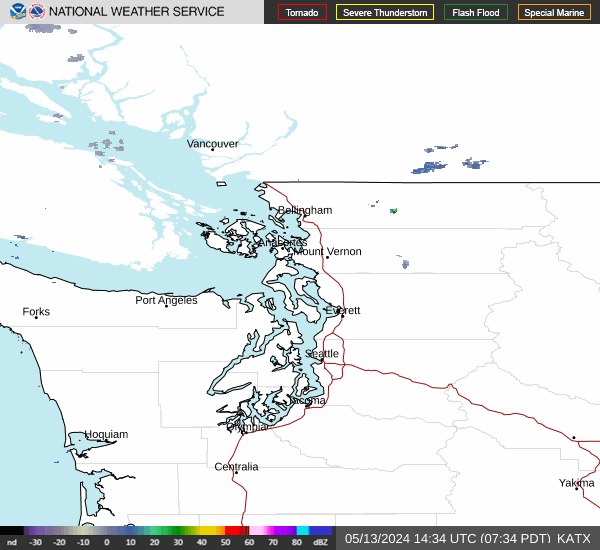
Current Radar Image
Sun Almanac for Balford, Washington
Sunrise: 07:56 AM
Sunset: 4:12 PM
Civil Sunrise:07:19 AM
Civil Sunset: 4:49 PM
Nautical Sunrise: 06:38 AM
Nautical Sunset: 5:30 PM
Astro Sunrise: 06:00 AM
Astro Sunset: 6:08 PM
Washington's Current Temperatures
 Washington's Satellite Image
 Washington's Current Wind Direction
| National Summary |
of upper and lower values of current conditions amongst 6979 locations
in the contiguous United States |
|
High
Temp |
79° |
Palm Springs, California
|
|
Low
Temp |
5° |
Antigo, Wisconsin
and 4 other locations
|
|
Wind
Speed |
35mph |
Julie, Montana
and 1 other location
|
|
Wind
Gust |
49mph |
Cutbank, Montana
|
|
Wind
Chill |
-6° |
Greenville, Maine
|
|
High
Pressure |
30.51Hg |
Salida Mountain, Colorado
|
|
Low
Pressure |
29.56Hg |
Crosby Municipal, North Dakota
|
|
| # Locations Reporting Snow |
8 |
|
| # Locations Reporting Rain |
17 |
|
| # Locations Reporting Fog |
4 |
|
| Average Temperature in the Contiguous USA |
34° |
|
Any use of the information on this page is at your own risk. This information should not be relied upon in life-threatening situations, potential financial loss situations or in lieu of any officially disseminated information. Visit the
National Weather Service for official information.