Badger Basin, Wyoming Weather
Issued: 8:17 pm MST Dec 16, 2025 Latitude: 44.9257816 Longitude: -109.0731995 View on Google Maps
|
|
|
|
|
|
|
|
|
|
 |
 |
 |
 |
 |
|
 |
 |
| Low: °F |
High: °F |
High: °F |
High: °F |
High: °F |
High: °F |
High: °F |
High: °F |
| Low: °F |
Low: °F |
Low: °F |
Low: °F |
Low: °F |
Low: °F |
|
| Mostly Cloudy |
Rain |
Mostly Cloudy |
Partly Sunny |
Snow |
Partly Sunny |
Rain & Snow |
Mostly Sunny |
Current Conditions at
CODY - (KCOD)
50°
Clear
as of 8:56 PM MST
Rel. Humidity: 34%
Dew Point: 23°F
Visibility: 10 Miles
Pressure: 29.94 in.
Flight Rule: VFR
Wind Data
8 MPH
240° Southwest
Cloud Level(s): Clear
Current Conditions at
SOUTH BIG HORN - (KGEY)
43°
Mostly Clear
as of 8:53 PM MST
Rel. Humidity: 52%
Dew Point: 27°F
Visibility: 10 Miles
Pressure: 29.89 in.
Flight Rule: VFR
Cloud Level(s): Few at 11000ft
Current Conditions at
BILLINGS - (KBIL)
46°
Partly Cloudy
as of 8:53 PM MST
Rel. Humidity: 52%
Dew Point: 30°F
Visibility: 10 Miles
Pressure: 29.81 in.
Flight Rule: VFR
Wind Data
8 MPH
240° Southwest
Cloud Level(s): Scattered at 9500ft
Current Conditions at
YELLOWSTONE - (KP60)
Partly Cloudy
as of 8:56 PM MST
Rel. Humidity: 69%
Dew Point: 27°F
Pressure: 30.04 in.
Wind Data
9 MPH
Gust: 23 MPH
270° West
|
Tonight... Mostly cloudy, with a low around 38. Windy, with a southeast wind 15 to 20 mph increasing to 24 to 29 mph after midnight. Winds could gust as high as 44 mph. |
|
|
Wednesday... Scattered showers, mainly before 1pm. Mostly sunny, with a temperature rising to near 56 by noon, then falling to around 38 during the remainder of the day. Windy, with a southwest wind 23 to 31 mph becoming northwest in the afternoon. Winds could gust as high as 48 mph. Chance of precipitation is 50%. |
|
 |
Wednesday Night... Mostly clear, with a low around 23. Breezy, with a west wind 17 to 22 mph decreasing to 7 to 12 mph after midnight. Winds could gust as high as 32 mph. |
|
|
Thursday... Mostly cloudy, with a high near 41. Breezy, with a southwest wind 8 to 13 mph becoming south southeast 16 to 21 mph in the afternoon. Winds could gust as high as 28 mph. |
|
 |
Thursday Night... A slight chance of snow showers before 8pm, then a chance of rain and snow showers between 8pm and 2am, then a chance of rain showers after 2am. Mostly cloudy, with a low around 32. Breezy, with a south wind 18 to 23 mph, with gusts as high as 31 mph. Chance of precipitation is 30%. |
|
|
Friday... A 40 percent chance of showers. Partly sunny, with a high near 55. Breezy, with a southwest wind 20 to 23 mph, with gusts as high as 36 mph. |
|
 |
Friday Night... A chance of rain and snow showers before 11pm, then a chance of snow showers. Mostly cloudy, with a low around 25. Blustery, with a west northwest wind 13 to 20 mph, with gusts as high as 28 mph. Chance of precipitation is 50%. |
|
|
Saturday... A 30 percent chance of snow showers, mainly before 11am. Mostly sunny, with a high near 40. |
|
 |
Saturday Night... A 20 percent chance of snow showers before 11pm. Partly cloudy, with a low around 22. |
|
|
Sunday... Partly sunny, with a high near 43. |
|
|
Sunday Night... A slight chance of rain and snow showers. Mostly cloudy, with a low around 29. |
|
|
Monday... A slight chance of rain and snow showers. Partly sunny, with a high near 53. |
|
|
Monday Night... Mostly cloudy, with a low around 33. |
|
|
Tuesday... Mostly sunny, with a high near 53. |
|
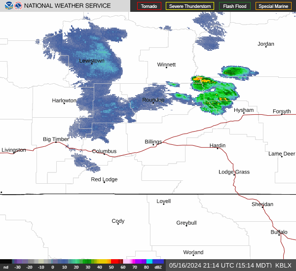
Current Radar Image
Sun Almanac for Badger Basin, Wyoming
Sunrise: 07:49 AM
Sunset: 4:36 PM
Civil Sunrise:07:15 AM
Civil Sunset: 5:10 PM
Nautical Sunrise: 06:38 AM
Nautical Sunset: 5:47 PM
Astro Sunrise: 06:02 AM
Astro Sunset: 6:23 PM
Wyoming's Current Temperatures
 Wyoming's Satellite Image
 Wyoming's Current Wind Direction
| National Summary |
of upper and lower values of current conditions amongst 7025 locations
in the contiguous United States |
|
High
Temp |
75° |
Keathley C 875, Louisiana
|
|
Low
Temp |
9° |
Robertson Field, North Dakota
and 1 other location
|
|
Wind
Speed |
43mph |
Boysen/Thermopol, Wyoming
|
|
Wind
Gust |
54mph |
Boysen/Thermopol, Wyoming
|
|
Wind
Chill |
-7° |
Flag Island, Minnesota
|
|
High
Pressure |
30.47Hg |
Salida Mountain, Colorado
|
|
Low
Pressure |
29.28Hg |
Copper Harbor, Michigan
|
|
| # Locations Reporting Snow |
5 |
|
| # Locations Reporting Rain |
64 |
|
| # Locations Reporting Fog |
11 |
|
| Average Temperature in the Contiguous USA |
40° |
|
Any use of the information on this page is at your own risk. This information should not be relied upon in life-threatening situations, potential financial loss situations or in lieu of any officially disseminated information. Visit the
National Weather Service for official information.