Arizona, Nebraska Weather
Current Conditions at
TEKAMAH - (KTQE)
Cloudy
as of 7:54 PM CDST
Rel. Humidity: 36%
Dew Point: 21°F
Visibility: 10 Miles
Pressure: 30.26 in.
Flight Rule: VFR
Wind Data
13 MPH
170° South
Cloud Level(s): Solid Overcast at 11000ft
Current Conditions at
FREMONT MUNICIPAL ARPT - (KFET)
43°
Mostly Cloudy
as of 8:35 PM CDST
Rel. Humidity: 41%
Dew Point: 21°F
Visibility: 10 Miles
Pressure: 30.26 in.
Flight Rule: VFR
Wind Data
5 MPH
140° Southeast
Cloud Level(s): Broken at 11000ft
Current Conditions at
OMAHA - (KOMA)
Mostly Cloudy
as of 7:52 PM CDST
Rel. Humidity: 36%
Dew Point: 21°F
Visibility: 10 Miles
Pressure: 30.27 in.
Flight Rule: VFR
Wind Data
12 MPH
140° Southeast
Cloud Level(s): Scattered at 12000ft, Broken at 20000ft
Current Conditions at
HARLAN - (KHNR)
Cloudy
as of 8:35 PM CDST
Rel. Humidity: 36%
Dew Point: 21°F
Visibility: 10 Miles
Pressure: 30.27 in.
Flight Rule: VFR
Cloud Level(s): Few at 8000ft, Solid Overcast at 12000ft
Moon Almanac for Arizona, Nebraska
Moon Phase: Waxing Crescent
Moon Illumination: 31%
Moon Age: 5.51 Days
Moon is currently above the horizon
Distance from Moon to Earth: 225,753 miles
Upcoming Lunar Events for
Arizona: |
| Next Event | Event Time | Illum |
|
|
|
| Moonset: | 02:54 am Tue | 32.8% |
| Moonrise: | 11:32 am Tue | 36.8% |
| High Moon: | 07:46 pm Tue | 40.7% |
| Moonset: | 04:01 am Wed | 44.6% |
 | New Moon: Wed Mar 18 |
 | First Quarter: Wed Mar 25 |
 | Full Moon: Wed Apr 1 |
 | Last Quarter: Fri Apr 10 |
| New Moon: Fri Apr 17 |
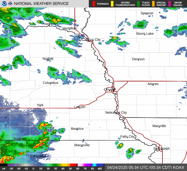
Current Radar Image
| Nebraska State Summary |
of upper and lower values of current conditions amongst 39 locations
in Nebraska |
|
High
Temp |
63° |
Chadron
and 1 other location
|
|
Low
Temp |
37° |
Wahoo Municipal A/P
|
|
|
|
Wind
Gust |
18mph |
North Platte
|
|
|
|
High
Pressure |
30.28Hg |
Omaha/Millard Airport
|
|
Low
Pressure |
29.95Hg |
Scottsbluff
|
|
| Average temperature in Nebraska |
48° |
|
# Locations Reporting VFR
(Visual Flight Rules) |
39 |
|
Nebraska's Current Temperatures
 Nebraska's Satellite Image
 Nebraska's Current Wind Direction
| National Summary |
of upper and lower values of current conditions amongst 6936 locations
in the contiguous United States |
|
High
Temp |
99° |
Bullhead City, Arizona
|
|
Low
Temp |
19° |
Chippewa Intl Arpt, Michigan
|
|
Wind
Speed |
33mph |
Berthoud Pass, Colorado
|
|
Wind
Gust |
56mph |
Sandburg, California
|
|
Wind
Chill |
11° |
Berthoud Pass, Colorado
|
|
High
Pressure |
30.49Hg |
Salida Mountain, Colorado
|
|
Low
Pressure |
29.77Hg |
Bullhead City, Arizona
|
|
| # Locations Reporting Snow |
42 |
|
| # Locations Reporting Rain |
11 |
|
| # Locations Reporting Thunderstorms / Lightning |
2 |
|
| Average Temperature in the Contiguous USA |
54° |
|
Any use of the information on this page is at your own risk. This information should not be relied upon in life-threatening situations, potential financial loss situations or in lieu of any officially disseminated information. Visit the
National Weather Service for official information.