American River, Washington Weather
Issued: 3:51 pm PST Dec 17, 2025 Latitude: 46.9759495 Longitude: -121.1617514 View on Google Maps
|
|
|
|
|
|
|
|
|
|
 |
 |
 |
|
 |
 |
 |
|
| Low: °F |
High: °F |
High: °F |
High: °F |
High: °F |
High: °F |
High: °F |
High: °F |
| Low: °F |
Low: °F |
Low: °F |
Low: °F |
Low: °F |
Low: °F |
|
| Snow |
Rain & Snow |
Snow |
Snow |
Rain & Snow |
Snow |
Snow |
Snow |
Current Conditions at
STAMPEDE PASS - (KSMP)
28°
Clear
Mist
as of 7:20 PM PST
Rel. Humidity: 100%
Dew Point: 28°F
Visibility: 3/4 Miles
Pressure: 30.03 in.
Flight Rule: MVFR
Current Conditions at
ELLENSBURG - (KELN)
Clear
as of 6:53 PM PST
Rel. Humidity: 69%
Dew Point: 28°F
Visibility: 10 Miles
Pressure: 30.03 in.
Flight Rule: VFR
Wind Data
21 MPH
310° Northwest
Cloud Level(s): Clear
Current Conditions at
YAKIMA - (KYKM)
Clear
as of 6:53 PM PST
Rel. Humidity: 60%
Dew Point: 28°F
Visibility: 10 Miles
Pressure: 30.06 in.
Flight Rule: VFR
Cloud Level(s): Clear
Current Conditions at
PIERCE CNTY A/P - (KPLU)
43°
Cloudy
Light Drizzle
as of 7:35 PM PST
Rel. Humidity: 93%
Dew Point: 41°F
Visibility: 6 Miles
Pressure: 30.14 in.
Flight Rule: MVFR
Cloud Level(s): Few at 2300ft, Broken at 2800ft, Solid Overcast at 3500ft
|
Tonight... Snow, mainly after 1am. Low around 28. Light and variable wind. Chance of precipitation is 80%. Total nighttime snow accumulation of less than one inch possible. |
|
|
Thursday... Rain, possibly mixed with snow, becoming all rain after 4pm. High near 41. South wind 3 to 6 mph. Winds could gust as high as 20 mph. Chance of precipitation is 100%. New snow accumulation of around an inch possible. |
|
|
Thursday Night... Snow, possibly mixed with rain, becoming all snow after 1am. Low around 23. West wind around 6 mph, with gusts as high as 21 mph. Chance of precipitation is 100%. New snow accumulation of less than one inch possible. |
|
|
Friday... Snow. High near 35. Light west wind. Chance of precipitation is 90%. New snow accumulation of 1 to 2 inches possible. |
|
|
Friday Night... Snow. Low around 24. Calm wind. Chance of precipitation is 90%. New snow accumulation of 1 to 2 inches possible. |
|
|
Saturday... Snow. High near 36. Chance of precipitation is 90%. New snow accumulation of 1 to 2 inches possible. |
|
|
Saturday Night... Snow. Low around 23. Chance of precipitation is 80%. New snow accumulation of less than one inch possible. |
|
|
Sunday... Snow before 1pm, then rain, possibly mixed with snow. High near 37. Chance of precipitation is 90%. |
|
|
Sunday Night... Rain and snow, becoming all snow after 10pm. Low around 24. Chance of precipitation is 90%. |
|
|
Monday... Snow. Partly sunny, with a high near 37. |
|
|
Monday Night... Snow likely. Mostly cloudy, with a low around 24. |
|
|
Tuesday... A chance of snow. Partly sunny, with a high near 38. |
|
|
Tuesday Night... A chance of snow. Mostly cloudy, with a low around 21. |
|
|
Wednesday... A chance of snow. Partly sunny, with a high near 36. |
|
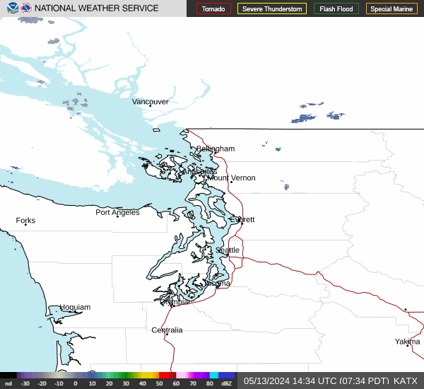
Current Radar Image
Sun Almanac for American River, Washington
Sunrise: 07:45 AM
Sunset: 4:17 PM
Civil Sunrise:07:10 AM
Civil Sunset: 4:52 PM
Nautical Sunrise: 06:31 AM
Nautical Sunset: 5:31 PM
Astro Sunrise: 05:54 AM
Astro Sunset: 6:08 PM
Washington's Current Temperatures
 Washington's Satellite Image
 Washington's Current Wind Direction
| National Summary |
of upper and lower values of current conditions amongst 6346 locations
in the contiguous United States |
|
High
Temp |
77° |
Keathley C 875, Louisiana
|
|
Low
Temp |
10° |
Cutbank, Montana
and 2 other locations
|
|
Wind
Speed |
58mph |
Salida Mountain, Colorado
|
|
Wind
Gust |
71mph |
Glasgow, Montana
and 2 other locations
|
|
Wind
Chill |
-14° |
Malta, Montana
|
|
High
Pressure |
30.24Hg |
Mecklenburg-Brunswic, Virginia
and 1 other location
|
|
Low
Pressure |
28.99Hg |
Grand Forks AFB, North Dakota
|
|
| # Locations Reporting Snow |
20 |
|
| # Locations Reporting Rain |
53 |
|
| # Locations Reporting Fog |
15 |
|
| Average Temperature in the Contiguous USA |
45° |
|
Any use of the information on this page is at your own risk. This information should not be relied upon in life-threatening situations, potential financial loss situations or in lieu of any officially disseminated information. Visit the
National Weather Service for official information.