Amanda Park, Washington Weather
Issued: 7:01 pm PST Dec 17, 2025 Latitude: 47.4631419 Longitude: -123.8860114 View on Google Maps
|
|
|
|
|
|
|
|
|
|
 |
 |
|
|
 |
|
|
 |
| Low: °F |
High: °F |
High: °F |
High: °F |
High: °F |
High: °F |
High: °F |
High: °F |
| Low: °F |
Low: °F |
Low: °F |
Low: °F |
Low: °F |
Low: °F |
|
| Rain |
Thunderstorms |
Thunderstorms |
Thunderstorms |
Rain |
Rain |
Rain |
Rain & Snow |
Current Conditions at
HOQUIAM - (KHQM)
Cloudy
Light Rain Mist
as of 9:53 PM PST
Rel. Humidity: 93%
Dew Point: 45°F
Visibility: 6 Miles
Pressure: 30.06 in.
Flight Rule: VFR
Cloud Level(s): Few at 2800ft, Broken at 3700ft, Solid Overcast at 5000ft
Current Conditions at
SHELTON - (KSHN)
43°
Cloudy
as of 10:42 PM PST
Rel. Humidity: 93%
Dew Point: 41°F
Visibility: 10 Miles
Pressure: 30.04 in.
Flight Rule: VFR
Cloud Level(s): Scattered at 2300ft, Broken at 3700ft, Solid Overcast at 6500ft
Current Conditions at
FORT LEWIS - (KGRF)
Cloudy
as of 10:22 PM PST
Rel. Humidity: 87%
Dew Point: 41°F
Visibility: 10 Miles
Pressure: 30.05 in.
Flight Rule: MVFR
Cloud Level(s): Broken at 3000ft, Solid Overcast at 3900ft
|
Tonight... Rain. Low around 39. South wind around 7 mph, with gusts as high as 20 mph. Chance of precipitation is 100%. New precipitation amounts between a half and three quarters of an inch possible. |
|
|
Thursday... Rain, mainly before 4pm, then showers and possibly a thunderstorm after 4pm. High near 49. Southeast wind 8 to 11 mph becoming west southwest in the afternoon. Winds could gust as high as 28 mph. Chance of precipitation is 100%. New rainfall amounts between a half and three quarters of an inch possible. |
|
 |
Thursday Night... Showers and possibly a thunderstorm before 7pm, then rain after 7pm. Low around 37. West wind 5 to 9 mph, with gusts as high as 22 mph. Chance of precipitation is 100%. New precipitation amounts between a tenth and quarter of an inch, except higher amounts possible in thunderstorms. |
|
|
Friday... Rain before 1pm, then showers and possibly a thunderstorm after 1pm. High near 42. West southwest wind 3 to 6 mph. Chance of precipitation is 100%. New rainfall amounts between a quarter and half of an inch possible. |
|
|
Friday Night... Showers and possibly a thunderstorm before 7pm, then rain after 7pm. Low around 37. West southwest wind around 5 mph. Chance of precipitation is 100%. New precipitation amounts between a quarter and half of an inch possible. |
|
|
Saturday... Rain before 1pm, then showers and possibly a thunderstorm after 1pm. High near 43. Chance of precipitation is 100%. New rainfall amounts between a quarter and half of an inch possible. |
|
|
Saturday Night... Showers and possibly a thunderstorm. Low around 39. Chance of precipitation is 100%. |
|
|
Sunday... Rain. Cloudy, with a high near 43. |
|
 |
Sunday Night... Showers and possibly a thunderstorm before 4am, then rain and possibly a thunderstorm after 4am. Cloudy, with a low around 38. |
|
|
Monday... Rain. Cloudy, with a high near 43. |
|
 |
Monday Night... Rain. Cloudy, with a low around 37. |
|
|
Tuesday... Rain. Mostly cloudy, with a high near 43. |
|
|
Tuesday Night... Rain likely, possibly mixed with snow. Mostly cloudy, with a low around 34. |
|
|
Wednesday... Rain likely, possibly mixed with snow. Mostly cloudy, with a high near 43. |
|
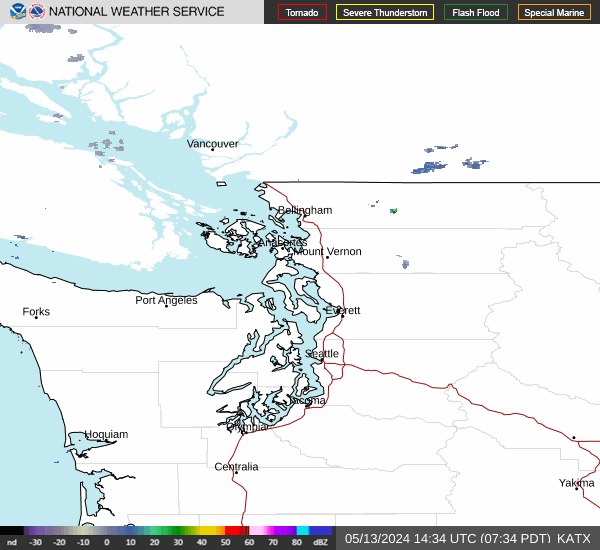
Current Radar Image
Sun Almanac for Amanda Park, Washington
Sunrise: 07:59 AM
Sunset: 4:26 PM
Civil Sunrise:07:23 AM
Civil Sunset: 5:02 PM
Nautical Sunrise: 06:44 AM
Nautical Sunset: 5:41 PM
Astro Sunrise: 06:06 AM
Astro Sunset: 6:18 PM
Washington's Current Temperatures
 Washington's Satellite Image
 Washington's Current Wind Direction
| National Summary |
of upper and lower values of current conditions amongst 7095 locations
in the contiguous United States |
|
High
Temp |
77° |
Keathley C 875, Louisiana
|
|
Low
Temp |
3° |
Glasgow, Montana
|
|
Wind
Speed |
61mph |
Buffalo, South Dakota
|
|
Wind
Gust |
96mph |
Buffalo, South Dakota
|
|
Wind
Chill |
-24° |
Glasgow, Montana
|
|
High
Pressure |
30.25Hg |
Glenn Martin Arpt, Maryland
and 2 other locations
|
|
Low
Pressure |
29.01Hg |
Grand Forks AFB, North Dakota
and 1 other location
|
|
| # Locations Reporting Snow |
24 |
|
| # Locations Reporting Rain |
61 |
|
| # Locations Reporting Fog |
30 |
|
| Average Temperature in the Contiguous USA |
44° |
|
Any use of the information on this page is at your own risk. This information should not be relied upon in life-threatening situations, potential financial loss situations or in lieu of any officially disseminated information. Visit the
National Weather Service for official information.