Altonah, Pennsylvania Weather
Current Conditions at
ALLENTOWN - (KABE)
72°
Mostly Cloudy
as of 4:51 PM EDST
Rel. Humidity: 33%
Dew Point: 41°F
Visibility: 10 Miles
Pressure: 29.76 in.
Flight Rule: VFR
Cloud Level(s): Broken at 9500ft
Current Conditions at
QUAKERTOWN - (KUKT)
73°
Mostly Cloudy
as of 4:55 PM EDST
Rel. Humidity: 31%
Dew Point: 41°F
Visibility: 10 Miles
Pressure: 29.77 in.
Flight Rule: VFR
Cloud Level(s): Broken at 8000ft
Current Conditions at
DOYLESTOWN - (KDYL)
75°
Mostly Clear
as of 4:54 PM EDST
Rel. Humidity: 25%
Dew Point: 37°F
Visibility: 10 Miles
Pressure: 29.75 in.
Flight Rule: VFR
Cloud Level(s): Few at 8000ft
Current Conditions at
POCONO MNTS MUNICIPAL AP - (KMPO)
64°
Mostly Clear
as of 4:53 PM EDST
Rel. Humidity: 29%
Dew Point: 32°F
Visibility: 10 Miles
Pressure: 29.79 in.
Flight Rule: VFR
Cloud Level(s): Few at 8000ft
Moon Almanac for Altonah, Pennsylvania
Moon Phase: First Quarter
Moon Illumination: 59%
Moon Age: 8.19 Days
Moon is currently above the horizon
Distance from Moon to Earth: 231,839 miles
Upcoming Lunar Events for
Altonah: |
| Next Event | Event Time | Illum |
|
|
|
| High Moon: | 08:06 pm Fri | 59.8% |
| Moonset: | 03:18 am Sat | 63.0% |
| Moonrise: | 01:53 pm Sat | 67.5% |
| High Moon: | 08:54 pm Sat | 70.4% |
| Moonset: | 03:43 am Sun | 73.1% |
 | New Moon: Fri Apr 17 |
 | First Quarter: Thu Apr 23 |
 | Full Moon: Fri May 1 |
 | Last Quarter: Sat May 9 |
| New Moon: Sat May 16 |
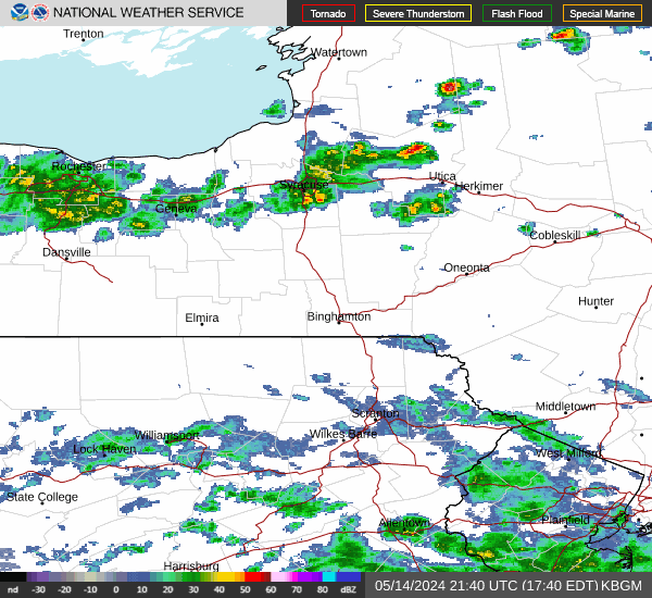
Current Radar Image
| Pennsylvania State Summary |
of upper and lower values of current conditions amongst 43 locations
in Pennsylvania |
|
High
Temp |
82° |
Muir Aaf
and 1 other location
|
|
|
|
Wind
Speed |
14mph |
Johnstown
and 1 other location
|
|
|
|
High
Pressure |
29.82Hg |
Wellsboro/Grand
and 1 other location
|
|
Low
Pressure |
29.73Hg |
Muir Aaf
and 1 other location
|
|
| Average temperature in Pennsylvania |
73° |
|
| # Locations Reporting Rain |
2 |
|
# Locations Reporting MVFR
(Marginal Visual Flight Rules) |
1 |
|
# Locations Reporting VFR
(Visual Flight Rules) |
42 |
|
Pennsylvania's Current Temperatures
 Pennsylvania's Satellite Image
 Pennsylvania's Current Wind Direction
| National Summary |
of upper and lower values of current conditions amongst 7036 locations
in the contiguous United States |
|
High
Temp |
97° |
Terrel County Arpt, Texas
|
|
Low
Temp |
21° |
Boysen/Thermopol, Wyoming
|
|
Wind
Speed |
37mph |
Minot AFB, North Dakota
and 1 other location
|
|
Wind
Gust |
55mph |
Evanston, Wyoming
|
|
Wind
Chill |
3° |
Boysen/Thermopol, Wyoming
|
|
High
Pressure |
30.13Hg |
Port Angeles Cga, Washington
|
|
Low
Pressure |
29.61Hg |
Cleburne, Texas
|
|
| # Locations Reporting Snow |
22 |
|
| # Locations Reporting Rain |
83 |
|
| # Locations Reporting Thunderstorms / Lightning |
5 |
|
| # Locations Reporting Fog |
1 |
|
| Average Temperature in the Contiguous USA |
69° |
|
Any use of the information on this page is at your own risk. This information should not be relied upon in life-threatening situations, potential financial loss situations or in lieu of any officially disseminated information. Visit the
National Weather Service for official information.