Albritton, Arkansas Weather
No Watches or Warnings for Albritton
Issued: 10:15 pm CST Dec 17, 2025 Latitude: 33.052624 Longitude: -91.4376169 View on Google Maps
|
|
|
|
|
|
|
|
|
|
 |
 |
 |
|
 |
 |
|
|
| Low: °F |
High: °F |
High: °F |
High: °F |
High: °F |
High: °F |
High: °F |
High: °F |
| Low: °F |
Low: °F |
Low: °F |
Low: °F |
Low: °F |
Low: °F |
|
| Cloudy |
Rain |
Sunny |
Sunny |
Partly Sunny |
Mostly Cloudy |
Partly Sunny |
Partly Sunny |
Current Conditions at
GREENVILLE - (KGLH)
54°
Mostly Cloudy
as of 9:53 PM CST
Rel. Humidity: 87%
Dew Point: 50°F
Visibility: 10 Miles
Pressure: 29.97 in.
Flight Rule: MVFR
Wind Data
8 MPH
130° Southeast
Cloud Level(s): Broken at 2300ft
Current Conditions at
MONTICELLO - (KLLQ)
55°
Cloudy
as of 9:53 PM CST
Rel. Humidity: 71%
Dew Point: 46°F
Visibility: 10 Miles
Pressure: 29.95 in.
Flight Rule: MVFR
Cloud Level(s): Broken at 2000ft, Solid Overcast at 3200ft
Current Conditions at
MONROE - (KMLU)
54°
Cloudy
Mist
as of 9:53 PM CST
Rel. Humidity: 100%
Dew Point: 54°F
Visibility: 5 Miles
Pressure: 29.98 in.
Flight Rule: MVFR
Cloud Level(s): Solid Overcast at 2000ft
Current Conditions at
GREENWOOD - (KGWO)
57°
Clear
as of 9:53 PM CST
Rel. Humidity: 71%
Dew Point: 48°F
Visibility: 10 Miles
Pressure: 30.00 in.
Flight Rule: VFR
Cloud Level(s): Clear
|
Tonight... Cloudy, with a low around 50. South southeast wind around 5 mph. |
|
|
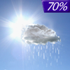
Thursday... Showers likely, mainly between 1pm and 5pm. Cloudy, then gradually becoming mostly sunny, with a high near 67. South wind 10 to 15 mph becoming west in the afternoon. Winds could gust as high as 20 mph. Chance of precipitation is 70%. New precipitation amounts of less than a tenth of an inch possible. |
|
 |
Thursday Night... Mostly clear, with a low around 36. Northwest wind 5 to 10 mph, with gusts as high as 20 mph. |
|
|
Friday... Sunny, with a high near 54. North northwest wind around 5 mph becoming east southeast in the afternoon. |
|
|
Friday Night... Mostly clear, with a low around 38. South wind around 5 mph. |
|
|
Saturday... Sunny, with a high near 69. South southwest wind 5 to 15 mph, with gusts as high as 25 mph. |
|
|
Saturday Night... Partly cloudy, with a low around 49. South wind 5 to 10 mph becoming east after midnight. Winds could gust as high as 20 mph. |
|
|
Sunday... A 20 percent chance of showers before noon. Partly sunny, with a high near 62. Northeast wind 5 to 10 mph. |
|
 |
Sunday Night... A 20 percent chance of showers before midnight. Mostly cloudy, with a low around 50. East northeast wind around 5 mph. |
|
|
Monday... Mostly cloudy, with a high near 65. |
|
 |
Monday Night... Mostly cloudy, with a low around 54. |
|
|
Tuesday... Partly sunny, with a high near 71. |
|
|
Tuesday Night... Partly cloudy, with a low around 54. |
|
|
Wednesday... Partly sunny, with a high near 72. |
|
Current Radar Image
Sun Almanac for Albritton, Arkansas
Sunrise: 07:03 AM
Sunset: 5:01 PM
Civil Sunrise:06:36 AM
Civil Sunset: 5:29 PM
Nautical Sunrise: 06:05 AM
Nautical Sunset: 6:00 PM
Astro Sunrise: 05:34 AM
Astro Sunset: 6:30 PM
Arkansas' Current Temperatures
 Arkansas' Satellite Image
 Arkansas' Current Wind Direction
| National Summary |
of upper and lower values of current conditions amongst 6900 locations
in the contiguous United States |
|
High
Temp |
77° |
Keathley C 875, Louisiana
|
|
Low
Temp |
9° |
Glasgow, Montana
|
|
Wind
Speed |
60mph |
Glendive, Montana
|
|
Wind
Gust |
77mph |
Jordan, Montana
|
|
Wind
Chill |
-15° |
Malta, Montana
|
|
High
Pressure |
30.24Hg |
Mecklenburg-Brunswic, Virginia
and 1 other location
|
|
Low
Pressure |
28.99Hg |
Grand Forks AFB, North Dakota
|
|
| # Locations Reporting Snow |
23 |
|
| # Locations Reporting Rain |
53 |
|
| # Locations Reporting Fog |
14 |
|
| Average Temperature in the Contiguous USA |
45° |
|
Any use of the information on this page is at your own risk. This information should not be relied upon in life-threatening situations, potential financial loss situations or in lieu of any officially disseminated information. Visit the
National Weather Service for official information.


