Adams Crossing, Pennsylvania Weather
Current Conditions at
STEWART FIELD - (KIDI)
52°
Cloudy
as of 5:35 AM EDST
Rel. Humidity: 100%
Dew Point: 52°F
Visibility: 10 Miles
Pressure: 29.86 in.
Flight Rule: VFR
Cloud Level(s): Scattered at 4800ft, Solid Overcast at 5500ft
Current Conditions at
JOHNSTOWN - (KJST)
61°
Clear
as of 4:54 AM EDST
Rel. Humidity: 67%
Dew Point: 50°F
Visibility: 10 Miles
Pressure: 29.87 in.
Flight Rule: VFR
Cloud Level(s): Clear
Current Conditions at
LATROBE - (KLBE)
59°
Mostly Cloudy
as of 5:35 AM EDST
Rel. Humidity: 82%
Dew Point: 54°F
Visibility: 10 Miles
Pressure: 29.87 in.
Flight Rule: VFR
Cloud Level(s): Broken at 6000ft, Broken at 7000ft, Broken at 8500ft
Current Conditions at
CLEARFIELD - (KFIG)
48°
Clear
as of 4:54 AM EDST
Rel. Humidity: 87%
Dew Point: 45°F
Visibility: 10 Miles
Pressure: 29.85 in.
Flight Rule: VFR
Cloud Level(s): Clear
Moon Almanac for Adams Crossing, Pennsylvania
Moon Phase: First Quarter
Moon Illumination: 53%
Moon Age: 7.68 Days
Moon is currently below the horizon
Distance from Moon to Earth: 230,624 miles
Upcoming Lunar Events for
Adams Crossing: |
| Next Event | Event Time | Illum |
|
|
|
| Moonrise: | 12:57 pm Fri | 56.6% |
| High Moon: | 08:21 pm Fri | 59.9% |
| Moonset: | 03:32 am Sat | 63.1% |
 | New Moon: Fri Apr 17 |
 | First Quarter: Thu Apr 23 |
 | Full Moon: Fri May 1 |
 | Last Quarter: Sat May 9 |
| New Moon: Sat May 16 |
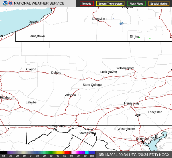
Current Radar Image
| Pennsylvania State Summary |
of upper and lower values of current conditions amongst 43 locations
in Pennsylvania |
|
High
Temp |
64° |
Beaver Falls
|
|
Low
Temp |
39° |
Pocono Mnts Municipalcipal Airport
|
|
|
|
High
Pressure |
29.89Hg |
Somerset
and 1 other location
|
|
Low
Pressure |
29.78Hg |
Philadelphia
|
|
| Average temperature in Pennsylvania |
51° |
|
| # Locations Reporting Thunderstorms |
1 |
|
# Locations Reporting VFR
(Visual Flight Rules) |
43 |
|
Pennsylvania's Current Temperatures
 Pennsylvania's Satellite Image
 Pennsylvania's Current Wind Direction
| National Summary |
of upper and lower values of current conditions amongst 7081 locations
in the contiguous United States |
|
High
Temp |
77° |
Key West Intl, Florida
and 5 other locations
|
|
Low
Temp |
14° |
Middlesboro, Kentucky
|
|
Wind
Speed |
31mph |
Salida Mountain, Colorado
|
|
Wind
Gust |
37mph |
Chippewa Intl Arpt, Michigan
|
|
Wind
Chill |
0° |
Berthoud Pass, Colorado
|
|
High
Pressure |
30.19Hg |
Arlington Municipalcipal, Washington
|
|
Low
Pressure |
29.48Hg |
Phillips/Price County, Wisconsin
|
|
| # Locations Reporting Snow |
17 |
|
| # Locations Reporting Rain |
66 |
|
| # Locations Reporting Thunderstorms / Lightning |
9 |
|
| # Locations Reporting Fog |
11 |
|
| Average Temperature in the Contiguous USA |
52° |
|
Any use of the information on this page is at your own risk. This information should not be relied upon in life-threatening situations, potential financial loss situations or in lieu of any officially disseminated information. Visit the
National Weather Service for official information.