New Salem, Pennsylvania Weather
No Watches or Warnings for New Salem
Issued: 8:36 pm EST Jan 9, 2026 Latitude: 39.9014882 Longitude: -76.7894152 View on Google Maps
|
|
|
|
|
|
|
|
|
|
 |
 |
 |
 |
 |
 |
 |
|
| Low: °F |
High: °F |
High: °F |
High: °F |
High: °F |
High: °F |
High: °F |
High: °F |
| Low: °F |
Low: °F |
Low: °F |
Low: °F |
Low: °F |
Low: °F |
|
| Cloudy |
Rain |
Rain & Snow |
Mostly Sunny |
Sunny |
Mostly Cloudy |
Partly Sunny |
Mostly Sunny |
Current Conditions at
YORK - (KTHV)
52°
Clear
as of 7:53 PM EST
Rel. Humidity: 87%
Dew Point: 48°F
Visibility: 9 Miles
Pressure: 30.06 in.
Flight Rule: VFR
Wind Data
7 MPH
210° Southwest
Cloud Level(s): Clear
Current Conditions at
COLLEGE PARK ARPT - (KCGS)
52°
Partly Cloudy
Mist
as of 8:35 PM EST
Rel. Humidity: 100%
Dew Point: 52°F
Visibility: 7 Miles
Pressure: 30.11 in.
Flight Rule: VFR
Cloud Level(s): Scattered at 11000ft
Current Conditions at
MIDDLETWN/HARRISB - (KMDT)
50°
Cloudy
as of 7:56 PM EST
Rel. Humidity: 87%
Dew Point: 46°F
Visibility: 8 Miles
Pressure: 30.05 in.
Flight Rule: MVFR
Wind Data
8 MPH
240° Southwest
Cloud Level(s): Solid Overcast at 1000ft
Current Conditions at
HARRISBURG - (KCXY)
48°
Cloudy
as of 7:56 PM EST
Rel. Humidity: 93%
Dew Point: 46°F
Visibility: 7 Miles
Pressure: 30.06 in.
Flight Rule: MVFR
Cloud Level(s): Solid Overcast at 1000ft
|
Tonight... Cloudy, with a low around 39. Southwest wind 5 to 7 mph becoming light and variable after midnight. Winds could gust as high as 20 mph. |
|
|
Saturday... Rain, mainly after 11am. Patchy fog between 8am and 9am. High near 45. Calm wind becoming east around 6 mph in the afternoon. Chance of precipitation is 100%. New precipitation amounts between a quarter and half of an inch possible. |
|
 |
Saturday Night... Rain likely, mainly between 7pm and 1am, then a slight chance of showers after 1am. Patchy fog before 2am. Otherwise, cloudy, with a low around 35. Calm wind becoming west 5 to 8 mph after midnight. Chance of precipitation is 60%. New precipitation amounts of less than a tenth of an inch possible. |
|
|
Sunday... A slight chance of rain showers after 1pm, mixing with snow after 4pm. Mostly sunny, with a high near 42. West wind 9 to 18 mph, with gusts as high as 34 mph. Chance of precipitation is 20%. |
|
|
Sunday Night... Partly cloudy, with a low around 27. West wind 11 to 14 mph, with gusts as high as 32 mph. |
|
|
Monday... Mostly sunny, with a high near 41. |
|
|
Monday Night... Partly cloudy, with a low around 28. |
|
|
Tuesday... Sunny, with a high near 47. |
|
 |
Tuesday Night... Mostly cloudy, with a low around 35. |
|
|
Wednesday... Mostly cloudy, with a high near 47. |
|
|
Wednesday Night... Mostly cloudy, with a low around 28. |
|
|
Thursday... Partly sunny, with a high near 36. |
|
|
Thursday Night... Mostly cloudy, with a low around 19. |
|
|
Friday... Mostly sunny, with a high near 33. |
|
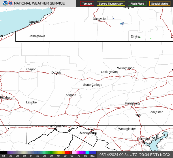
Current Radar Image
Sun Almanac for New Salem, Pennsylvania
Sunrise: 07:28 AM
Sunset: 5:00 PM
Civil Sunrise:06:58 AM
Civil Sunset: 5:30 PM
Nautical Sunrise: 06:25 AM
Nautical Sunset: 6:04 PM
Astro Sunrise: 05:52 AM
Astro Sunset: 6:36 PM
Pennsylvania's Current Temperatures
 Pennsylvania's Satellite Image
 Pennsylvania's Current Wind Direction
| National Summary |
of upper and lower values of current conditions amongst 7002 locations
in the contiguous United States |
|
High
Temp |
82° |
Mcallen, Texas
|
|
Low
Temp |
-8° |
Berthoud Pass, Colorado
|
|
Wind
Speed |
31mph |
Big Spring, Texas
|
|
Wind
Gust |
49mph |
Saranac Lake, New York
|
|
Wind
Chill |
-36° |
Berthoud Pass, Colorado
|
|
High
Pressure |
30.63Hg |
Ontario, Oregon
|
|
Low
Pressure |
29.68Hg |
Frenchville, Maine
|
|
| # Locations Reporting Snow |
35 |
|
| # Locations Reporting Rain |
119 |
|
| # Locations Reporting Thunderstorms / Lightning |
6 |
|
| # Locations Reporting Fog |
14 |
|
| Average Temperature in the Contiguous USA |
46° |
|
Any use of the information on this page is at your own risk. This information should not be relied upon in life-threatening situations, potential financial loss situations or in lieu of any officially disseminated information. Visit the
National Weather Service for official information.