Rock Springs, Alabama Weather
No Watches or Warnings for Rock Springs
Issued: 12:01 pm CST Dec 18, 2025 Latitude: 31.9715365 Longitude: -86.9908171 View on Google Maps
|
|
|
|
|
|
|
|
|
|
 |
 |
 |
|
 |
 |
|
|
| High: °F |
Low: °F |
High: °F |
High: °F |
High: °F |
High: °F |
High: °F |
High: °F |
| Low: °F |
Low: °F |
Low: °F |
Low: °F |
Low: °F |
|
| Thunderstorms |
Thunderstorms |
Sunny |
Sunny |
Rain |
Mostly Sunny |
Sunny |
Mostly Sunny |
Current Conditions at
EVERGREEN - (KGZH)
63°
Cloudy
Heavy Rain Mist
as of 12:32 PM CST
Rel. Humidity: 93%
Dew Point: 61°F
Visibility: 2 Miles
Pressure: 29.90 in.
Flight Rule: IFR
Wind Data
8 MPH
140° Southeast
Cloud Level(s): Broken at 500ft, Solid Overcast at 1000ft
Current Conditions at
MONTGOMERY - (KMGM)
63°
Cloudy
Rain Mist
as of 12:22 PM CST
Rel. Humidity: 88%
Dew Point: 59°F
Visibility: 5 Miles
Pressure: 29.91 in.
Flight Rule: MVFR
Wind Data
10 MPH
140° Southeast
Cloud Level(s): Broken at 1300ft, Broken at 3500ft, Solid Overcast at 11000ft
Current Conditions at
MAXWELL AFB - (KMXF)
63°
Cloudy
Rain Mist
as of 12:25 PM CST
Rel. Humidity: 88%
Dew Point: 59°F
Visibility: 5 Miles
Pressure: 29.88 in.
Flight Rule: MVFR
Wind Data
10 MPH
150° Southeast
Cloud Level(s): Broken at 1400ft, Broken at 7500ft, Solid Overcast at 10000ft
Current Conditions at
ANDALUSIA - (K79J)
63°
Cloudy
Heavy Rain Mist
as of 12:40 PM CST
Rel. Humidity: 93%
Dew Point: 61°F
Visibility: 1 1/2 Miles
Pressure: 29.91 in.
Flight Rule: IFR
Wind Data
7 MPH
130° Southeast
Cloud Level(s): Broken at 500ft, Broken at 1100ft, Solid Overcast at 2800ft
|
This Afternoon... Showers and possibly a thunderstorm before 3pm, then a chance of showers. High near 65. Southeast wind around 10 mph, with gusts as high as 20 mph. Chance of precipitation is 80%. New rainfall amounts between a quarter and half of an inch possible. |
|
|
Tonight... Showers and thunderstorms likely before midnight, then a slight chance of showers between midnight and 3am. Cloudy, then gradual clearing toward daybreak, with a low around 39. South wind around 10 mph becoming northwest after midnight. Winds could gust as high as 25 mph. Chance of precipitation is 70%. New precipitation amounts between a tenth and quarter of an inch, except higher amounts possible in thunderstorms. |
|
|
Friday... Sunny, with a high near 55. Northwest wind 5 to 10 mph. |
|
 |
Friday Night... Clear, with a low around 32. Calm wind. |
|
|
Saturday... Sunny, with a high near 65. Light southeast wind becoming south 5 to 10 mph in the morning. |
|
 |
Saturday Night... Partly cloudy, with a low around 46. South wind around 5 mph becoming calm in the evening. |
|
|
Sunday... A 20 percent chance of showers. Mostly cloudy, with a high near 65. Calm wind becoming north around 5 mph in the morning. |
|
 |
Sunday Night... A 20 percent chance of showers before midnight. Partly cloudy, with a low around 41. Northeast wind around 5 mph. |
|
|
Monday... Mostly sunny, with a high near 63. East wind 5 to 10 mph. |
|
|
Monday Night... Partly cloudy, with a low around 41. |
|
|
Tuesday... Sunny, with a high near 69. |
|
 |
Tuesday Night... Mostly clear, with a low around 47. |
|
|
Wednesday... Mostly sunny, with a high near 72. |
|
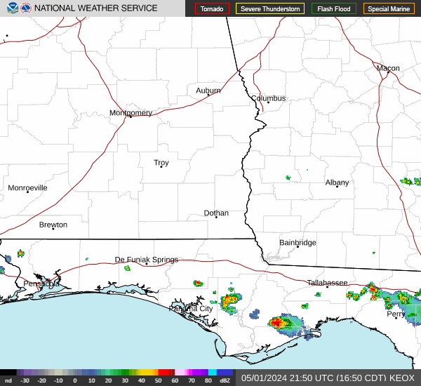
Current Radar Image
Sun Almanac for Rock Springs, Alabama
Sunrise: 06:43 AM
Sunset: 4:47 PM
Civil Sunrise:06:16 AM
Civil Sunset: 5:14 PM
Nautical Sunrise: 05:45 AM
Nautical Sunset: 5:44 PM
Astro Sunrise: 05:16 AM
Astro Sunset: 6:14 PM
Alabama's Current Temperatures
 Alabama's Satellite Image
 Alabama's Current Wind Direction
| National Summary |
of upper and lower values of current conditions amongst 5469 locations
in the contiguous United States |
|
High
Temp |
84° |
Miss Canyan 807, Louisiana
|
|
Low
Temp |
-8° |
Rolla Municipal A/P, North Dakota
|
|
Wind
Speed |
53mph |
Fergus Falls, Minnesota
|
|
Wind
Gust |
60mph |
Willmar Municipal A/P, Minnesota
and 2 other locations
|
|
Wind
Chill |
-37° |
Rolla Municipal A/P, North Dakota
|
|
High
Pressure |
30.30Hg |
Marshfield, Massachusetts
|
|
Low
Pressure |
29.05Hg |
Grand Marais, Minnesota
|
|
| # Locations Reporting Snow |
96 |
|
| # Locations Reporting Rain |
177 |
|
| # Locations Reporting Fog |
15 |
|
| Average Temperature in the Contiguous USA |
48° |
|
Any use of the information on this page is at your own risk. This information should not be relied upon in life-threatening situations, potential financial loss situations or in lieu of any officially disseminated information. Visit the
National Weather Service for official information.