Chase Mills, Maine Weather
Issued: 12:43 am EST Dec 15, 2025 Latitude: 44.7561884 Longitude: -67.35999 View on Google Maps
|
|
|
|
|
|
|
|
|
|
 |
 |
 |
 |
 |
 |
|
 |
| Low: °F |
High: °F |
High: °F |
High: °F |
High: °F |
High: °F |
High: °F |
High: °F |
| Low: °F |
Low: °F |
Low: °F |
Low: °F |
Low: °F |
Low: °F |
|
| Mostly Cloudy |
Partly Sunny |
Sunny |
Mostly Cloudy |
Mostly Sunny |
Rain |
Mostly Sunny |
Rain & Snow |
Current Conditions at
BAR HARBOR - (KBHB)
16°
Cloudy
Light Snow
as of 12:56 AM EST
Rel. Humidity: 52%
Dew Point: 1°F
Visibility: 10 Miles
Pressure: 29.80 in.
Flight Rule: MVFR
Wind Data
7 MPH
Gust: 16 MPH
310° Northwest
Cloud Level(s): Broken at 2800ft, Solid Overcast at 3600ft
Current Conditions at
BANGOR - (KBGR)
Cloudy
as of 12:53 AM EST
Rel. Humidity: 51%
Dew Point: -0°F
Visibility: 10 Miles
Pressure: 29.81 in.
Flight Rule: VFR
Wind Data
10 MPH
Gust: 17 MPH
300° Northwest
Cloud Level(s): Few at 3800ft, Solid Overcast at 5000ft
Current Conditions at
MILLINOCKET - (KMLT)
Cloudy
as of 12:53 AM EST
Rel. Humidity: 78%
Dew Point: 7°F
Visibility: 10 Miles
Pressure: 29.79 in.
Flight Rule: VFR
Wind Data
10 MPH
Gust: 21 MPH
300° Northwest
Cloud Level(s): Solid Overcast at 5500ft
Current Conditions at
HOULTON - (KHUL)
16°
Cloudy
Light Snow Mist
as of 1:35 AM EST
Rel. Humidity: 85%
Dew Point: 12°F
Visibility: 5 Miles
Pressure: 29.73 in.
Flight Rule: MVFR
Wind Data
7 MPH
320° Northwest
Cloud Level(s): Scattered at 2300ft, Solid Overcast at 6000ft
|
Overnight... Mostly cloudy, with a low around 11. Wind chill values as low as -3. Northwest wind 8 to 10 mph, with gusts as high as 20 mph. |
|
|
Monday... Partly sunny, with a high near 20. Wind chill values as low as -3. West wind 11 to 15 mph, with gusts as high as 26 mph. |
|
 |
Monday Night... Partly cloudy, with a low around 10. West wind 5 to 8 mph. |
|
|
Tuesday... Sunny, with a high near 34. Calm wind becoming west around 6 mph. |
|
|
Tuesday Night... Mostly cloudy, with a low around 23. Calm wind becoming southwest 5 to 9 mph after midnight. |
|
|
Wednesday... Mostly cloudy, with a high near 42. Southwest wind 10 to 15 mph, with gusts as high as 26 mph. |
|
|
Wednesday Night... Partly cloudy, with a low around 24. West wind 3 to 6 mph. |
|
|
Thursday... Mostly sunny, with a high near 45. |
|
 |
Thursday Night... Rain likely, mainly after 4am. Patchy fog after 9pm. Otherwise, cloudy, with a low around 35. Chance of precipitation is 60%. |
|
|
Friday... Rain, mainly before 1pm. Patchy fog before 9am. High near 51. Chance of precipitation is 80%. |
|
 |
Friday Night... A slight chance of rain. Mostly cloudy, with a low around 14. Chance of precipitation is 20%. |
|
|
Saturday... Mostly sunny, with a high near 33. |
|
 |
Saturday Night... Snow likely. Mostly cloudy, with a low around 21. Chance of precipitation is 60%. |
|
|
Sunday... A chance of rain and snow. Mostly cloudy, with a high near 40. Chance of precipitation is 40%. |
|
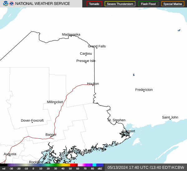
Current Radar Image
Sun Almanac for Chase Mills, Maine
Sunrise: 07:00 AM
Sunset: 3:49 PM
Civil Sunrise:06:27 AM
Civil Sunset: 4:23 PM
Nautical Sunrise: 05:50 AM
Nautical Sunset: 5:00 PM
Astro Sunrise: 05:14 AM
Astro Sunset: 5:36 PM
Maine's Current Temperatures
 Maine's Satellite Image
 Maine's Current Wind Direction
| National Summary |
of upper and lower values of current conditions amongst 7088 locations
in the contiguous United States |
|
High
Temp |
73° |
Key West NAS, Florida
and 1 other location
|
|
Low
Temp |
-11° |
Edgar County Arpt, Illinois
and 1 other location
|
|
Wind
Speed |
33mph |
Worthington, Minnesota
|
|
Wind
Gust |
46mph |
Nantucket, Massachusetts
|
|
Wind
Chill |
-27° |
Bloomington, Illinois
|
|
High
Pressure |
30.65Hg |
Little Rock Adams Fld, Arkansas
and 2 other locations
|
|
Low
Pressure |
29.73Hg |
Greenville, Maine
and 1 other location
|
|
| # Locations Reporting Snow |
55 |
|
| # Locations Reporting Rain |
10 |
|
| # Locations Reporting Thunderstorms / Lightning |
1 |
|
| # Locations Reporting Fog |
26 |
|
| Average Temperature in the Contiguous USA |
25° |
|
Any use of the information on this page is at your own risk. This information should not be relied upon in life-threatening situations, potential financial loss situations or in lieu of any officially disseminated information. Visit the
National Weather Service for official information.