Plantersville, Alabama Weather
No Watches or Warnings for Plantersville
Issued: 11:31 am CST Dec 18, 2025 Latitude: 33.3698324 Longitude: -86.2358082 View on Google Maps
|
|
|
|
|
|
|
|
|
|
 |
 |
 |
|
 |
 |
|
|
| High: °F |
Low: °F |
High: °F |
High: °F |
High: °F |
High: °F |
High: °F |
High: °F |
| Low: °F |
Low: °F |
Low: °F |
Low: °F |
Low: °F |
|
| Rain |
Thunderstorms |
Sunny |
Sunny |
Rain |
Mostly Sunny |
Mostly Sunny |
Mostly Sunny |
Current Conditions at
ANNISTON - (KANB)
63°
Cloudy
as of 12:40 PM CST
Rel. Humidity: 77%
Dew Point: 55°F
Visibility: 10 Miles
Pressure: 29.90 in.
Flight Rule: MVFR
Wind Data
12 MPH
Gust: 24 MPH
180° South
Cloud Level(s): Broken at 2200ft, Solid Overcast at 4100ft
Current Conditions at
BIRMINGHAM - (KBHM)
61°
Cloudy
as of 11:53 AM CST
Rel. Humidity: 82%
Dew Point: 55°F
Visibility: 10 Miles
Pressure: 29.91 in.
Flight Rule: MVFR
Wind Data
10 MPH
Gust: 23 MPH
160° South
Cloud Level(s): Solid Overcast at 1000ft
Current Conditions at
CALERA - (KEET)
63°
Cloudy
as of 12:33 PM CST
Rel. Humidity: 82%
Dew Point: 57°F
Visibility: 10 Miles
Pressure: 29.88 in.
Flight Rule: IFR
Wind Data
5 MPH
140° Southeast
Cloud Level(s): Solid Overcast at 900ft
Current Conditions at
ALEXANDER CITY - (KALX)
63°
Cloudy
as of 12:35 PM CST
Rel. Humidity: 88%
Dew Point: 59°F
Visibility: 10 Miles
Pressure: 29.91 in.
Flight Rule: MVFR
Wind Data
12 MPH
Gust: 17 MPH
150° Southeast
Cloud Level(s): Solid Overcast at 1400ft
|
This Afternoon... Rain. Patchy fog. High near 63. South wind around 10 mph, with gusts as high as 25 mph. Chance of precipitation is 80%. New precipitation amounts between a tenth and quarter of an inch possible. |
|
|
Tonight... Showers and possibly a thunderstorm before midnight. Low around 37. South wind 5 to 10 mph becoming northwest after midnight. Winds could gust as high as 25 mph. Chance of precipitation is 80%. New precipitation amounts between a tenth and quarter of an inch, except higher amounts possible in thunderstorms. |
|
|
Friday... Sunny, with a high near 52. Northwest wind around 5 mph becoming calm in the afternoon. |
|
 |
Friday Night... Mostly clear, with a low around 29. Calm wind. |
|
|
Saturday... Sunny, with a high near 62. Calm wind becoming south around 5 mph in the afternoon. |
|
 |
Saturday Night... A 20 percent chance of rain after midnight. Increasing clouds, with a low around 42. |
|
|
Sunday... A 20 percent chance of rain before noon. Partly sunny, with a high near 62. |
|
 |
Sunday Night... Partly cloudy, with a low around 36. |
|
|
Monday... Mostly sunny, with a high near 60. |
|
|
Monday Night... Partly cloudy, with a low around 39. |
|
|
Tuesday... Mostly sunny, with a high near 65. |
|
|
Tuesday Night... Partly cloudy, with a low around 46. |
|
|
Wednesday... Mostly sunny, with a high near 70. |
|
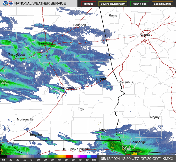
Current Radar Image
Sun Almanac for Plantersville, Alabama
Sunrise: 06:43 AM
Sunset: 4:40 PM
Civil Sunrise:06:16 AM
Civil Sunset: 5:08 PM
Nautical Sunrise: 05:45 AM
Nautical Sunset: 5:39 PM
Astro Sunrise: 05:15 AM
Astro Sunset: 6:09 PM
Alabama's Current Temperatures
 Alabama's Satellite Image
 Alabama's Current Wind Direction
| National Summary |
of upper and lower values of current conditions amongst 7193 locations
in the contiguous United States |
|
High
Temp |
82° |
Immokalee, Florida
and 10 other locations
|
|
Low
Temp |
-8° |
Rolla Municipal A/P, North Dakota
|
|
Wind
Speed |
51mph |
Russell, Kansas
|
|
Wind
Gust |
71mph |
Russell, Kansas
|
|
Wind
Chill |
-37° |
Rolla Municipal A/P, North Dakota
|
|
High
Pressure |
30.35Hg |
Nantucket, Massachusetts
|
|
Low
Pressure |
29.04Hg |
Grand Marais, Minnesota
|
|
| # Locations Reporting Snow |
107 |
|
| # Locations Reporting Rain |
231 |
|
| # Locations Reporting Fog |
25 |
|
| Average Temperature in the Contiguous USA |
50° |
|
Any use of the information on this page is at your own risk. This information should not be relied upon in life-threatening situations, potential financial loss situations or in lieu of any officially disseminated information. Visit the
National Weather Service for official information.