Londonderry, Maryland Weather
Current Conditions at
US NAVAL ACADEMY - (KNAK)
63°
Cloudy
Rain
as of 8:54 PM EDST
Rel. Humidity: 82%
Dew Point: 57°F
Visibility: 5 Miles
Pressure: 29.82 in.
Flight Rule: MVFR
Cloud Level(s): Broken at 8000ft, Solid Overcast at 10000ft
Current Conditions at
PATUXENT RIV NAS - (KNHK)
63°
Mostly Cloudy
as of 8:52 PM EDST
Rel. Humidity: 59%
Dew Point: 48°F
Visibility: 10 Miles
Pressure: 29.79 in.
Flight Rule: VFR
Wind Data
10 MPH
150° Southeast
Cloud Level(s): Few at 6000ft, Broken at 10000ft
Current Conditions at
GEORGETOWN - (KGED)
61°
Mostly Cloudy
as of 8:54 PM EDST
Rel. Humidity: 41%
Dew Point: 37°F
Visibility: 10 Miles
Pressure: 29.83 in.
Flight Rule: VFR
Wind Data
6 MPH
120° Southeast
Cloud Level(s): Broken at 9000ft
Current Conditions at
ST MARYS - (K2W6)
61°
Mostly Clear
as of 8:55 PM EDST
Rel. Humidity: 72%
Dew Point: 52°F
Visibility: 10 Miles
Pressure: 29.79 in.
Flight Rule: VFR
Cloud Level(s): Few at 18000ft
Moon Almanac for Londonderry, Maryland
Moon Phase: Waxing Gibbous
Moon Illumination: 60%
Moon Age: 8.35 Days
Moon is currently above the horizon
Distance from Moon to Earth: 232,238 miles
Upcoming Lunar Events for
Londonderry: |
| Next Event | Event Time | Illum |
|
|
|
| Moonset: | 03:17 am Sat | 63.0% |
| Moonrise: | 01:59 pm Sat | 67.6% |
| High Moon: | 08:57 pm Sat | 70.4% |
| Moonset: | 03:43 am Sun | 73.1% |
 | New Moon: Fri Apr 17 |
 | First Quarter: Thu Apr 23 |
 | Full Moon: Fri May 1 |
 | Last Quarter: Sat May 9 |
| New Moon: Sat May 16 |
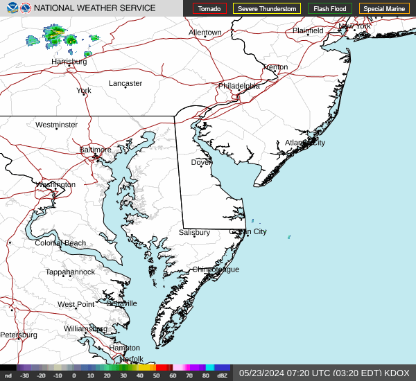
Current Radar Image
| Maryland State Summary |
of upper and lower values of current conditions amongst 22 locations
in Maryland |
|
High
Temp |
70° |
Greater Cumberland Arpt
|
|
|
|
Wind
Speed |
10mph |
Patuxent RivNAS
|
|
High
Pressure |
29.85Hg |
Garrett Cnty A/P
|
|
Low
Pressure |
29.78Hg |
St Inigoes/Webster
|
|
| Average temperature in Maryland |
63° |
|
| # Locations Reporting Rain |
1 |
|
# Locations Reporting MVFR
(Marginal Visual Flight Rules) |
1 |
|
# Locations Reporting VFR
(Visual Flight Rules) |
21 |
|
Maryland's Current Temperatures
 Maryland's Satellite Image
 Maryland's Current Wind Direction
| National Summary |
of upper and lower values of current conditions amongst 6284 locations
in the contiguous United States |
|
High
Temp |
95° |
Terrel County Arpt, Texas
|
|
Low
Temp |
27° |
Yellowstone, Wyoming
and 4 other locations
|
|
Wind
Speed |
33mph |
Dickinson, North Dakota
|
|
Wind
Gust |
47mph |
Scottsbluff, Nebraska
|
|
Wind
Chill |
12° |
Echo, Montana
and 2 other locations
|
|
High
Pressure |
30.10Hg |
Salida Mountain, Colorado
|
|
Low
Pressure |
29.58Hg |
Sterling Municipal, Colorado
|
|
| # Locations Reporting Snow |
15 |
|
| # Locations Reporting Rain |
70 |
|
| # Locations Reporting Thunderstorms / Lightning |
2 |
|
| # Locations Reporting Fog |
1 |
|
| Average Temperature in the Contiguous USA |
65° |
|
Any use of the information on this page is at your own risk. This information should not be relied upon in life-threatening situations, potential financial loss situations or in lieu of any officially disseminated information. Visit the
National Weather Service for official information.