Hillcrest, Alabama Weather
No Watches or Warnings for Hillcrest
Issued: 5:06 am CST Dec 15, 2025 Latitude: 31.7251615 Longitude: -85.8116123 View on Google Maps
|
|
|
|
|
|
|
|
|
|
 |
 |
|
 |
 |
|
|
 |
| High: °F |
Low: °F |
High: °F |
High: °F |
High: °F |
High: °F |
High: °F |
High: °F |
| Low: °F |
Low: °F |
Low: °F |
Low: °F |
Low: °F |
|
| Sunny |
Clear |
Sunny |
Partly Sunny |
Rain |
Sunny |
Sunny |
Mostly Sunny |
Current Conditions at
TROY - (KTOI)
32°
Clear
as of 8:53 AM CST
Rel. Humidity: 39%
Dew Point: 10°F
Visibility: 10 Miles
Pressure: 30.50 in.
Flight Rule: VFR
Cloud Level(s): Clear
Current Conditions at
FT RUCKER - (KOZR)
Clear
as of 8:55 AM CST
Rel. Humidity: 34%
Dew Point: 10°F
Visibility: 10 Miles
Pressure: 30.44 in.
Flight Rule: VFR
Wind Data
12 MPH
Gust: 18 MPH
070° East
Cloud Level(s): Clear
Current Conditions at
DOTHAN - (KDHN)
Clear
as of 8:53 AM CST
Rel. Humidity: 37%
Dew Point: 10°F
Visibility: 10 Miles
Pressure: 30.49 in.
Flight Rule: VFR
Wind Data
16 MPH
Gust: 23 MPH
090° East
Cloud Level(s): Clear
Current Conditions at
ANDALUSIA - (K79J)
Clear
as of 8:56 AM CST
Rel. Humidity: 37%
Dew Point: 10°F
Visibility: 10 Miles
Pressure: 30.47 in.
Flight Rule: VFR
Cloud Level(s): Clear
|
Today... Sunny, with a high near 45. East wind around 5 mph becoming calm in the afternoon. |
|
|
Tonight... Clear, with a low around 20. Calm wind. |
|
|
Tuesday... Sunny, with a high near 53. Calm wind. |
|
 |
Tuesday Night... Mostly cloudy, with a low around 30. Calm wind. |
|
|
Wednesday... Partly sunny, with a high near 63. Calm wind. |
|
 |
Wednesday Night... Partly cloudy, with a low around 42. |
|
|
Thursday... A 30 percent chance of rain after noon. Partly sunny, with a high near 70. |
|
 |
Thursday Night... Rain likely and possibly a thunderstorm before midnight, then a chance of rain. Mostly cloudy, with a low around 46. Chance of precipitation is 60%. |
|
|
Friday... Sunny, with a high near 58. |
|
 |
Friday Night... Mostly clear, with a low around 35. |
|
|
Saturday... Sunny, with a high near 64. |
|
|
Saturday Night... Partly cloudy, with a low around 45. |
|
|
Sunday... Mostly sunny, with a high near 72. |
|
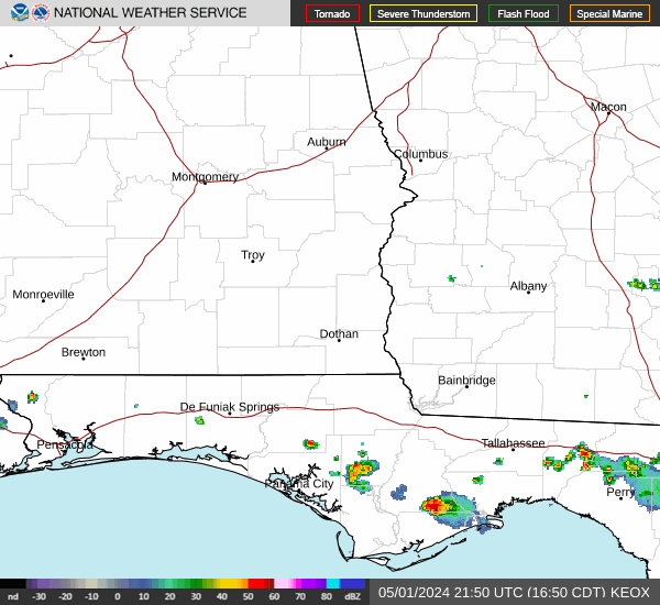
Current Radar Image
Sun Almanac for Hillcrest, Alabama
Sunrise: 06:36 AM
Sunset: 4:41 PM
Civil Sunrise:06:09 AM
Civil Sunset: 5:08 PM
Nautical Sunrise: 05:39 AM
Nautical Sunset: 5:39 PM
Astro Sunrise: 05:09 AM
Astro Sunset: 6:08 PM
Alabama's Current Temperatures
 Alabama's Satellite Image
 Alabama's Current Wind Direction
| National Summary |
of upper and lower values of current conditions amongst 7320 locations
in the contiguous United States |
|
High
Temp |
72° |
Homestead AFB, Florida
and 8 other locations
|
|
Low
Temp |
0° |
Gunnison, Colorado
|
|
Wind
Speed |
35mph |
Whidbey IsNAS, Washington
and 1 other location
|
|
Wind
Gust |
58mph |
Astoria, Oregon
|
|
Wind
Chill |
-13° |
Champaign, Illinois
|
|
High
Pressure |
30.62Hg |
Salida Mountain, Colorado
|
|
Low
Pressure |
29.61Hg |
Port Angeles Cga, Washington
|
|
| # Locations Reporting Snow |
67 |
|
| # Locations Reporting Rain |
43 |
|
| # Locations Reporting Fog |
34 |
|
| Average Temperature in the Contiguous USA |
28° |
|
Any use of the information on this page is at your own risk. This information should not be relied upon in life-threatening situations, potential financial loss situations or in lieu of any officially disseminated information. Visit the
National Weather Service for official information.